Weekend deluge could produce worst conditions since Flood of the Century, provincial officials warn
Read this article for free:
or
Already have an account? Log in here »
To continue reading, please subscribe:
Monthly Digital Subscription
$0 for the first 4 weeks*
- Enjoy unlimited reading on winnipegfreepress.com
- Read the E-Edition, our digital replica newspaper
- Access News Break, our award-winning app
- Play interactive puzzles
*No charge for 4 weeks then price increases to the regular rate of $19.00 plus GST every four weeks. Offer available to new and qualified returning subscribers only. Cancel any time.
Monthly Digital Subscription
$4.75/week*
- Enjoy unlimited reading on winnipegfreepress.com
- Read the E-Edition, our digital replica newspaper
- Access News Break, our award-winning app
- Play interactive puzzles
*Billed as $19 plus GST every four weeks. Cancel any time.
To continue reading, please subscribe:
Add Free Press access to your Brandon Sun subscription for only an additional
$1 for the first 4 weeks*
*Your next subscription payment will increase by $1.00 and you will be charged $16.99 plus GST for four weeks. After four weeks, your payment will increase to $23.99 plus GST every four weeks.
Read unlimited articles for free today:
or
Already have an account? Log in here »
Hey there, time traveller!
This article was published 29/04/2022 (1320 days ago), so information in it may no longer be current.
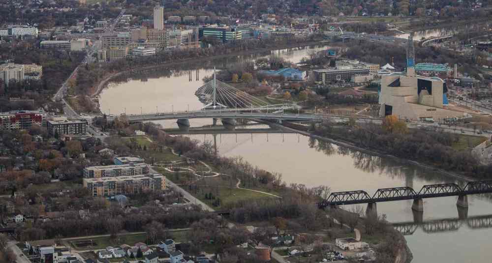
The Red River Valley is bracing for what could be its highest spring flood volume since 1997, with dozens of rural Manitoba homes already evacuated and communities on alert.
Provincial officials aren’t panicking because, they say, communities and properties in the flood zone are protected from the projected peak thanks to upgrades since the “flood of the century” 25 years ago.
Fisaha Unduche, executive director of hydrologic forecasting and water management, said this weekend’s Colorado low could dump between 30 and 80 millimetres of precipitation in southern and central Manitoba, and higher amounts in the U.S. portion of the Red River basin.
That could propel the Red’s peak flows past those of the major flood in 2009, which were the highest since 1997, he said at a news conference Friday.

“We’re going through a little bit of crazy weather this year,” said Unduche, citing four weather systems which dumped extreme amounts of snow and/or rain earlier this month.
Unduche said peak levels on the Red are expected in Emerson around May 7-9, and they could stay within the valley until May 14.
Graphic: Today's James Avenue water levels
Posted:
Water levels in Winnipeg are measured in “feet James,” the level above the normal winter ice level as measured at a gauge on the Red River east of James Avenue in the Exchange District, just downstream of The Forks where the Red and Assiniboine rivers meet.
The province announced Friday night it had closed Highway 75 on the north side of Morris, due to the rising Red. A dike had been constructed on the road, and Hwy. 75 at Provincial Road 205 was open for local traffic only, a news release said.
Earlier in the day, rural residents who stay put had been deemed at risk of being cut off from emergency services if local access roads are under water.
Six rural municipalities — Cartier, Fisher, Headingley, Montcalm, Morris and Ritchot — have declared local states of emergency, said Transportation and Infrastructure Minister Doyle Piwniuk, as communities made final preparations for the storm.
In Montcalm, about 60 kilometres south of Winnipeg, 17 homes on partially-submerged St. Mary’s Road (Provincial Road 246) on the east side of the Red were ordered to evacuate.
Some households were refusing to leave as of Friday, said Reeve Paul Gilmore.
Most of the homes are protected by ring dikes, he said. “I hope they have boats. If not, we will have to make arrangements to get them out if it becomes more severe.”
RCMP spokeswoman Cpl. Julie Courchaine said officers will be doing patrols and checking in with those who’ve stayed behind, “as long as it’s accessible.”
In a news release, the City of Winnipeg said 16 properties could be at risk of river flooding, with one owner advised to build a dike.
“I hope they have boats. If not, we will have to make arrangements to get them out if it becomes more severe.” – Reeve Paul Gilmore
Basement and overland flooding is a risk throughout the capital. About 40,000 sandbags were available at three city yards (1220 Pacific Ave., 1090 Thomas Ave. and 1539 Waverley St.).
Just south of Winnipeg, at least 14 homes have been evacuated in Ritchot. The figure could climb to between 50 and 60 this weekend, said Mayor Chris Ewen.
“It’s just a matter of being on standby, in case we see the precipitation that is anticipated,” he said. “We’re all hoping for good weather. Mother Nature has been slamming us with Colorado lows.”
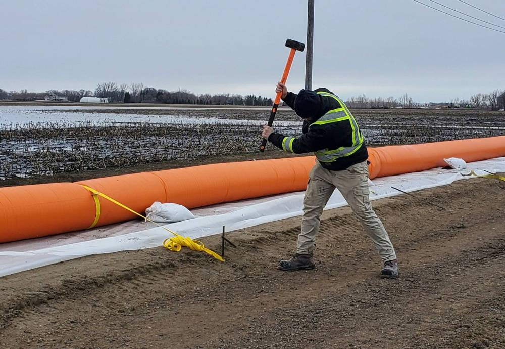
In Altona, a Tiger Dam — large portable tubes filled with water to act as a flood barrier — has been set up in a vulnerable area of the town, about 100 kilometres southwest of Winnipeg.
“We are as prepared as we can be,” said Mayor Al Friesen. “Our hope would be that three inches don’t fall like last (weekend).”
The province has issued a mix of flood warnings and watches, while Environment Canada has put out rainfall warnings for central and southern Manitoba, and snowfall warnings for some areas of the North.
Environment Canada meteorologist Alysa Pederson said 20-40 mm of precipitation is generally expected, with higher amounts in some places.
“We’re anticipating a worsening of the overland flood situation,” she said.
Depending on how much rain falls, peak flows on the Red could be between 90,000 and 115,000 cubic feet per second (CFS) in Ste. Agathe, said Unduche.
In 2009, the peak flow was 91,000 CFS, he said.

The province is using the Red River Floodway and Portage Diversion to reduce water levels in Winnipeg. Unduche said the level at James Avenue could climb as high as 20 ft., a lower mark than 2009.
Retired Environment Canada meteorologist Rob Paola said an additional 25 mm of rain this weekend would make it the second-wettest April on record in Winnipeg, and the wettest in more than 100 years.
The total as of Friday was 73 mm of precipitation (rain and melted snow) at Winnipeg’s airport, he tweeted.
Piwniuk said it’s too soon to say how long the closure of Highway 75 could last. The province is monitoring water levels on the south side of Morris, in case it has to close that section of the major trade route.
The north closure creates a four-kilometre detour for drivers, including trucks hauling goods between Manitoba and the United States.
If the south section closes, a detour of 165 km will add up to $300 per truck journey, with a ripple effect for consumers, said Aaron Dolyniuk, executive director of the Manitoba Trucking Association.
“Initially, drivers and companies bear that cost. Longer term, it gets passed on to you and I,” said Dolyniuk. “We hope there is not as much rain as forecast and the impact is minimal.”
chris.kitching@freepress.mb.ca
Twitter: @chriskitching
As a general assignment reporter, Chris covers a little bit of everything for the Free Press.
Our newsroom depends on a growing audience of readers to power our journalism. If you are not a paid reader, please consider becoming a subscriber.
Our newsroom depends on its audience of readers to power our journalism. Thank you for your support.
Related Articles
Flooding triggers evacuations in Peguis
History
Updated on Friday, April 29, 2022 7:57 PM CDT: Adds Hwy 75 at Morris closure.