Manitoba flood fight grinds on as Red River crest looms
Read this article for free:
or
Already have an account? Log in here »
To continue reading, please subscribe:
Digital Subscription
One year of digital access for only $75*
- Enjoy unlimited reading on winnipegfreepress.com
- Read the E-Edition, our digital replica newspaper
- Access News Break, our award-winning app
- Play interactive puzzles
*Billed as $5.77 plus GST every four weeks. After 52 weeks, price increases to the regular rate of $19.95 plus GST every four weeks. Offer available to new and qualified returning subscribers only. Cancel any time.
Monthly Digital Subscription
$4.99/week*
- Enjoy unlimited reading on winnipegfreepress.com
- Read the E-Edition, our digital replica newspaper
- Access News Break, our award-winning app
- Play interactive puzzles
*Billed as $19.95 plus GST every four weeks. Cancel any time.
To continue reading, please subscribe:
Add Free Press access to your Brandon Sun subscription for only an additional
$1 for the first 4 weeks*
- Enjoy unlimited reading on winnipegfreepress.com
- Read the E-Edition, our digital replica newspaper
- Access News Break, our award-winning app
- Play interactive puzzles
*Your next Brandon Sun subscription payment will increase by $1.00 and you will be charged $17.95 plus GST for four weeks. After four weeks, your payment will increase to $24.95 plus GST every four weeks.
Read unlimited articles for free today:
or
Already have an account? Log in here »
Hey there, time traveller!
This article was published 04/05/2022 (1543 days ago), so information in it may no longer be current.
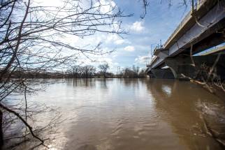
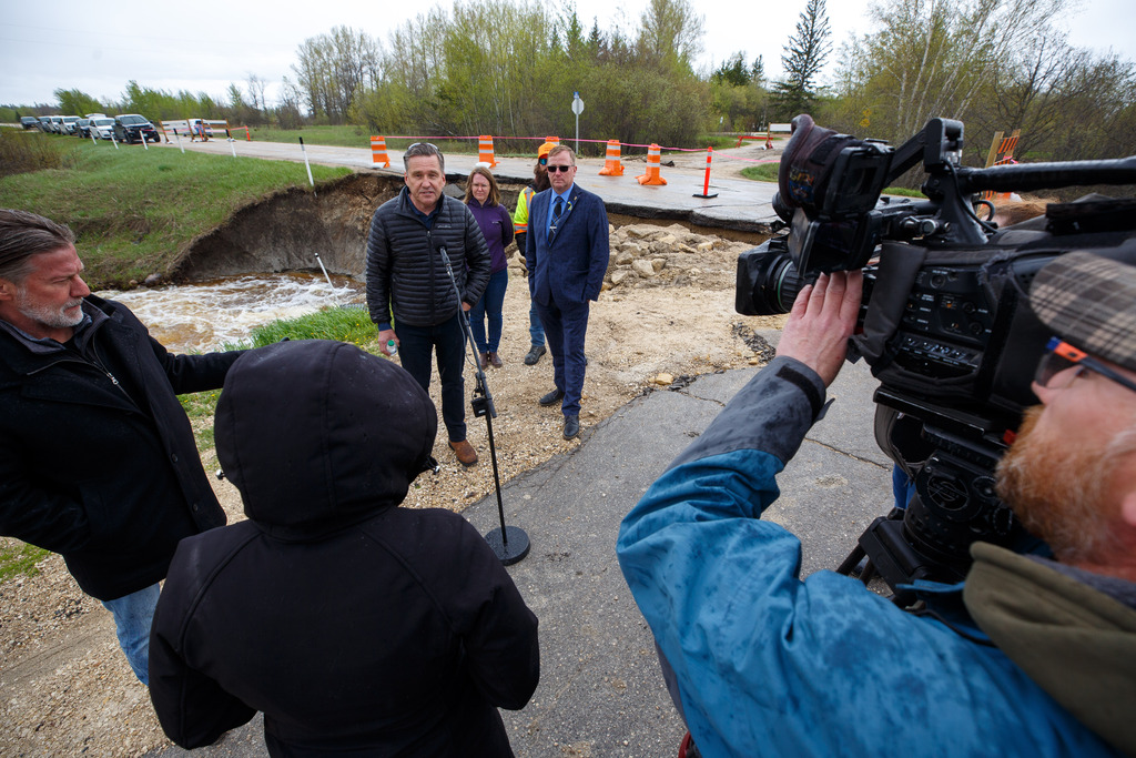
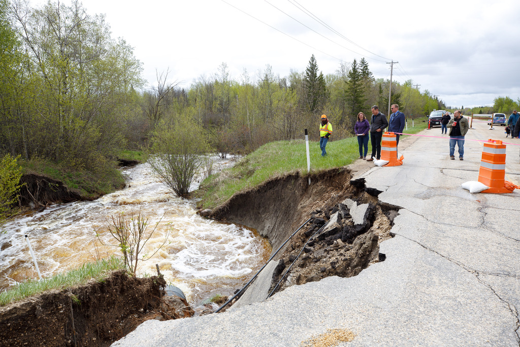
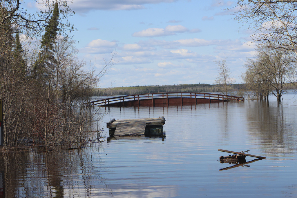
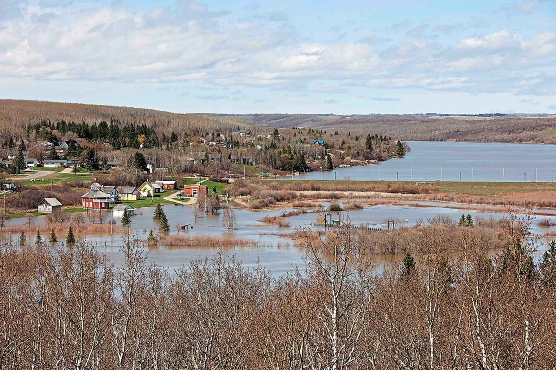
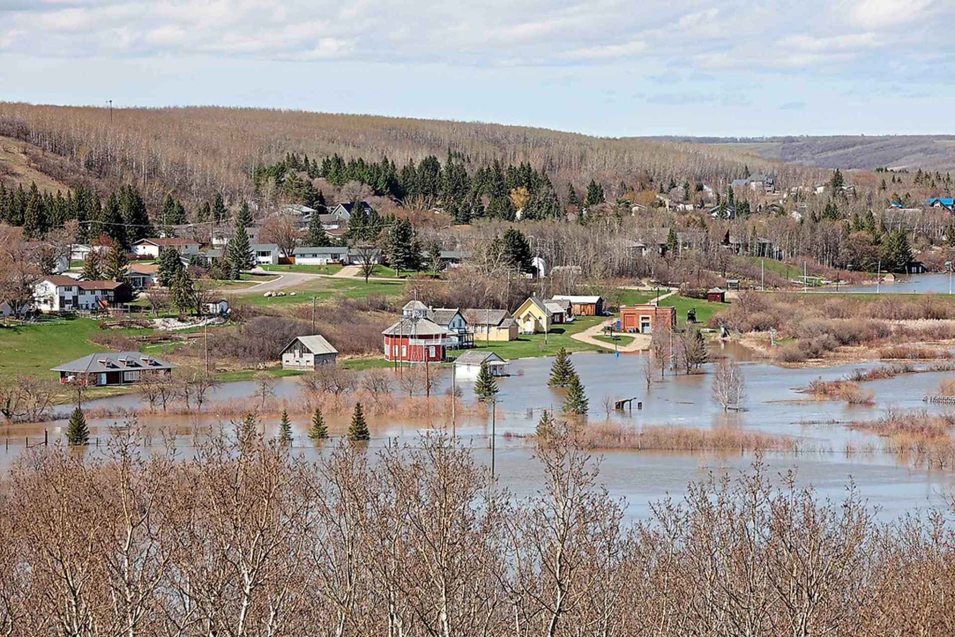
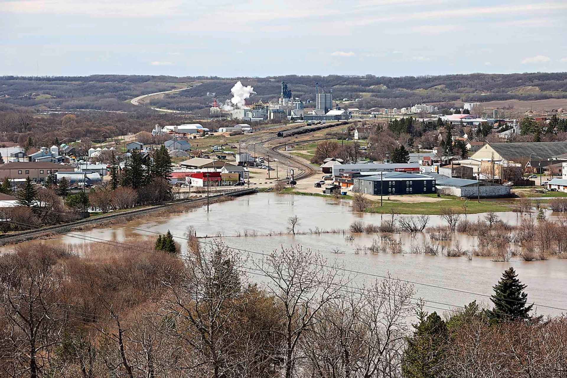
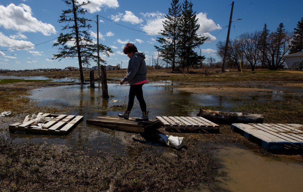
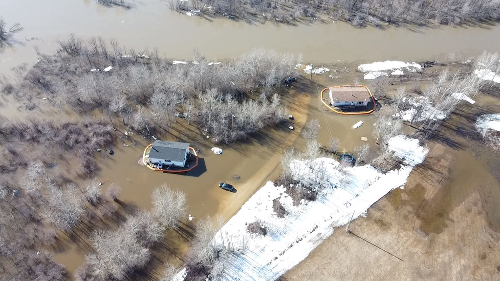
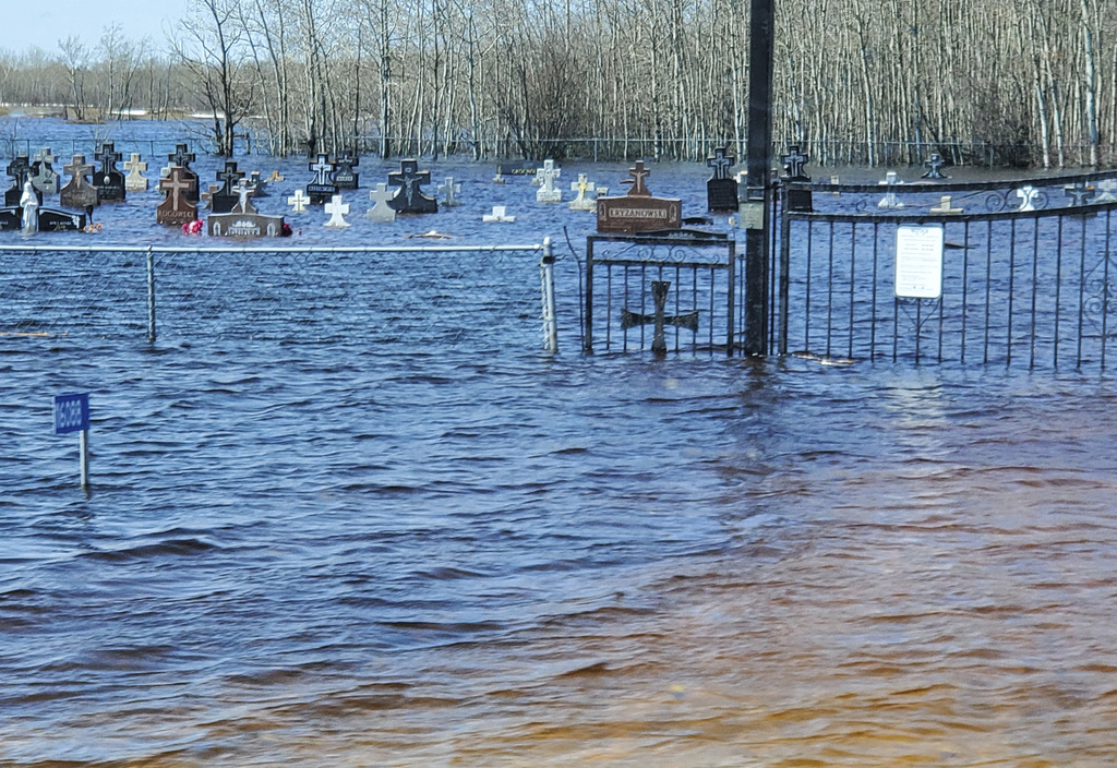
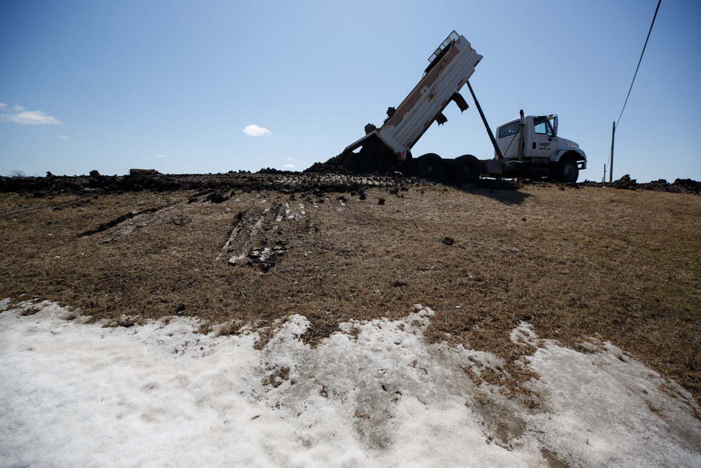
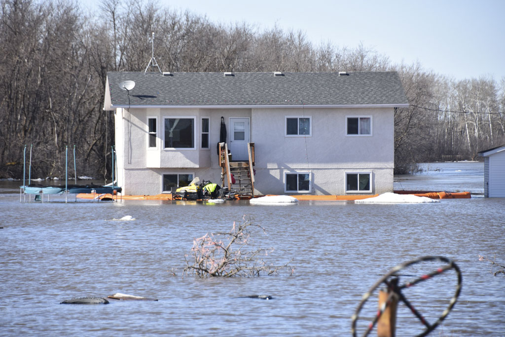
Manitobans continue to battle spring flooding between the Interlake and Canada-U.S. border, with hundreds more forced to leave their homes and the number of washed-out roads increasing.
The fight is being helped by sunshine and the warmest temperatures so far this year, but rain is expected in flood zones again this weekend.
In the Interlake, the number of evacuees from Peguis First Nation climbed to more than 1,400 Wednesday, from about 1,200 the previous day, while crews were working to avert a crisis in the town of Arborg.

“We are at the highest level that we’ve ever had,” Peguis Chief Glenn Hudson said, after the Fisher River reached its peak. “It seems to have levelled off and it is maintaining that level.”
In a statement, Indigenous Services Canada said another 800 residents are expected to leave Peguis over the next few days, as community leaders and the Canadian Red Cross co-ordinate a full evacuation.
Evacuees are staying in hotels in Winnipeg, Gimli and Brandon, said ISC.
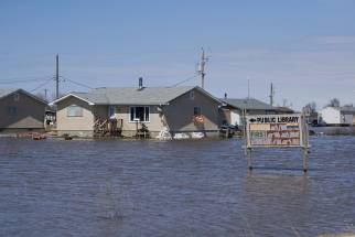
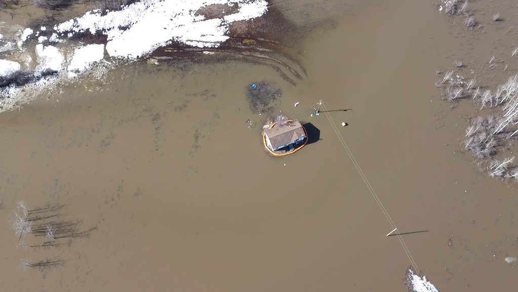
Hudson said more than 700 homes have flooded after an ice jam caused the swollen river to spill its banks over the weekend.
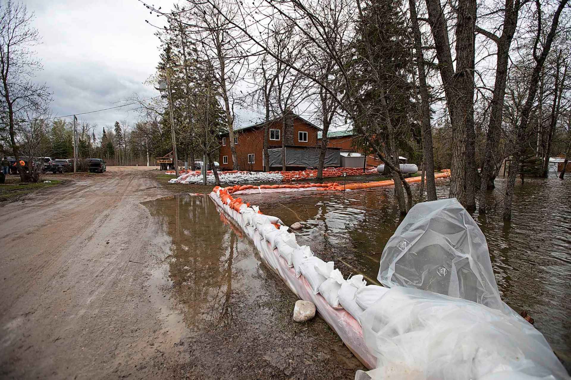
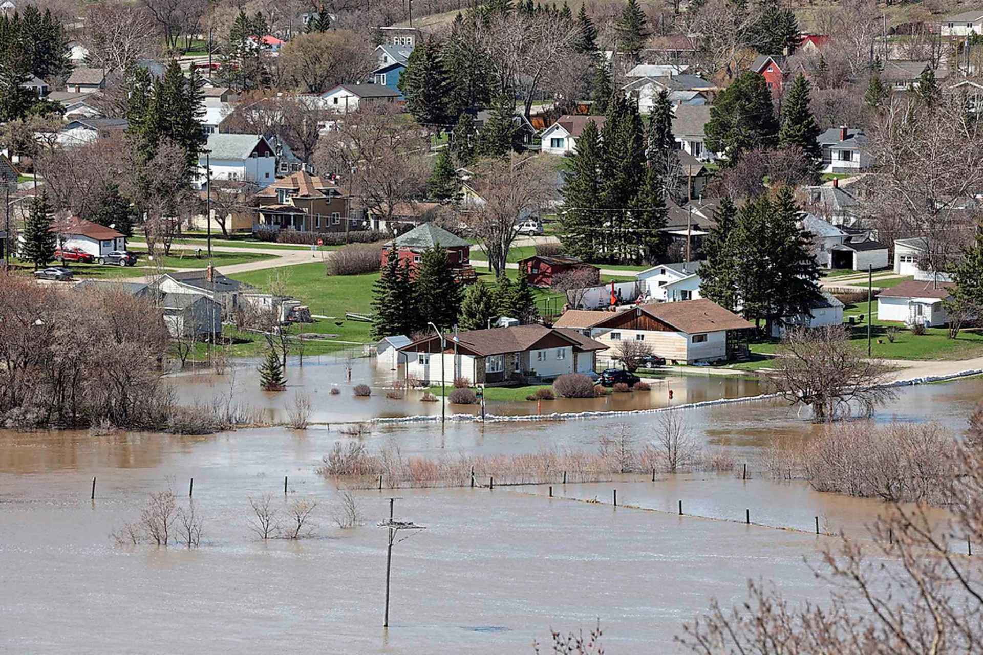
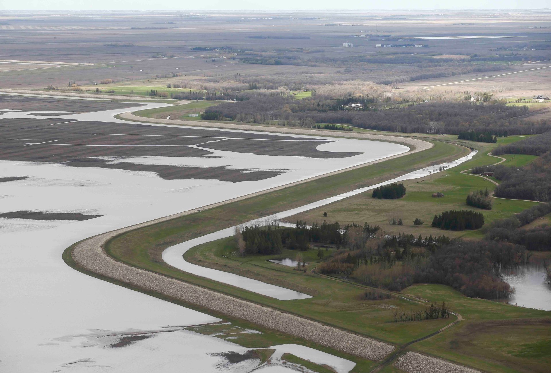
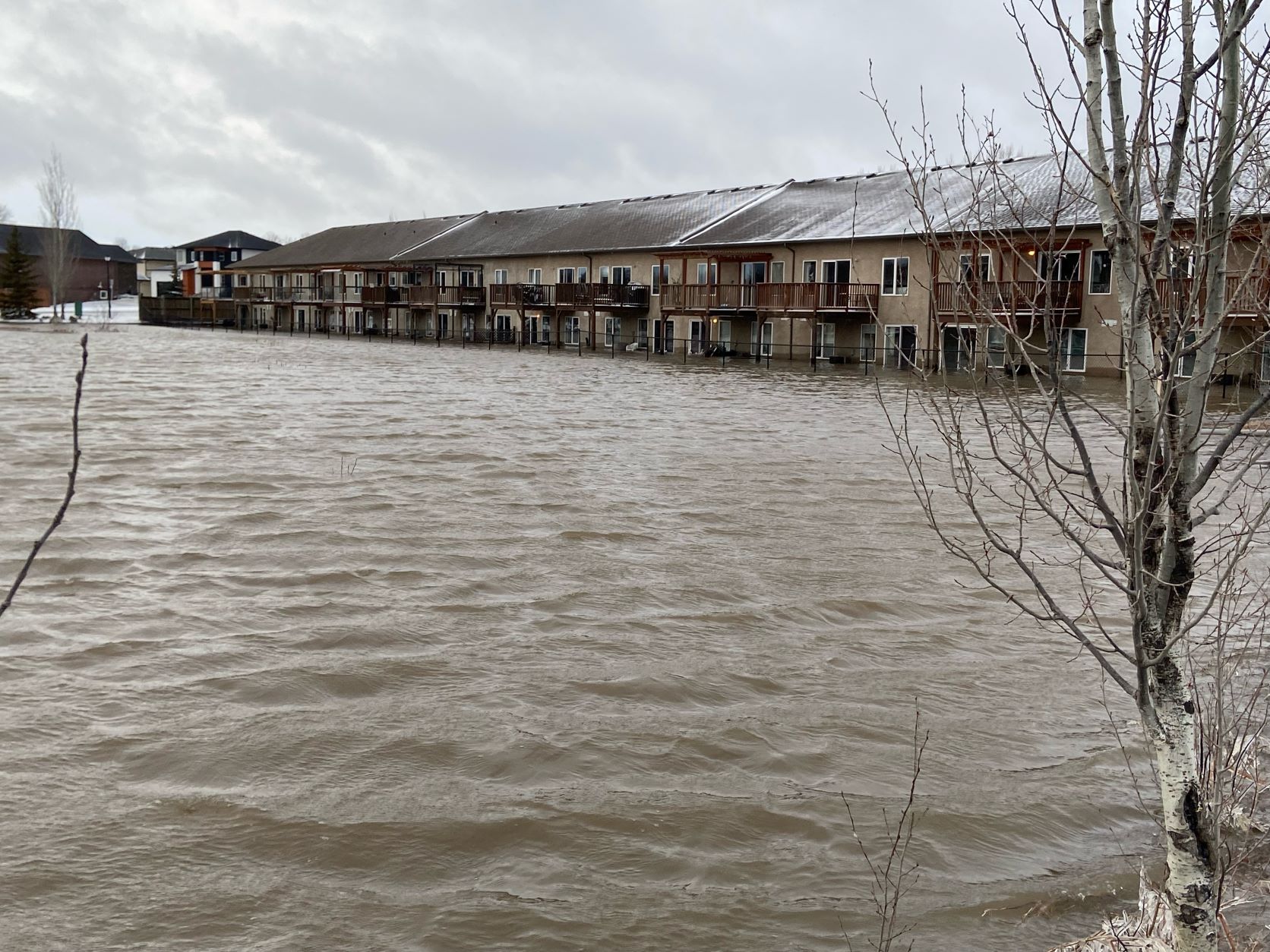
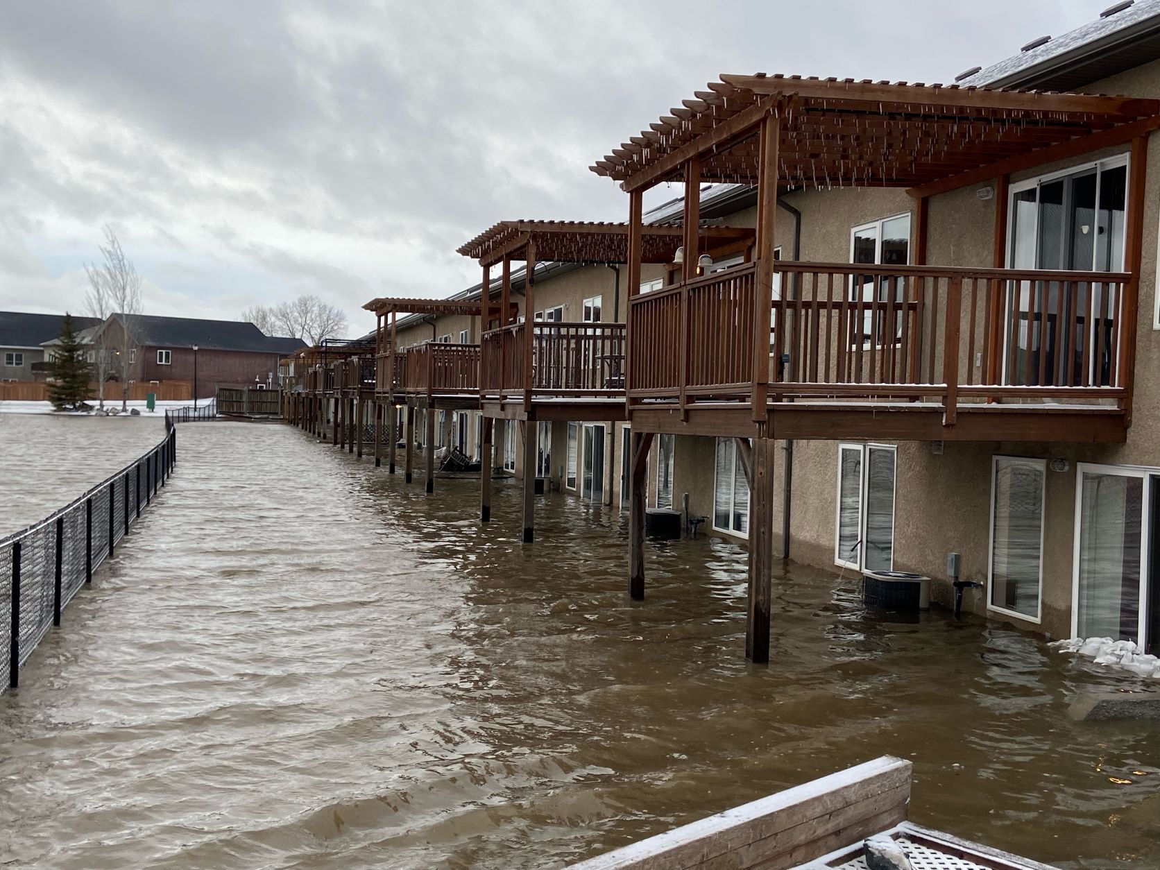
Many keep careful eye on water from behind dike walls

Posted:
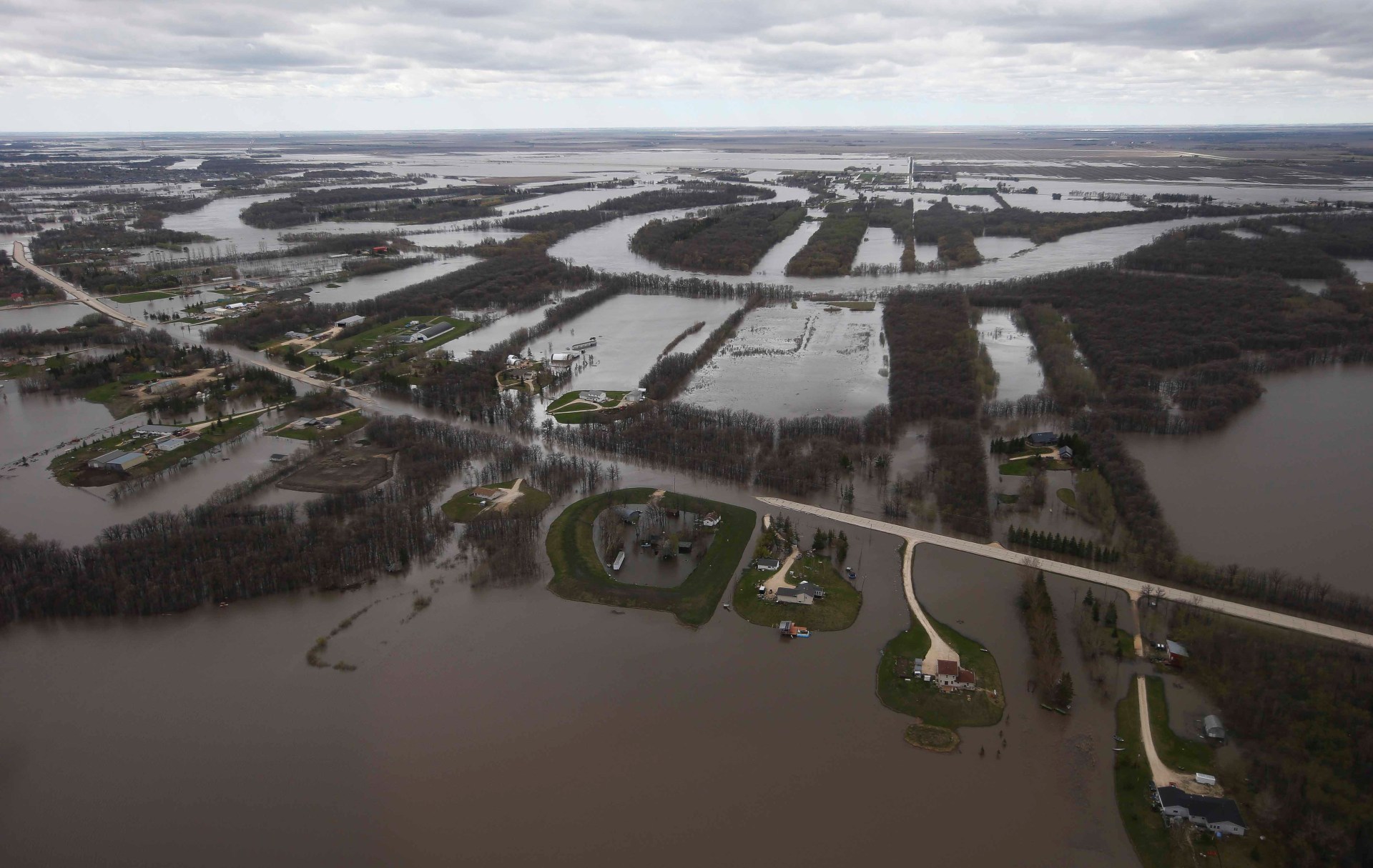
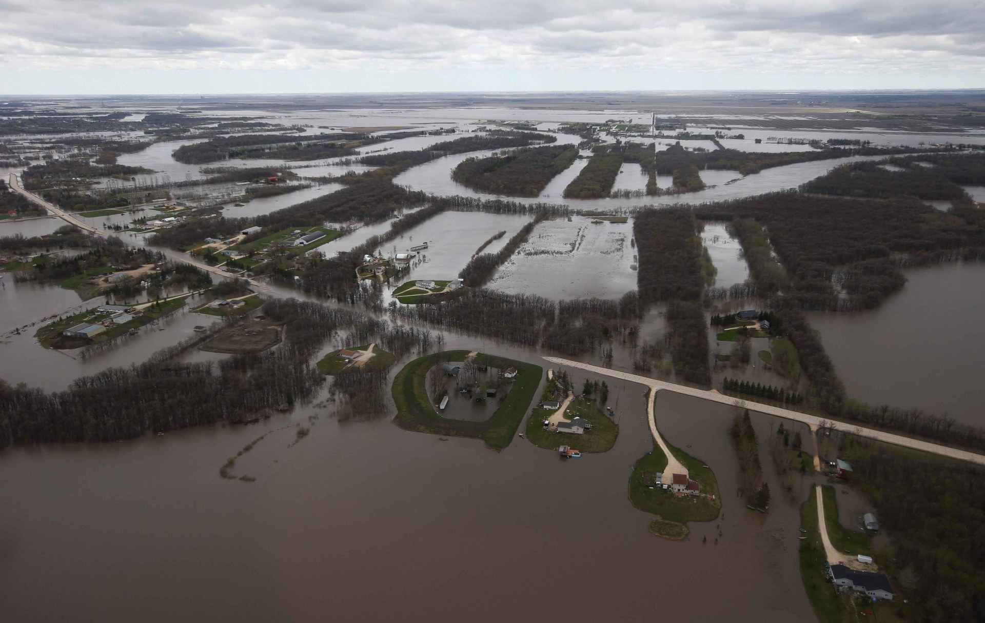
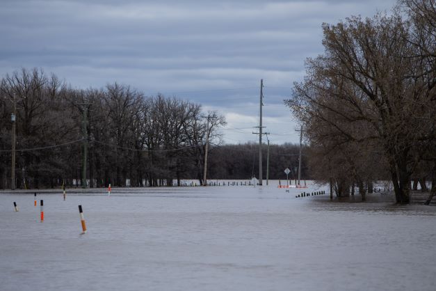
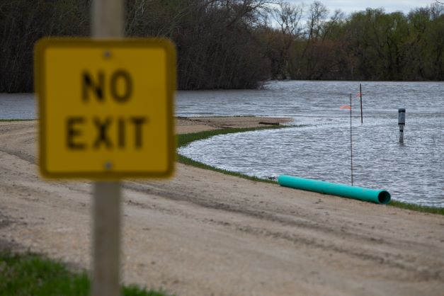
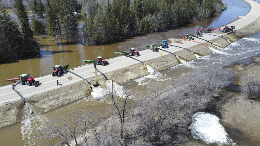
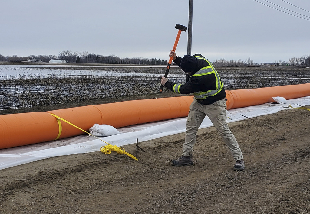
MUNICIPALITY OF RITCHOT — As far as one can drive past the closure sign on Provincial Road 200, where the Red River has become a lake, Don Clark stopped Wednesday with supplies to shore up a dike.
He said a request for military aid is on hold, after more people joined the flood fight through a public call for help and an Assembly of Manitoba Chiefs program.
Hudson said he plans to speak with Ottawa about a long-term flood protection strategy for the First Nation, about 170 kilometres northwest of Winnipeg.
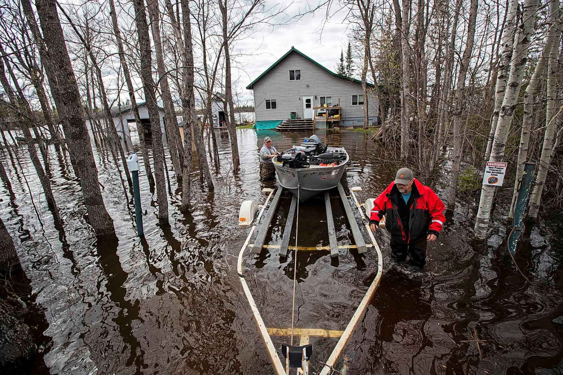
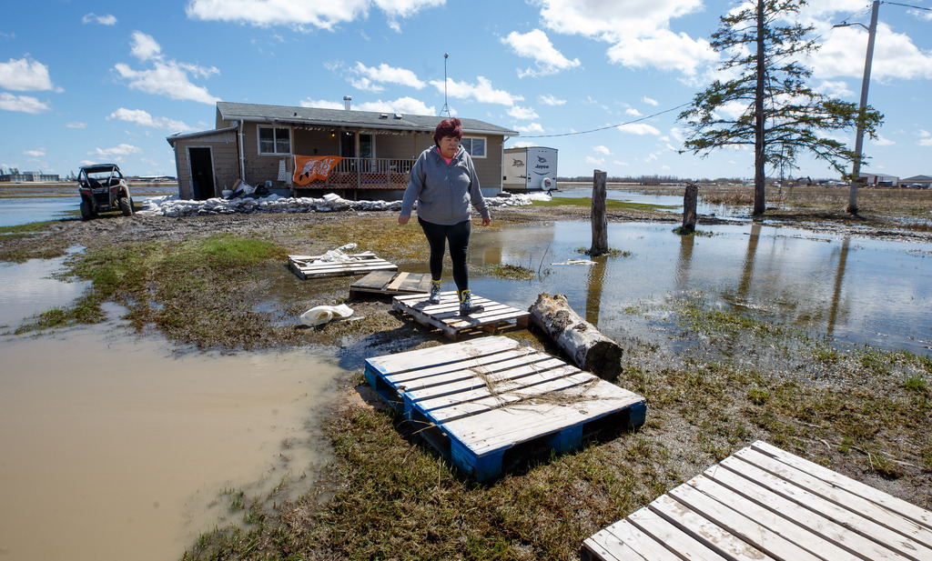
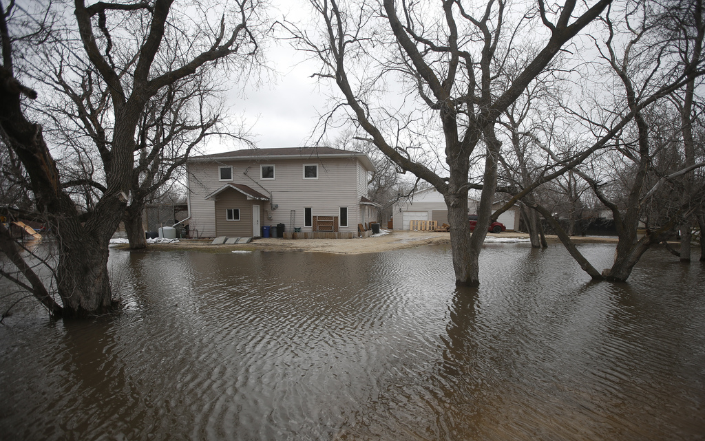
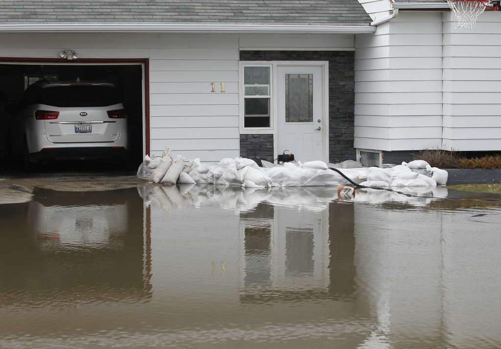
Peguis resident Cindy Sutherland, who stayed behind despite a mandatory evacuation notice, doesn’t know how much more she can take.
Sutherland, her husband and their 18-year-old son have been pumping water out of their basement non-stop since Saturday, leaving them tired and stressed.
“We’re almost to our last straw. It’s pushing through the basement windows and our chimney stack,” she said. “It’s coming in as fast as it’s coming out.”
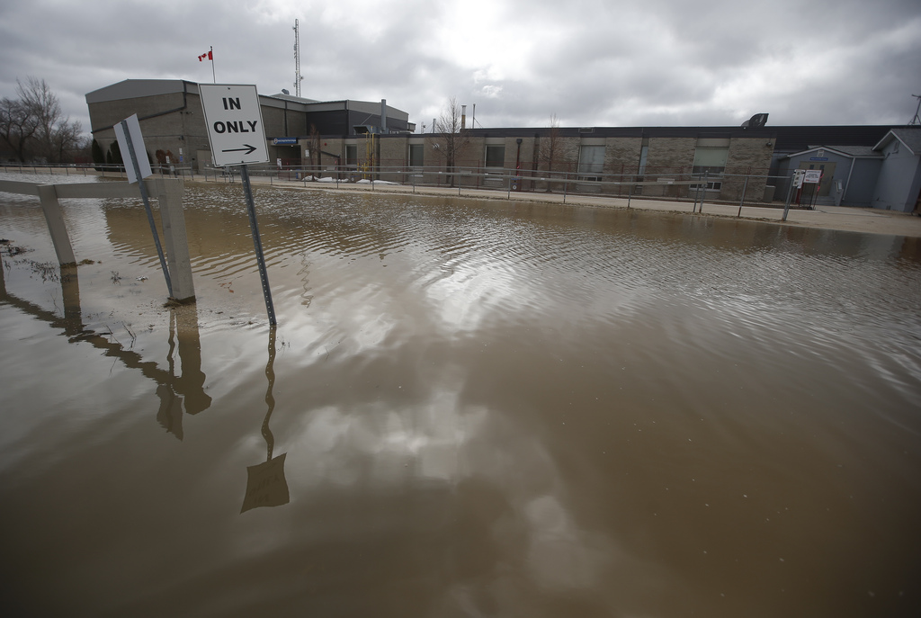
Arborg put a hospital, care home and some residences on evacuation notice after flooding and a washout near the junction of highways 7 and 68.
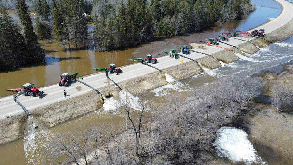
Non-stop operation of 10 large pumps helped reduce the water level and take pressure off Highway 68 and culverts at risk of eroding. The swollen Icelandic River was also receding.
“We are cautiously optimistic that it is all moving in the right direction for us,” said Mayor Peter Dueck.

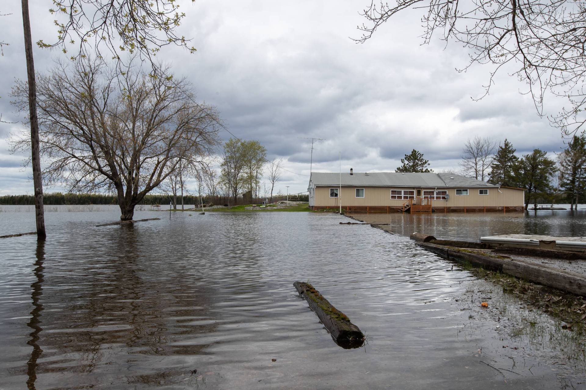
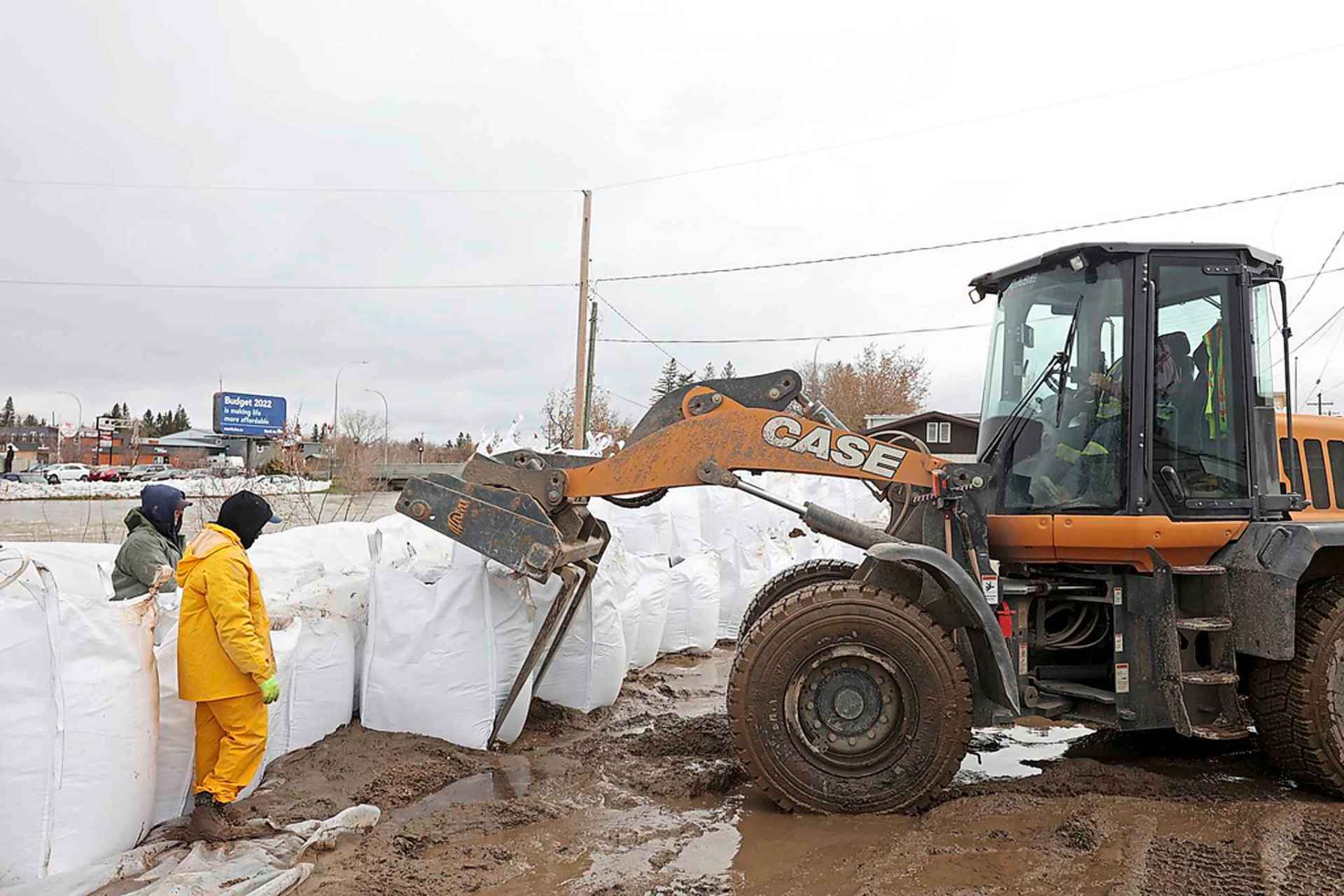
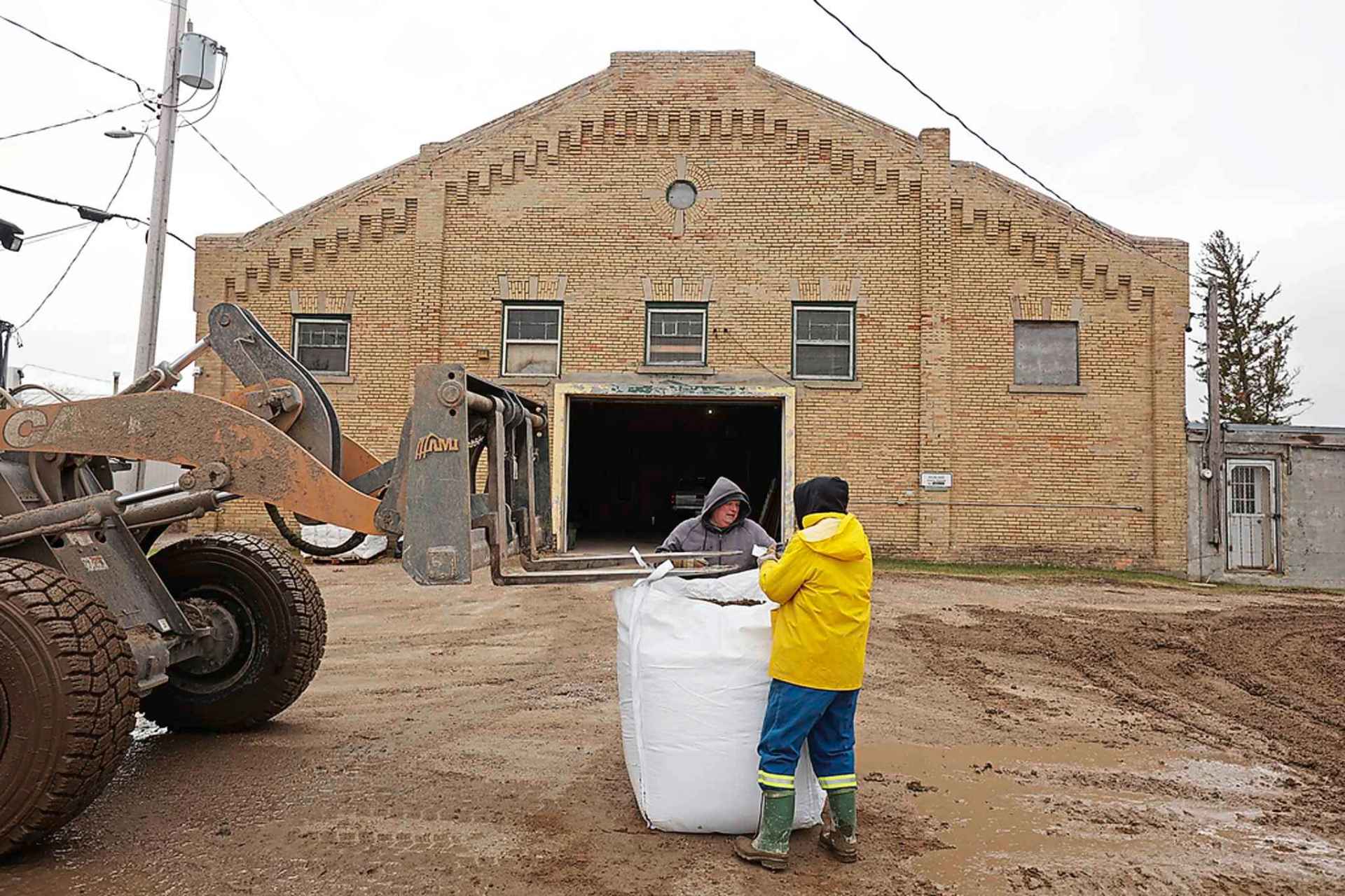
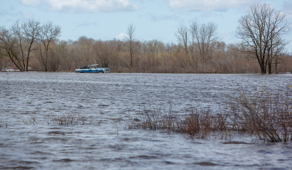
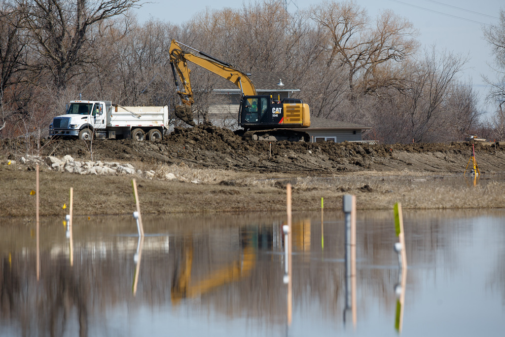
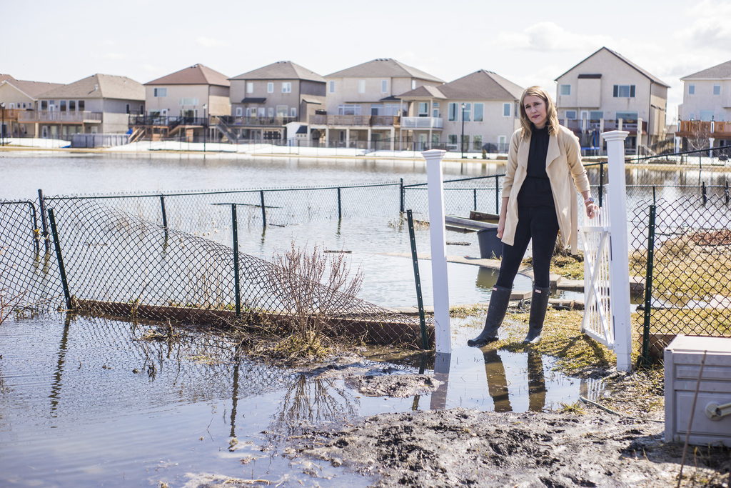
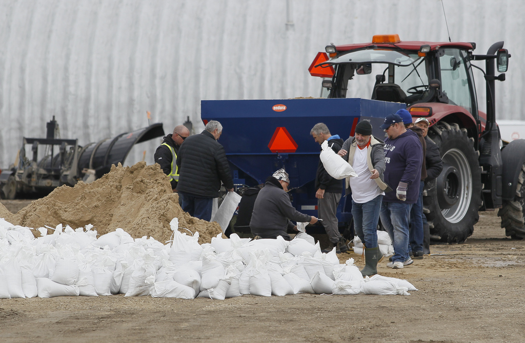
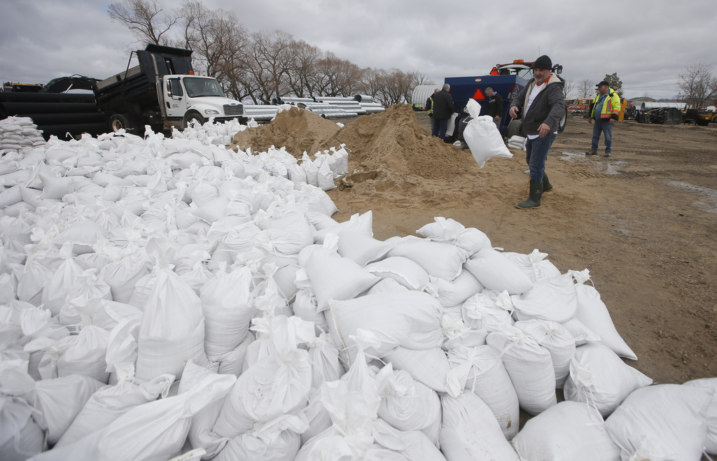
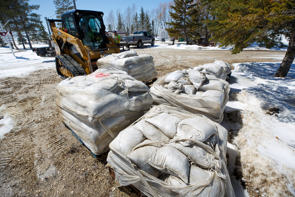
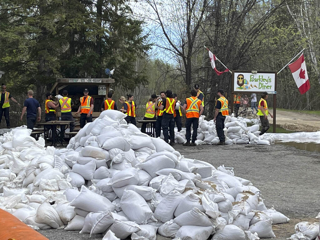
South of Winnipeg, municipalities in the Red River Valley are preparing to hand out more evacuation notices as work continues on closing ring dikes, pumping water and stacking sandbags where needed.
The province is predicting a peak similar to the major flood of 2009, with a crest in Emerson between May 7 and 10. Community ring dikes and individual flood protections are designed to withstand such a flood.
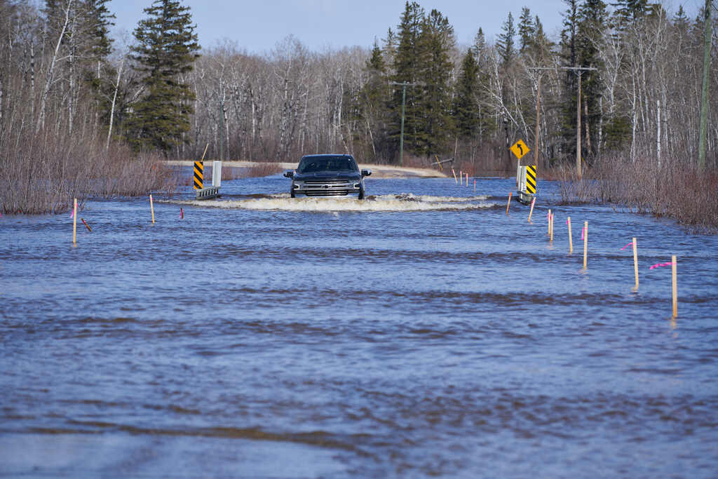
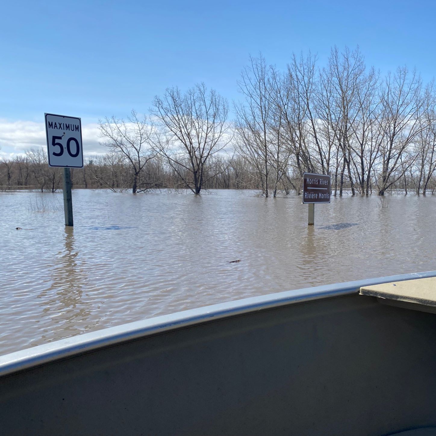
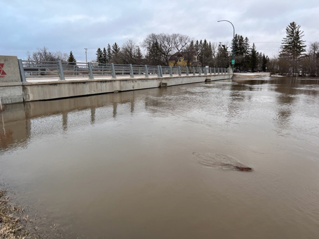
The ring dike protecting Morris is surrounded by floodwater, with just one road access point after the province closed Highway 75 on the north and south sides of town. Highway 23 is closed on the west side.
Mayor Scott Crick said Highway 23 on the east side, the town’s highest access, is expected to stay open throughout the flood.
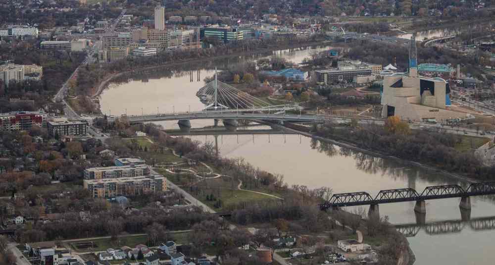
How high is the Red River today? Check this graph.
Posted:
Water levels in Winnipeg are measured in “feet James,” the level above the normal winter ice level as measured at a gauge on the Red River east of James Avenue in the Exchange District, just downstream of The Forks where the Red and Assiniboine rivers meet.
“What things will look like in a few weeks is anyone’s guess,” he said. “We’re dealing with an atypical year.”
Crick said the highway closures are challenging for Morris residents who commute to work, truckers who now have to take a long detour and businesses which benefit from people driving through the town.
South of Morris, 72 residents in the Rural Municipality of Montcalm have been asked to leave their homes, with some choosing to stay behind, said Reeve Paul Gilmore.
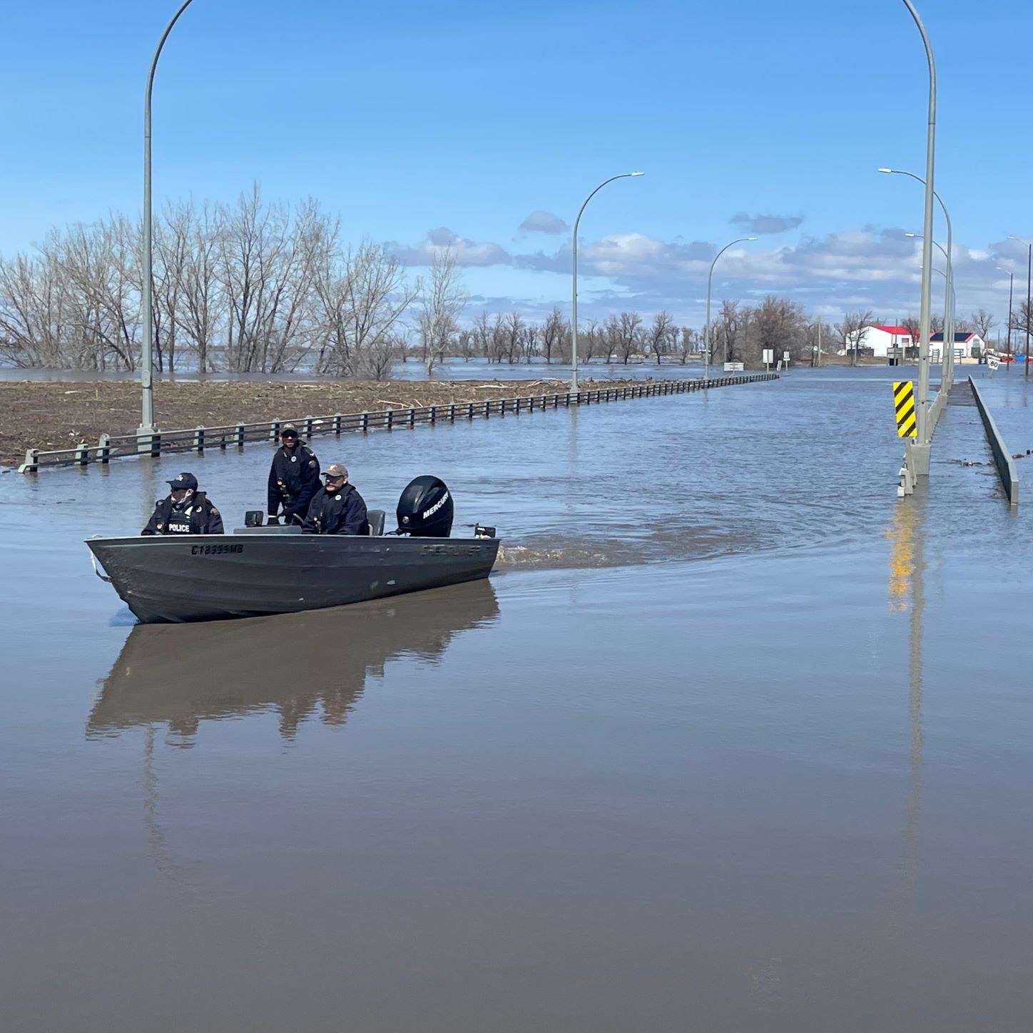
He said the RM has asked the RCMP to check on vacated properties and people who’ve stayed behind, although some roads were impassable.
Manitoba RCMP Sgt. Paul Manaigre said officers in flood zones are using pickup trucks and boats to do patrols, depending on access.
Two officers working in the Fisher River region are using Sherp amphibious vehicles to travel over any terrain, he said.
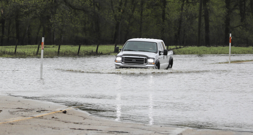
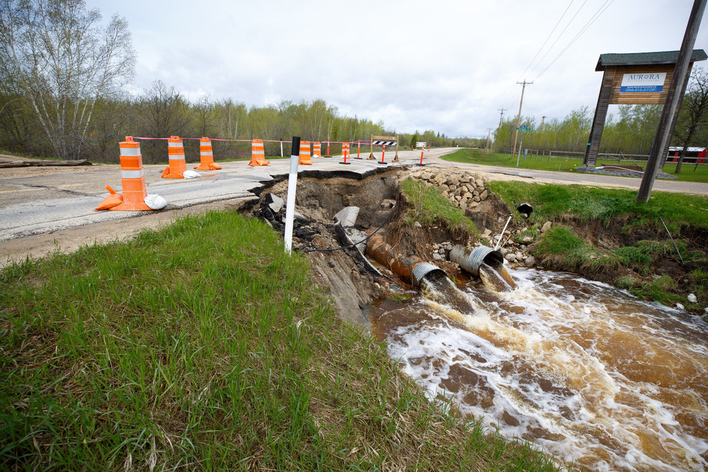
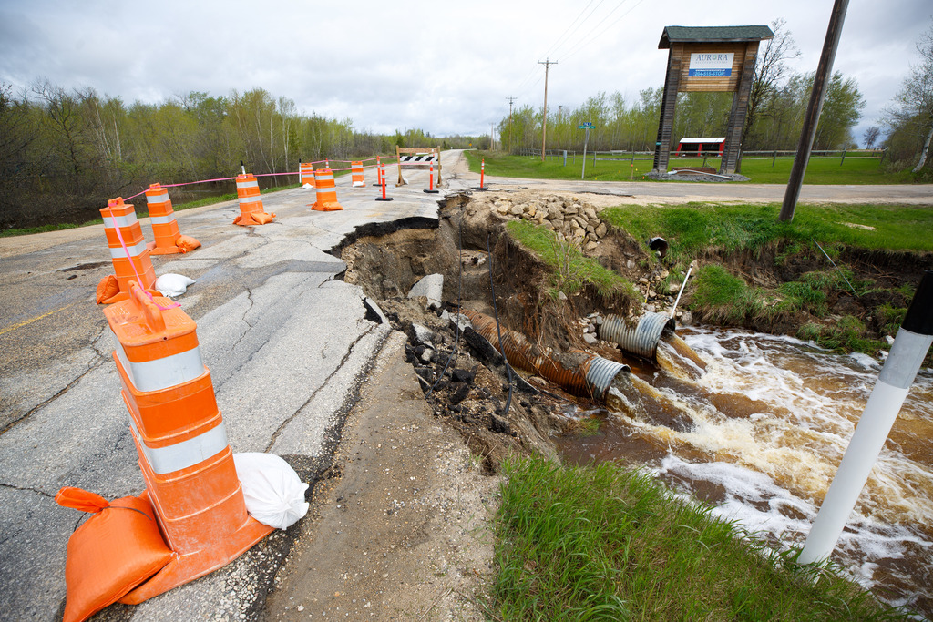
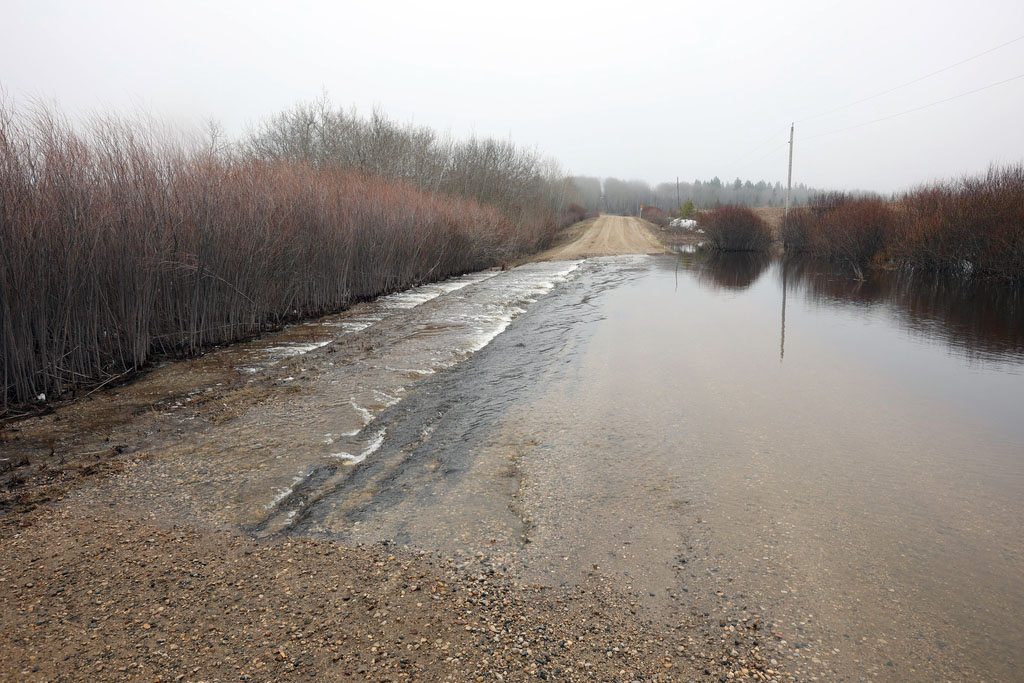
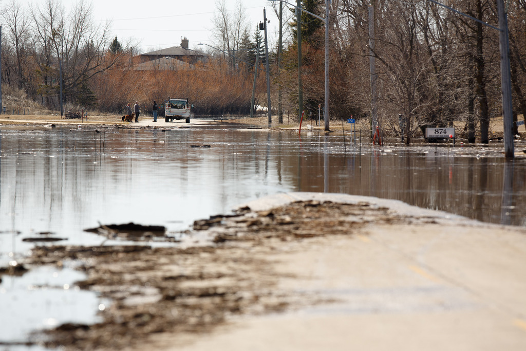
Loss of road access is one of the biggest problems for RMs dealing with flooding in southern and central Manitoba.
Gilmore said Montcalm, which includes Letellier and St. Jean Baptiste, will probably ask the province for disaster financial assistance to repair gravel roads post-flood.
The RM of Grey is also looking at making repairs to some roads which are submerged or too soft or rutted to drive on.
“We need some good, hot sunny days to dry them up,” said deputy reeve Rod Savage.
“What things will look like in a few weeks is anyone’s guess. We’re dealing with an atypical year.” – Morris Mayor Scott Crick
He said the flood situation is improving in Grey, where about 12 pumps were being used to protect homes in the Elm Creek and St. Claude areas.
To further prepare for river flooding, the surrounding RM of Rhineland became the 25th Manitoba municipality to declare a local state of emergency.
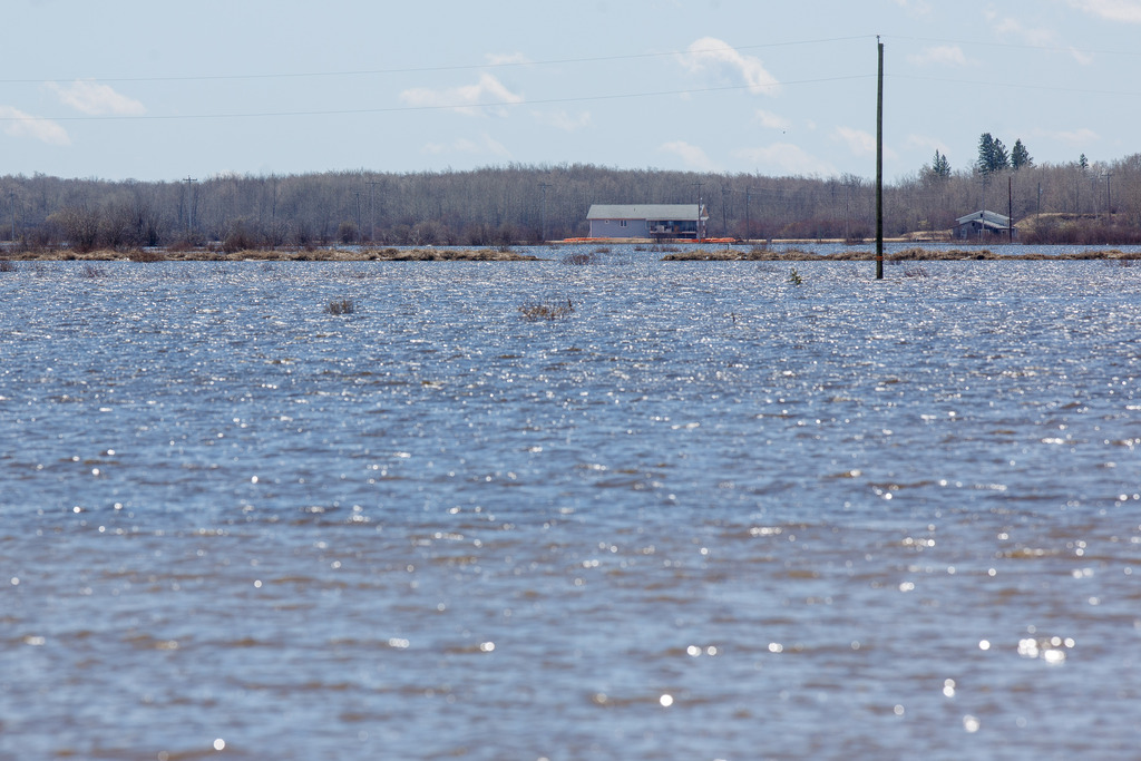
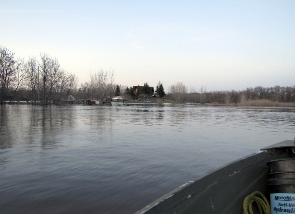
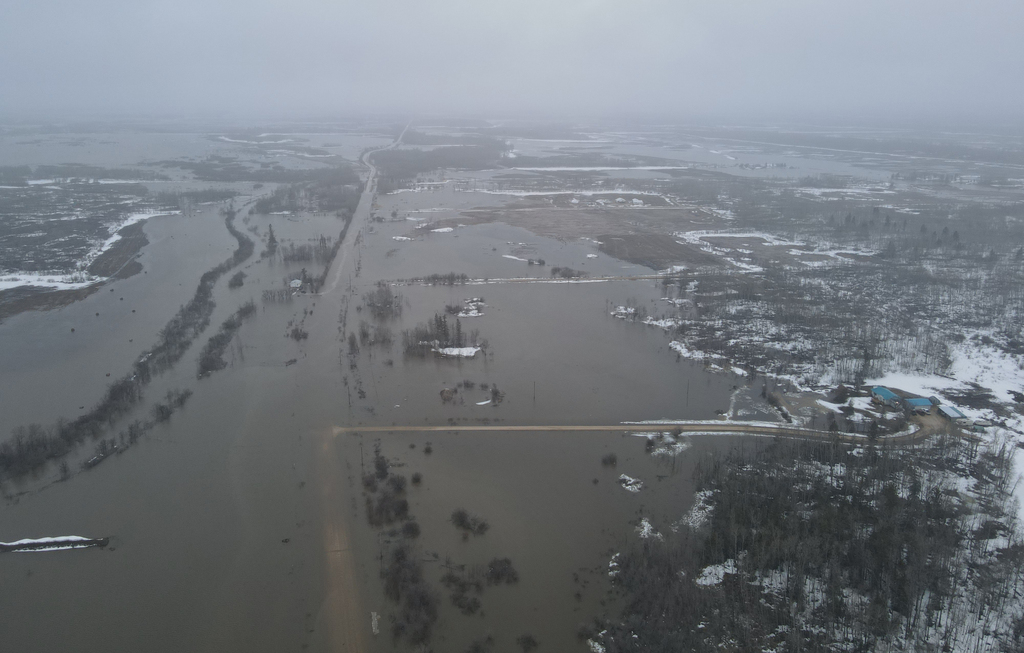
North of Grand Forks, N.D., the bloated Red River has been dubbed the “Red Sea.” The U.S. National Weather Service said floodwater is about 13 km wide in places.
The surface area is so large it is behaving like a lake and generating its own weather, said Scott Kehler, president and chief scientist of Weatherlogics.
On Tuesday, the sprawling river spawned a breeze, a phenomenon which usually occurs on large bodies of water such as Lake Winnipeg, said Kehler.
“The water heats up more slowly than the land when the sun is out. That creates a circulation where the air is flowing from the water to the land,” he said. “To get it from a river, it almost never happens.”
.jpg?w=1920)


.jpg?w=1920)
.jpg?w=1920)
.jpg?w=1920)


.jpg?w=1920)

Forecasters are expecting rain in southern and central Manitoba this weekend and early next week, but not as much as previous weekends.
Initially, it looked like another Colorado low could form, but a series of weaker low-pressure systems are now expected, said Kehler.
“For us, that was welcome news,” said Gilmore.
Environment Canada meteorologist Jesse Wagar said scattered showers are possible Friday and into Saturday, while a second low-pressure system later Saturday and into Sunday will bring more widespread rain.
She said five to 10 millimetres is possible. The Dauphin and Swan River areas could get heavier amounts.
A third system could dump about five to 10 mm starting Monday, said Wagar.
chris.kitching@freepress.mb.ca
Twitter: @chriskitching

Chris Kitching is a general assignment reporter at the Free Press. He began his newspaper career in 2001, with stops in Winnipeg, Toronto and London, England, along the way. After returning to Winnipeg, he joined the Free Press in 2021, and now covers a little bit of everything for the newspaper. Read more about Chris.
Every piece of reporting Chris produces is reviewed by an editing team before it is posted online or published in print — part of the Free Press‘s tradition, since 1872, of producing reliable independent journalism. Read more about Free Press’s history and mandate, and learn how our newsroom operates.
Our newsroom depends on a growing audience of readers to power our journalism. If you are not a paid reader, please consider becoming a subscriber.
Our newsroom depends on its audience of readers to power our journalism. Thank you for your support.