City-made satellites to soar into space Magellan Aerospace contributed to $1.2-billion project to monitor Canada's land mass
Read this article for free:
or
Already have an account? Log in here »
To continue reading, please subscribe:
Digital Subscription
One year of digital access for only $75*
- Enjoy unlimited reading on winnipegfreepress.com
- Read the E-Edition, our digital replica newspaper
- Access News Break, our award-winning app
- Play interactive puzzles
*Billed as $5.77 plus GST every four weeks. After 52 weeks, price increases to the regular rate of $19.95 plus GST every four weeks. Offer available to new and qualified returning subscribers only. Cancel any time.
Monthly Digital Subscription
$4.99/week*
- Enjoy unlimited reading on winnipegfreepress.com
- Read the E-Edition, our digital replica newspaper
- Access News Break, our award-winning app
- Play interactive puzzles
*Billed as $19.95 plus GST every four weeks. Cancel any time.
To continue reading, please subscribe:
Add Free Press access to your Brandon Sun subscription for only an additional
$1 for the first 4 weeks*
- Enjoy unlimited reading on winnipegfreepress.com
- Read the E-Edition, our digital replica newspaper
- Access News Break, our award-winning app
- Play interactive puzzles
*Your next Brandon Sun subscription payment will increase by $1.00 and you will be charged $17.95 plus GST for four weeks. After four weeks, your payment will increase to $24.95 plus GST every four weeks.
Read unlimited articles for free today:
or
Already have an account? Log in here »
Hey there, time traveller!
This article was published 05/06/2019 (2596 days ago), so information in it may no longer be current.
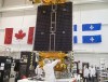
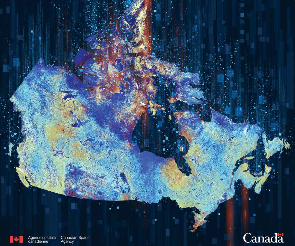
First responders in remote regions, maritime surveillance organizations and especially the monitoring of Canada’s Arctic regions will all soon have more accurate and timely data after next Tuesday’s launch of three satellites partly made in Winnipeg.
The satellites comprise the $1.2 billion RADARSAT Constellation Mission (RCM) and will get blasted into orbit 600 kilometres above the earth from the Vandenberg Air Force Base, Calif., on a SpaceX Falcon 9 rocket.
It’s the culmination of 14 years of work by the Canadian Space Agency. The three-satellite configuration will orbit 96 minutes apart and will pass over and transmit data on Canada’s land mass up to four times a day as well as provide daily access to any point of 90 per cent of the world’s surface.

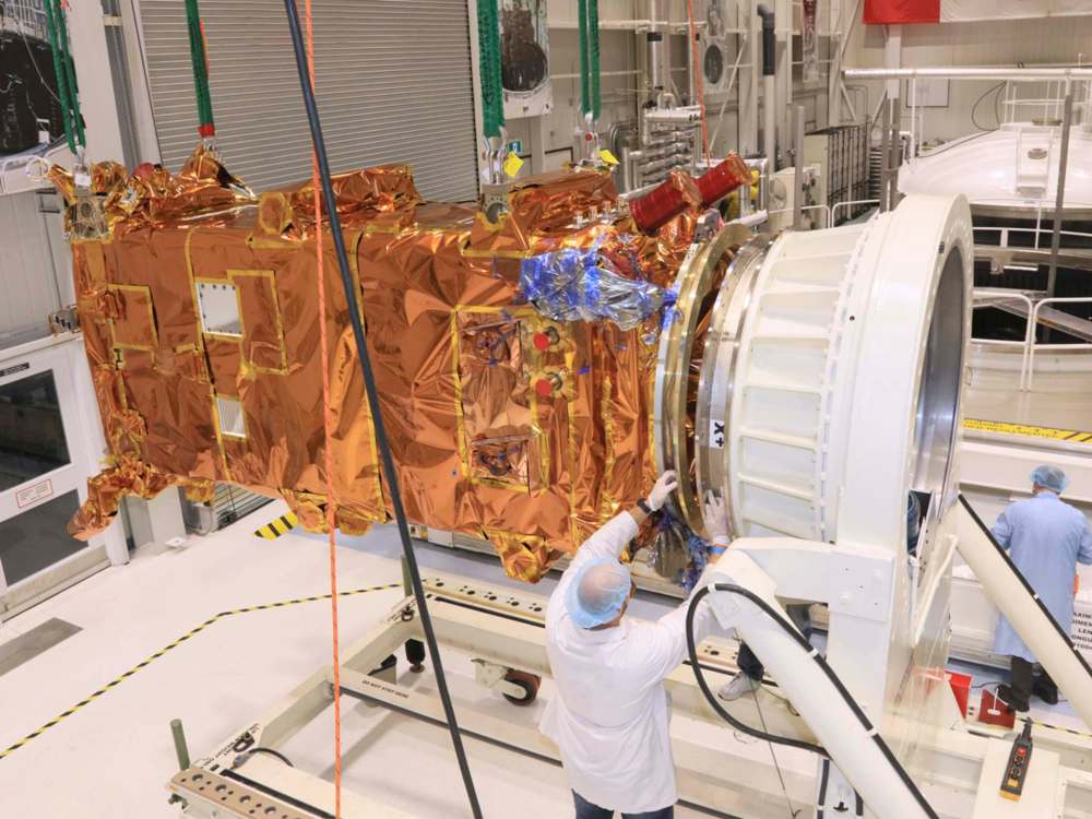
Winnipeg’s Magellan Aerospace was one of the major suppliers of hardware for the project. The aerospace manufacturing facility built the three satellite bodies at a cost of about $110 million, delivering the last piece of equipment last October.
It was the largest space contract in Magellan’s history and kept close to 75 technologists and scientists busy for the better part of five years.
The three-satellite configuration will replace two older RADARSAT missions, and will send SAR (synthetic aperture radar) data to 12 government departments to monitor climate change, assist in disaster relief and pinpoint ships around the world.
“As we all know Canada has the longest coastline in the world and the second largest land mass… with large remote areas with varied geography,” said Magda Wierus, operations engineer at the Canadian Space Agency. “Space-based EO (earth observation) is the natural choice to monitor our assets.”
The satellites will take between three and six months to be commissioned and after that the data — a form of radar that is used to create both two-dimensional images and three-dimensional reconstructions of objects, such as landscapes — will start sending 250,000 images a year.
Steve Iris, the RADARSAT Constellation Mission manager, said the implications for the monitoring of climate change especially in Canada’s Arctic will be huge, where the use of space-based radar system can observe the earth day or night in any weather conditions.
“With the RCM we will be able to monitor the subtle changes like the melting of the permafrost every four days,” he said. “It is a big, big advantage compared to what we have right now.”
The three-satellite constellation will take 250,000 images per year, 50 times more than is currently possible from the two independent RADARSAT satellites that have now out-lived-lived their seven year lifespan.

Canadian Space Agency officials say the manner in which the data will be distributed is still be determined, but at least a dozen federal government departments including the Department of Defence will use the data.
Wierus said that although the data will not be sold commercially to third parties it will be made available to industry and academia on “some other basis”.
She said the main requests are from various departments to have daily coverage of the Canadian land mass and maritime approaches including images of the Arctic.
The RCM satellites’ payload includes technology that will capture the location of all ships on the seas from their transponders that can pinpoint the locations of ships including rogue ships that do not want to be found.
martin.cash@freepress.mb.ca
Related Articles
Canadian RADARSAT Constellation mission in orbit