Manning the ‘moat’ in the Red River Valley Weary property owners resigned to more rain
Read this article for free:
or
Already have an account? Log in here »
To continue reading, please subscribe:
Digital Subscription
One year of digital access for only $75*
- Enjoy unlimited reading on winnipegfreepress.com
- Read the E-Edition, our digital replica newspaper
- Access News Break, our award-winning app
- Play interactive puzzles
*Billed as $5.77 plus GST every four weeks. After 52 weeks, price increases to the regular rate of $19.95 plus GST every four weeks. Offer available to new and qualified returning subscribers only. Cancel any time.
Monthly Digital Subscription
$4.99/week*
- Enjoy unlimited reading on winnipegfreepress.com
- Read the E-Edition, our digital replica newspaper
- Access News Break, our award-winning app
- Play interactive puzzles
*Billed as $19.95 plus GST every four weeks. Cancel any time.
To continue reading, please subscribe:
Add Free Press access to your Brandon Sun subscription for only an additional
$1 for the first 4 weeks*
- Enjoy unlimited reading on winnipegfreepress.com
- Read the E-Edition, our digital replica newspaper
- Access News Break, our award-winning app
- Play interactive puzzles
*Your next Brandon Sun subscription payment will increase by $1.00 and you will be charged $17.95 plus GST for four weeks. After four weeks, your payment will increase to $24.95 plus GST every four weeks.
Read unlimited articles for free today:
or
Already have an account? Log in here »
Hey there, time traveller!
This article was published 11/05/2022 (1541 days ago), so information in it may no longer be current.
In the flooded Red River Valley, island life — and having to hop in a boat to complete even the simplest of everyday tasks — isn’t for everyone.
Gillian Potvin decided to heed a voluntary evacuation notice and leave with her son, Luc, a week ago as water lapped over roads and surrounded their home just south of St. Adolphe.
“With a two-year-old, it wasn’t practical to think we could boat in and out every day with him to go to daycare,” said Potvin, who runs a communications and marketing firm. “We had safety in mind. We’re going to hunker down (with in-laws in Ste. Agathe) until it’s safe to go back.”

Her husband, Daniel, stayed behind to “man the moat” amid the first major flood since they moved to the rural property, located on the east side of the Red, five years ago.
Their house is on a hill and is safe from the projected peak of this spring’s flood, which will be similar to those of 2009 and 2011.
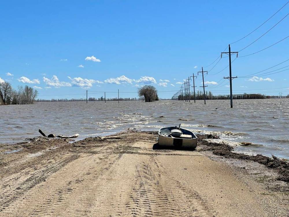
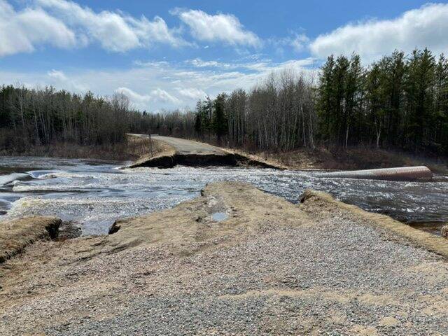
About 200 households in the RM of Ritchot have received voluntary evacuation notices due to flooded access roads.
“In these experiences, as scary as they can be, we’ve seen our community come together to sandbag, to bring food and to be there to help their neighbours,” Potvin said Wednesday. “That’s just heartwarming.”
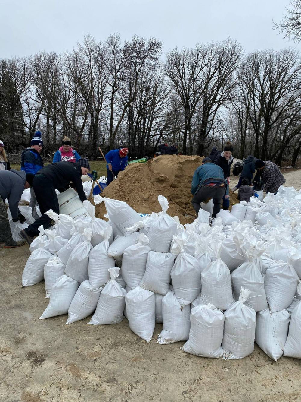
Potvin witnessed that kind of support when about 50 volunteers helped set up a structural dike around her parents’ home, which is also south of St. Adolphe and now boat access only, about three weeks ago.
Barbara Biggar and Reg Giesbrecht are staying put to monitor seepage and water pumps within the dike that protects their home from 1997 levels plus two feet.
“We are surrounded by water. We are basically on an island,” said Biggar, who runs a communications consulting firm and is a Progressive Conservative strategist. “It’s very stressful. Any level of flood is stressful.”
Last week — before local roads became submerged — she called 911 after a vehicle went into a water-filled ditch. Witnesses helped the woman escape through a window.
“We are surrounded by water. We are basically on an island… It’s very stressful. Any level of flood is stressful.” – Barbara Biggar
“The water was up to her waist and rising,” said Biggar.
Like many who live in flood zones, Potvin and Biggar are concerned about a Colorado low that’s set to dump more rain Thursday and Friday.
The system, coupled with one last Monday, could cause rivers to rise again, Transportation and Infrastructure Minister Doyle Piwniuk said in a statement to the legislature.
High water levels could continue into June, he said, as the Red neared its crest in Morris and Ste. Agathe.
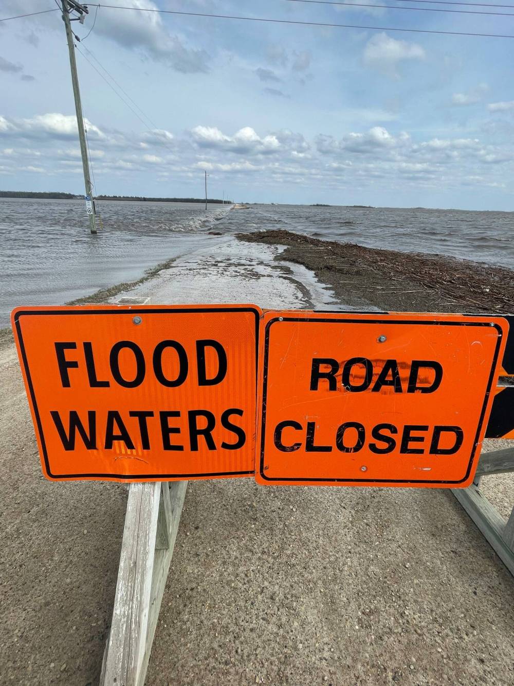
The province issued an overland flood warning for parts of southwest and southeast Manitoba ahead of the rainstorm. A flood warning was issued for Dauphin Lake.
As of Wednesday, 28 rural municipalities and four First Nations had declared local states of emergency.

Environment Canada meteorologist Terri Lang said the heaviest rain is expected in communities close to the Manitoba-Saskatchewan boundary.
Between 30 and 50 mm will fall in the west, with more than 60 mm possible in places hit by embedded showers or thunderstorms, according to a special weather statement.
Amounts of 20 to 40 mm are possible elsewhere before the system tapers off by Friday night.
“It’s another Colorado low in procession with all the other Colorado lows (this spring),” said Lang. “Any amount of rain isn’t welcome at this point.”
Wind gusts of up to 90 km/h will also cause problems.
Wet snow and freezing rain are possible as the system moves into northern areas Saturday.
Flood-hit areas of the Interlake are preparing for rivers to peak again. Dikes are being raised in the First Nation communities of Peguis and Fisher River. About 2,000 residents have left their homes since late last month.
“It’s another Colorado low in procession with all the other Colorado lows (this spring)… Any amount of rain isn’t welcome at this point.” – Terri Lang, Environment Canada meteorologist
The Rural Municipality of West Interlake is looking for more workers to fill sandbags, operate water pumps and monitor a dike on Provincial Road 325, about six kilometres east of Ashern.
As floodwater finally began to recede at the dike, officials were concerned about the storm and water yet to flow through the RM before draining into Lake Manitoba.
“If that (dike) washes out, it could overpower the drains and endanger Ashern,” said Reeve Arnthor Jonasson.
Home to about 700 people, Ashern is 170 kilometres northwest of Winnipeg.
West Interlake is operating a diversion and trying to source more tractor pumps. It ordered 25,000 sandbags from the province, filling about 2,000 by Wednesday afternoon.
The RM’s public works staff “have been going full out” to protect properties, said Jonasson.
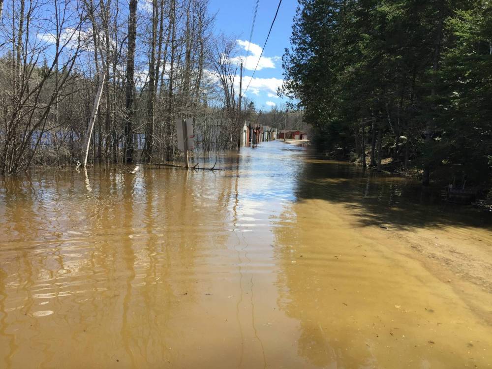
People in cottage country in eastern Manitoba are also dealing with significant flooding. Docks, watercraft and other objects have floated away on some bloated lakes, and many roads are closed.
Gail and Danny Adair, who live year-round on McKenzie Bay at West Hawk Lake, said their road was under about half a foot of water.
They’re worried they will become cut off if the water rises further.
“We’re trying to decide right now, do we go into (Winnipeg) or do we stay here?” said Gail Adair. “I’m scared for the weekend, with three days of rain.”
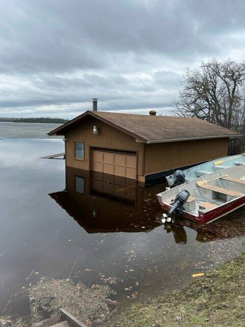
To the north, Donna Hastings has never seen water levels this high on Long Lake in Nopiming Provincial Park, where she and her husband own Windsock Lodge. Their boathouse is partially submerged.
“The water has nowhere to go but overland. Everything is completely full,” said Hastings.
Provincial Road 314 is washed out near the Manigotagan River and Cat Lake, and Hastings is worried PR 304 will close, leaving the lodge without road access.
“The water has nowhere to go but overland. Everything is completely full.” – Donna Hastings
If that happens, Hastings’ guests from Toronto and Jamaica will have to leave on a float plane.
The lodge, which is in spring bear hunt season, began welcoming customers after the COVID-19 pandemic slashed business for about two years.
“We were really excited about getting back to normal, but then we got this,” said Hastings. “We’ll survive. There are people who are doing worse than this.”
— with files from Danielle Da Silva
chris.kitching@freepress.mb.ca
Twitter: @chriskitching


Chris Kitching is a general assignment reporter at the Free Press. He began his newspaper career in 2001, with stops in Winnipeg, Toronto and London, England, along the way. After returning to Winnipeg, he joined the Free Press in 2021, and now covers a little bit of everything for the newspaper. Read more about Chris.
Every piece of reporting Chris produces is reviewed by an editing team before it is posted online or published in print — part of the Free Press‘s tradition, since 1872, of producing reliable independent journalism. Read more about Free Press’s history and mandate, and learn how our newsroom operates.
Our newsroom depends on a growing audience of readers to power our journalism. If you are not a paid reader, please consider becoming a subscriber.
Our newsroom depends on its audience of readers to power our journalism. Thank you for your support.