Heavy snow across the border forces province to revise flood forecast along Red
Read this article for free:
or
Already have an account? Log in here »
To continue reading, please subscribe:
Monthly Digital Subscription
$0 for the first 4 weeks*
- Enjoy unlimited reading on winnipegfreepress.com
- Read the E-Edition, our digital replica newspaper
- Access News Break, our award-winning app
- Play interactive puzzles
*No charge for 4 weeks then price increases to the regular rate of $19.00 plus GST every four weeks. Offer available to new and qualified returning subscribers only. Cancel any time.
Monthly Digital Subscription
$4.75/week*
- Enjoy unlimited reading on winnipegfreepress.com
- Read the E-Edition, our digital replica newspaper
- Access News Break, our award-winning app
- Play interactive puzzles
*Billed as $19 plus GST every four weeks. Cancel any time.
To continue reading, please subscribe:
Add Free Press access to your Brandon Sun subscription for only an additional
$1 for the first 4 weeks*
*Your next subscription payment will increase by $1.00 and you will be charged $16.99 plus GST for four weeks. After four weeks, your payment will increase to $23.99 plus GST every four weeks.
Read unlimited articles for free today:
or
Already have an account? Log in here »
Hey there, time traveller!
This article was published 18/03/2019 (2459 days ago), so information in it may no longer be current.
Recent heavy snows in the northern United States have caused the provincial government to upgrade the expected severity of this spring’s flood along the Red River.
On Monday, the Hydrologic Forecast Centre issued a bulletin saying it now forecasts a flood “of a magnitude higher than in 2009,” with normal or average weather conditions.
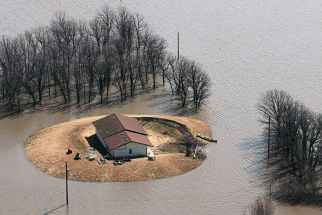
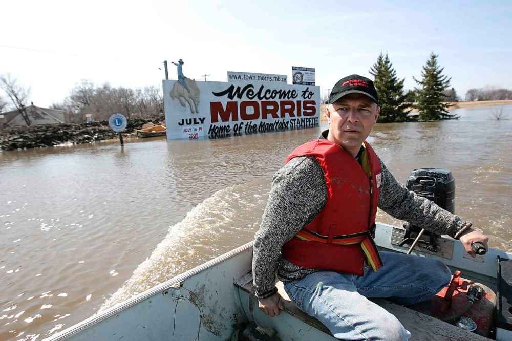
The flood of 2009 was the fourth highest along the Red since 1826 and largest since 1997’s Flood of the Century. In 2009, 1,000 square kilometres of land flooded in the Red River Valley between Winnipeg and Emerson. Highway 75 was closed at Morris for 37 days (April 7 to May 13).
In its Feb. 28 flood forecast, the province predicted a flood along the Red comparable to 2011 — which was best remembered for flooding along the Assiniboine River. Next to the 1997 and 2009 floods, however, 2011 was the third largest Red River flood in a half-century.
With favourable weather from here on out, the Red could still rise to 2011 levels. However, with unfavourable weather, water levels will be higher than 2009 levels by almost one foot at Emerson, by 1.5 feet at Ste. Agathe and reach 22 feet at James Avenue in Winnipeg.
The province said floodwater levels will depend on the rate of snow melt and the amount of precipitation in the coming weeks. It said it would issue a fully updated flood outlook in the coming days.
Monday’s bulletin follows an updated flood forecast on Friday by the U.S. National Weather Service.
That forecast took into account large storms in the Red River watershed south of the border on March 9 and 14.
Greg Gust, warning co-ordination meteorologist with the National Weather Service in Grand Forks, said the U.S. storms “undoubtedly” contributed to the revised Manitoba flood forecast.
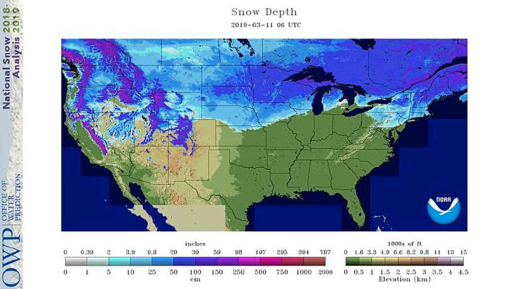
“We’ve bumped up the flow projections on the Red River on the U.S. side of the border,” he said by telephone Monday.
Currently, U.S. officials say there’s a 50 per cent chance that the Red River at Pembina will be a quarter-foot above 2009 levels. That would still put it at a little more than two feet below the 1997 mark.
Future weather and the speed of the snow melt are expected to significantly affect the severity of the flood, Gust said. “This week is running pretty well for us (weather-wise),” he said, “but next week, there’s a little bit more unsettled weather.”
The Assiniboine River system will see “limited flooding,” the province said Monday, so the focus, for now, is on the Red and its tributaries.
The province said it is working with municipalities on local preparations, including support for evacuations if needed. It said it is also working with Ottawa to ensure the safety of Indigenous communities in the Red River Valley.
The government said it’s assembling teams to work with farmers to move livestock out of impacted areas.

And it’s preparing for road closures and closures of community ring dikes. Community ring dikes and the majority of individual flood protection works along the Red are at 1997 water levels plus two feet (61cm).
larry.kusch@freepress.mb.ca

Our newsroom depends on a growing audience of readers to power our journalism. If you are not a paid reader, please consider becoming a subscriber.
Our newsroom depends on its audience of readers to power our journalism. Thank you for your support.
Related Articles
Minister warns flood situation could change in an instant