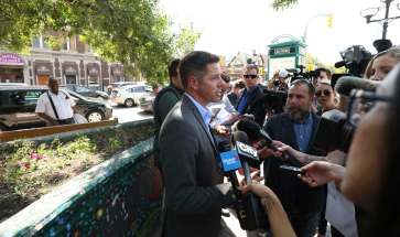
Word on the street A guide to reopening Portage and Main to pedestrians
Read this article for free:
or
Already have an account? Log in here »
To continue reading, please subscribe:
Monthly Digital Subscription
$0 for the first 4 weeks*
- Enjoy unlimited reading on winnipegfreepress.com
- Read the E-Edition, our digital replica newspaper
- Access News Break, our award-winning app
- Play interactive puzzles
*No charge for 4 weeks then price increases to the regular rate of $19.00 plus GST every four weeks. Offer available to new and qualified returning subscribers only. Cancel any time.
Monthly Digital Subscription
$4.75/week*
- Enjoy unlimited reading on winnipegfreepress.com
- Read the E-Edition, our digital replica newspaper
- Access News Break, our award-winning app
- Play interactive puzzles
*Billed as $19 plus GST every four weeks. Cancel any time.
To continue reading, please subscribe:
Add Free Press access to your Brandon Sun subscription for only an additional
$1 for the first 4 weeks*
*Your next subscription payment will increase by $1.00 and you will be charged $16.99 plus GST for four weeks. After four weeks, your payment will increase to $23.99 plus GST every four weeks.
Read unlimited articles for free today:
or
Already have an account? Log in here »
Hey there, time traveller!
This article was published 09/08/2018 (2681 days ago), so information in it may no longer be current.
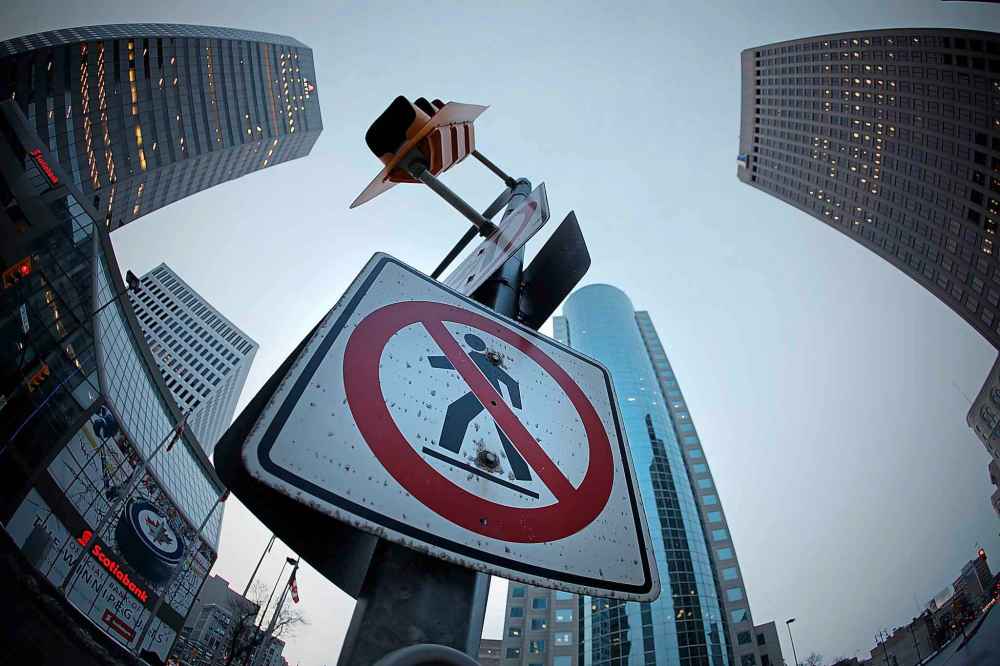
There’s undoubtedly a fortune to be made for the individual who can put together a Portage & Main For Dummies ahead of the fall civic election.
It’s been 35 years since Winnipeggers were asked to vote on a ballot question and having access to an easy-to-understand background briefing could prove invaluable when it comes time to vote Yes or No to the question of reopening the famous downtown intersection to pedestrians.
“I hope people will get themselves as informed on this as much as possible before they vote on it,” said Coun. Jenny Gerbasi, the longest serving council member and a strong supporter of the Yes vote.

City hall had commissioned an analysis on the effect of having pedestrians use the intersection. The 95-page report from Dillon Consulting, titled Portage and Main Transportation Study, was released in October 2017.
The Dillon report relies on a great deal of technical jargon, maps and drawings, but the document best summarized the effect of pedestrians in two pages (36 and 37), comparing travel time for pedestrians, vehicles and transit through the intersection in 2016 with what it projected to be with pedestrians in the mix, using what it calls micro simulation models.
!function(e,t,n,s){var i=”InfogramEmbeds”,o=e.getElementsByTagName(t)[0],d=/^http:/.test(e.location)?”http:”:”https:”;if(/^/{2}/.test(s)&&(s=d+s),window[i]&&window[i].initialized)window[i].process&&window[i].process();else if(!e.getElementById(n)){var a=e.createElement(t);a.async=1,a.id=n,a.src=s,o.parentNode.insertBefore(a,o)}}(document,”script”,”infogram-async”,”https://e.infogram.com/js/dist/embed-loader-min.js”);
“Overall roadway operations are relatively unaffected (with the introduction of pedestrian crossings) with (delays) generally contained to the individual turning movements,” the report states among its conclusions. “There will be an increase in travel time through the area after the crosswalks are restored, primarily to the turning movements at the Portage and Main intersection as they must yield to pedestrians.
“This poses a risk to cross-city travel as congestion and variability will increase on average. This, however, should be balanced with the improvements to mobility for non-auto users and progress towards the city’s goal of a multi-modal and sustainable transportation system.”
Dillon proposed only minor changes to the intersection to accommodate pedestrian access, including:
- Pedestrian crossing at all four intersections
- Scramble crossing would not be allowed
- No right-hand turns from northbound Main traffic onto Portage Avenue East
- Portage Avenue East reduced to one lane to accommodate pedestrian crossing
The study found that people can, and do, cross the intersection via a circuitous underground route that is about 400 metres long: the equivalent to four CFL football fields placed end to end.
The report estimated it takes an able-bodied individual about four minutes to manoeuvre the underground route (assuming they know where they are going) but nine minutes for an individual in a wheelchair (again, assuming they know where they are going and the elevators and escalators are in working order, which they aren’t always, especially those located in private buildings during evenings and weekends).
The study found that the at-grade crossing for able-bodied pedestrians would be shortened, compared with the underground route, as they have to wait for the lights to change.
While the report considered five options, it recommended one – option 4 – which had the least impact on traffic while providing the greatest degree of safety to pedestrians.
The Dillon report was clear at the outset that introducing pedestrians would negatively affect traffic flow.
“It can be seen from the tables that in all cases, the introduction of at-grade pedestrian crossings to the intersection will have a negative impact on vehicular traffic,” states the report. “This is logical and to be expected as the traffic controls must be adjusted to provide safe crossing for pedestrians of all levels of mobility, whereas existing conditions prohibit crossings by pedestrians and prioritizes efficiency of vehicle movement over everything else.”
The report concluded that introducing pedestrians will have minimal impact on traffic flows – traffic north and south on Main Street will see minimal delays, if any; and the greatest impacts will be vehicles turning left and right at the intersection, with greater delays for transit.
The chart on pages 36 and 37 laid out the differences in vehicle travel times through the intersection, as it was in 2016 and how it’s projected to be for the recommended Option 4:
- peak morning traffic delay would average about 30 seconds
- peak afternoon traffic delay would average about 52 seconds
- there would be no delay for northbound and southbound traffic on Main Street
— Transit will experience some delays: Morning travel times through the intersection, in all directions, are projected to be unaffected; Afternoon travel times will see delays for left- and right-hand turns through the intersection varying from under two minutes (east-bound Portage right onto Main) to 4:39 (west-bound from Portage Avenue East).
Highlights of the Dillon Consulting report, Portage and Main Transportation Study
Average vehicle delay time, for all directions, based on the recommended design using 2016 data: Mornings: 30.6 seconds; Afternoons: 52.6 seconds
No delay for afternoon traffic in either northbound or southbound Main street
A projected 15-second delay for morning southbound Main Street traffic
Traffic delays through the intersection
Average vehicle delay time, for all directions, based on the recommended design using 2016 data: Mornings: 30.6 seconds; Afternoons: 52.6 seconds
No delay for afternoon traffic in either northbound or southbound Main street
A projected 15-second delay for morning southbound Main Street traffic
Afternoon East-bound Portage Avenue traffic turning right onto Main: 2-minute, 42-second delay
Afternoon East-bound Portage Avenue traffic turning left onto Main: 1-minute, 59-second delay
Afternoon West-bound Portage Avenue traffic turning right onto Main: 5-minute, 6-second delay
For Transit
Morning travel times through the intersection, in all directions, is projected to be unaffected
Afternoon travel times will see delays for left- and right-hand turns through the intersection varying from under 2 minutes (east-bound Portage right onto Main) to 4-minutes, 39 seconds (west-bound from Portage Avenue East)
Afternoon buses travelling north and south on Main through the intersection are not projected to experience any delays
Costs:
A Class 4 estimate (considered accurate to within 30 per cent under and 60 per cent over), based on “a highly conceptual design”
$11.1 million: including $3.8 million construction, $2.3 million for possible construction over-runs, $5.5 million for the purchase of 11 additional transit buses to offset transit delays
$1.8 million: additional annual operating costs to Winnipeg Transit for the hiring of 12.5 equivalent full-time drivers and other staff
Intersection changes
Pedestrian crossings at all four intersections
Scramble crossing will not be allowed
No right-hand turns from northbound Main traffic onto Portage Avenue East
Portage Avenue East reduced to one lane to accommodate pedestrian crossing
Dillon estimated the cost of allowing pedestrians to cross the intersection to be $11.1 million – but advised the dollar amount is based on “a high conceptual design” and considered a Class 4 estimate, which means it could be 30 per cent lower or 60 per cent higher.
City hall was expected to obtain a more realistic estimate and a more detailed design through another consulting contract that was to be awarded in July but, as a result of the ballot question, that will not be awarded until after the Oct. 24 election.
Dillon said its estimate was for bare-bone streetscaping, but suggested the intersection’s iconic status warrants more decorative and landscaping elements in the final design, which will increase the cost.
That $11.1 million included: $3.8 million for construction, $2.3 million for possible construction over-runs, and $5.5 million for the purchase of 11 additional transit buses to offset transit delays.
Dillon said city officials informed it that Winnipeg Transit could expect to see an additional $1.8 million in annual operating costs due to the hiring of 12.5 equivalent full-time drivers and other staff as a result of the additional buses.

