City’s Kenaston plan won’t work, outside consultant told Crown land authority in October
Read this article for free:
or
Already have an account? Log in here »
To continue reading, please subscribe:
Digital Subscription
One year of digital access for only $75*
- Enjoy unlimited reading on winnipegfreepress.com
- Read the E-Edition, our digital replica newspaper
- Access News Break, our award-winning app
- Play interactive puzzles
*Billed as $5.77 plus GST every four weeks. After 52 weeks, price increases to the regular rate of $19.95 plus GST every four weeks. Offer available to new and qualified returning subscribers only. Cancel any time.
Monthly Digital Subscription
$4.99/week*
- Enjoy unlimited reading on winnipegfreepress.com
- Read the E-Edition, our digital replica newspaper
- Access News Break, our award-winning app
- Play interactive puzzles
*Billed as $19.95 plus GST every four weeks. Cancel any time.
To continue reading, please subscribe:
Add Free Press access to your Brandon Sun subscription for only an additional
$1 for the first 4 weeks*
- Enjoy unlimited reading on winnipegfreepress.com
- Read the E-Edition, our digital replica newspaper
- Access News Break, our award-winning app
- Play interactive puzzles
*Your next Brandon Sun subscription payment will increase by $1.00 and you will be charged $17.95 plus GST for four weeks. After four weeks, your payment will increase to $24.95 plus GST every four weeks.
Read unlimited articles for free today:
or
Already have an account? Log in here »
Hey there, time traveller!
This article was published 12/07/2018 (2944 days ago), so information in it may no longer be current.
The consulting firm hired to redesign the former Kapyong Barracks property agrees with area residents who believe the plan to widen Kenaston Boulevard is flawed and will negatively impact surrounding neighbourhoods.
A letter sent from B.C.-based Urban Systems to Canada Lands Company says the City of Winnipeg is intent on turning Kenaston into an “urban freeway” — an approach that fails to mesh with CLC’s proposed development of the Kapyong property.
“Developing Route 90 into an urban freeway will create disruptions through significant acquisitions of the Kapyong lands by the city as required to meet right-of-way requirements for an urban freeway,” a principal of the firm says in the later dated Oct. 23, 2017.
The letter was obtained by the Winnipeg Free Press through an Access to Information request. The letter-writer’s identity had been blacked-out.
The letter states the city’s plans for Kenaston would “create an urban freeway that doesn’t respond to the character and scale of the existing area that would conflict with the intended future redevelopment of the Kapyong lands.”
The Canada Lands Company is a federal Crown corporation whose mandate is to ensure former government properties are redeveloped with their highest and best use and harmoniously integrated into local communities.
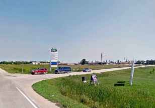
The CLC was given control of the 164-acre Kapyong Barracks property following the relocation of the 2nd Battalion Princess Patricia’s Canadian Light Infantry II to CFB Shilo in 2004. As a result of court action and subsequent negotiations with seven Treaty 1 First Nations, 110 acres will now be turned over to the First Nations as part of the Treaty Land Entitlement settlement process. CLC will retain 50 acres and oversee its redevelopment.
City responds
City hall offered the following statement when asked to respond to the assessment and criticism of the Route 90/Kenaston Boulevard plans:
“Developing an urban freeway is not being considered in the planning and design of Route 90. A 60 km/h road is being designed with connections to the community as well as accommodating pedestrians and cyclists.
“The city is currently undertaking a preliminary design study for improvements to Route 90 between Taylor Avenue and Ness Avenue. The study, which is anticipated to be complete in spring 2019, aims to address traffic volumes, new development, future redevelopment, and the needs of pedestrians, cyclists and transit users.
“The city will consider property impacts along the corridor as part of the design process. Affected property owners will be kept informed as the project moves from technical review to preliminary design.
“The design team will also be evaluating how the work can be accomplished in stages if necessitated.
“Upon completion of the current study, council approval will be required to proceed with the next design phase and construction. One of the purposes of the study is to develop a Class 3 estimate (accuracy minus-20 per cent to plus-30 per cent). The current Class 5 (rough estimate accuracy minus-50 per cent to plus-100 per cent) is $450 million.”
•••
The Canada Lands Company contracted Urban Systems to update City of Winnipeg Route 90/Kenaston project team officials on best practices in redeveloping a roadway through an urban neighbourhood, focusing on several key areas linking Kapyong Barracks, Kenaston and River Heights.
The presentation, entitled Characteristics of a Great Urban Corridor was to include: existing context and redevelopment potential of Kapyong Barracks lands; characteristics of vibrant urban corridors; best practices of urban corridor design; and local policy and land use planning considerations. (It was unclear Thursday whether this presentation had yet occurred.)
The project, according to the presentation, requires several elements:
• Able to move large amounts of traffic.
• Able to accommodate multiple modes of travel safely and efficiently.
• Sensitive to adjacent lands, land uses and character of existing area.
• Attractive to pedestrians and other active transportation modes.
• Tend to promote alternative modes of travel and can reduce annual average daily traffic.
Examples in the presentation of “great urban corridors” found in other Canadian cities include such features as:
• Pedestrian scaled lighting.
• Wide sidewalks and treescaping.
• Dedicated bike lanes.
• Painted intersection markings.
• Transit stops.
• Centre landscaped boulevard.
• Public art components.
• Frequent pedestrian crossings
The material cited Sherbrook Street at Wolseley Avenue as one example of a properly rehabilitated Winnipeg roadway.
— Aldo Santin
While the CLC has set aside four acres for the widening of Kenaston (an expected 15.25 metres on both sides running the length of the property), the city has not confirmed the amount of land it will need.
The letter was the consulting firm’s assessment of the designs the city provided to CLC. It appears the sole objective of the Route 90 widening project is to move a large amount of traffic along the corridor, the letter says.
“The completion of the project would see the existing stretch of Route 90 from Ness Avenue to Taylor Avenue widened to a six-lane highway to accommodate an annual average daily traffic (AADT) in excess of 50,000,” the writer states.
“It is anticipated that the city will likely take an ‘urban freeway’ design approach for the Route 90 widening that will focus primarily on meeting AADT targets, while lending little consideration to surrounding lands, land uses and the general built form and scale of the area.”
Officials from Urban Systems and the Canada Lands Company did not respond to repeated requests for comment.
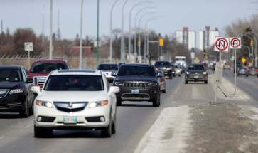
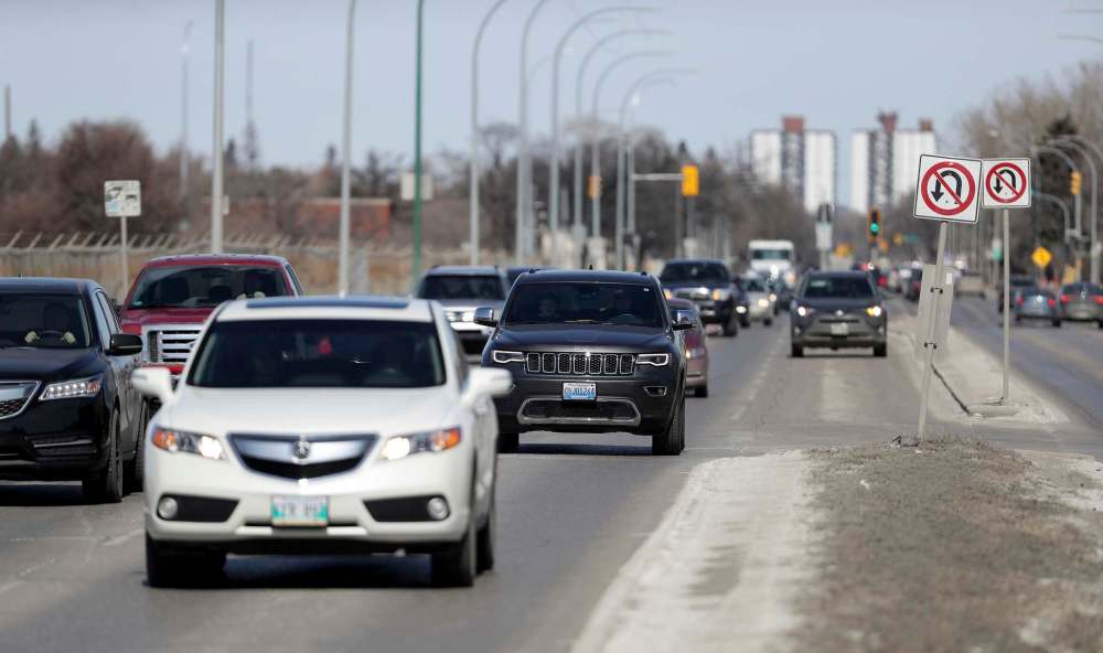
The city plans to widen Kenaston from four lanes to six and increase capacity on the St. James bridges. The $450-million project will require the acquisition – through purchase or expropriation – of 136 properties along Kenaston, including 94 single-family homes and 21 duplex units.
Some area residents have expressed concern, suggesting the project will convert Kenaston into an expressway, with little regard for the River Heights neighbourhood east of the property.
Preliminary plans show several side streets will be closed at Kenaston (north of Willow Avenue, on both east and west sides of Kenaston), with options for an overpass or street-level crossing for pedestrians at Lockston Avenue.
Through traffic for vehicles, pedestrians and cyclists, at lighted intersections, will occur at Taylor, Grant, Corydon and Tuxedo avenues. Additional pedestrian and cycling access will be provided with half signal crossings at Boulton Bay, Carpathia Road and Willow Avenue. Pedestrians will also be able to cross at Academy.
The current routing and crossings are part of a functional design that is being refined by a consulting firm, which will submit a preliminary design by Feb. 28 for council’s consideration.
A request for an interview with a member of the city’s Route 90 project team was denied, but a civic spokesman issued a statement denying the project will create “an urban freeway.”
River Heights Coun. John Orlikow told the Free Press previously efforts are being made to address residents’ concerns and deal with noise-buffering issues. Orlikow said concerns Kenaston will become an expressway have been addressed as the speed limit will be capped at 60 km/h.
— with files from Dylan Robertson
aldo.santin@freepress.mb.ca


History
Updated on Friday, July 13, 2018 12:55 PM CDT: Tweaks references to specific aspects of preliminary plans, including land needed for widening, street closures and through-traffic crossings.