Heat records shattered across southern Manitoba
Advertisement
Read this article for free:
or
Already have an account? Log in here »
To continue reading, please subscribe:
Monthly Digital Subscription
$1 per week for 24 weeks*
- Enjoy unlimited reading on winnipegfreepress.com
- Read the E-Edition, our digital replica newspaper
- Access News Break, our award-winning app
- Play interactive puzzles
*Billed as $4.00 plus GST every four weeks. After 24 weeks, price increases to the regular rate of $19.95 plus GST every four weeks. Offer available to new and qualified returning subscribers only. Cancel any time.
Monthly Digital Subscription
$4.99/week*
- Enjoy unlimited reading on winnipegfreepress.com
- Read the E-Edition, our digital replica newspaper
- Access News Break, our award-winning app
- Play interactive puzzles
*Billed as $19.95 plus GST every four weeks. Cancel any time.
To continue reading, please subscribe:
Add Free Press access to your Brandon Sun subscription for only an additional
$1 for the first 4 weeks*
*Your next subscription payment will increase by $1.00 and you will be charged $16.99 plus GST for four weeks. After four weeks, your payment will increase to $23.99 plus GST every four weeks.
Read unlimited articles for free today:
or
Already have an account? Log in here »
Hey there, time traveller!
This article was published 20/06/2022 (1400 days ago), so information in it may no longer be current.
Sunday’s extreme heat shattered almost 20 weather records in southern Manitoba, while severe thunderstorms knocked out power to hundreds of homes.
Winnipeg’s high of 37 C eclipsed the previous daily maximum temperature on June 19, 1888, which was 33.3 C, according to Environment Canada.
Manitoba Marathon organizers cancelled the annual Father’s Day race shortly after 8 a.m. due to sweltering conditions.

“For the extreme heat, a ridge of high pressure brought in hot and humid air… from the south,” said Environment Canada meteorologist Danielle Desjardins.
Highs of 38 C in Dominion City and Emerson broke previous records of 34.5 C, both of which were set in 1995.
Carman, Gimli, McCreary, Morden, Pilot Mound, Pinawa and Steinbach also set records.
Desjardins said 18 Manitoba locations set records with many broken by two or more degrees.
A total of 14 locations also broke records for warm overnight lows, as temperatures stayed above 20 C in the early hours of Monday morning.
The average overnight low in Winnipeg for this time of year is 11.4 C.
A risk of severe thunderstorms continued Monday, while a heat warning remained for places in southeastern Manitoba.
There will be a reprieve Tuesday, with daytime highs around 20 C and showers. The normal high for Winnipeg at this time of year is almost 23.7 C.
Temperatures could climb to 25 C on Wednesday before hitting 30 C on Thursday and Friday, when more showers are possible, said Desjardins.

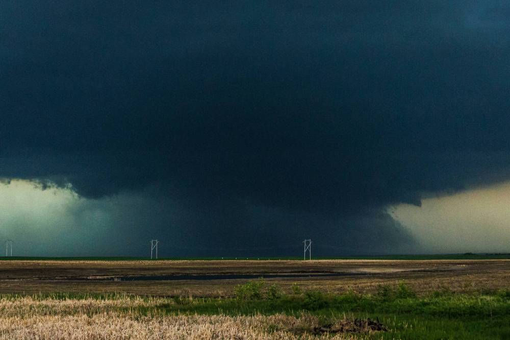
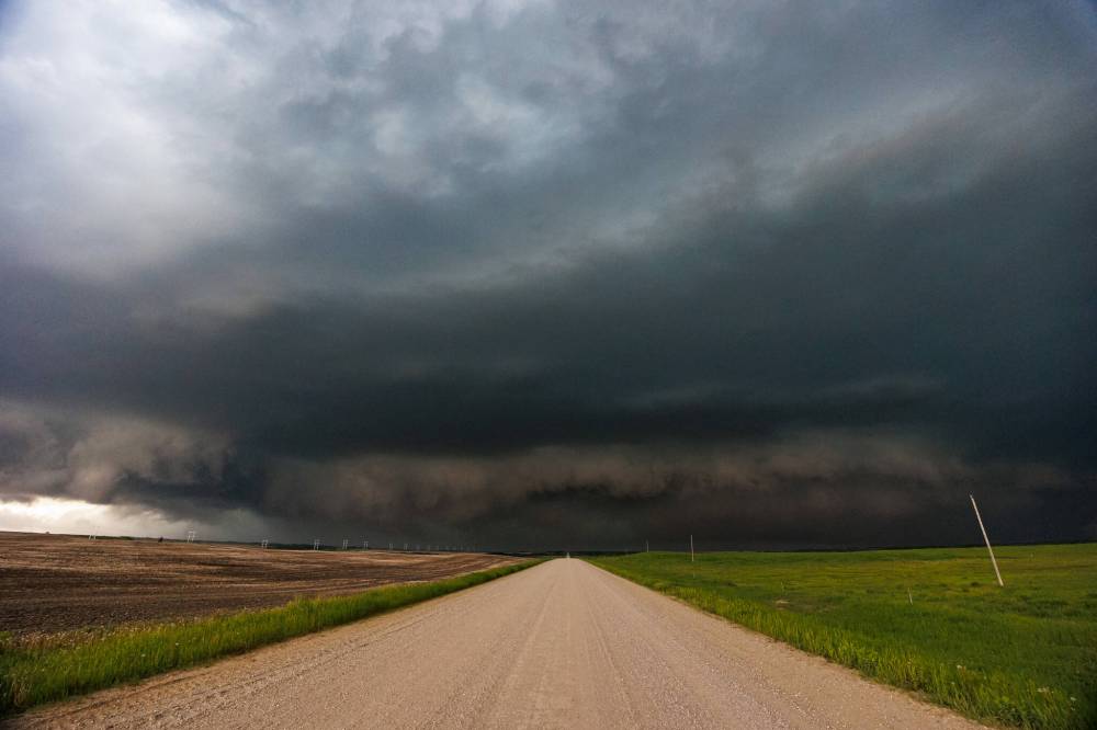
Sunday’s hot and humid weather fuelled wild storms in southern and central Manitoba. A tornado watch was issued for western areas, including Dauphin, Minnedosa and Boissevain.
There were no reports of a tornado touching down, said Desjardins.
Some properties suffered damage, trees were brought down and power outages occurred, as strong winds, heavy rain and lightning hit.
Desjardins said 100 km/h wind gusts were reported in Binscarth, about 160 km northwest of Brandon, while radar indicated gusts as strong as 120 km/h elsewhere.
Roblin was hit by toonie-sized hail, while pea-sized stones fell in Swan River and St-Lazare.
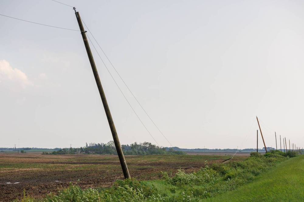
Highway signs were knocked over, hydro poles were snapped and part of a grain bin was blown into a field near Foxwarren, said Regina-based photographer Chris Graham.
“We saw a lot of trees that were knocked over all over the place in that area,” said Graham. “I think that area took a direct hit.”
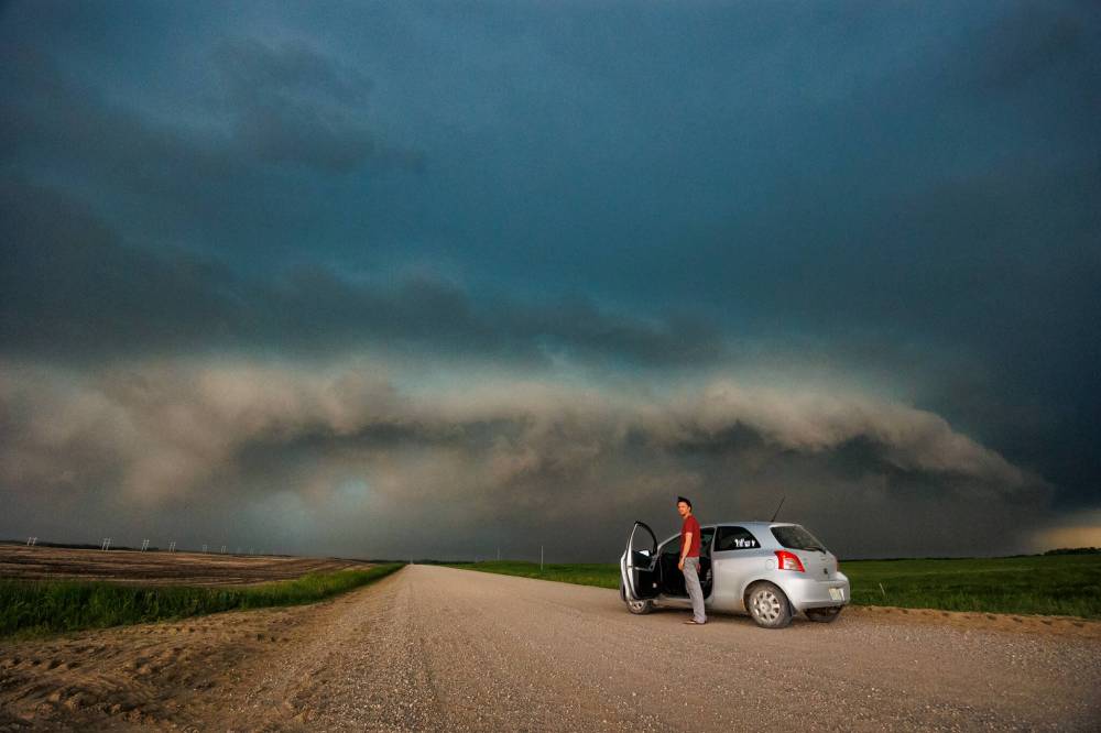
He and a friend, Nick Schenher, followed a storm as it moved into Manitoba from Saskatchewan.
Graham, who photographs severe thunderstorms as a hobby, is expecting to follow more in the coming weeks, as the season gets into full swing.

Manitoba Hydro spokesman Bruce Owen said 4,215 customers were without electricity in Foxwarren, Binscarth, Waywayseecappo First Nation, Rossburn, St-Lazare, Roblin, Greenway and Angusville.
Hydro crews worked through the night to restore power.
Almost 500 properties were still without electricity Monday morning.
Three separate power lines had broken poles, Owen said, noting 11 poles had to be replaced.
Several lines were brought down by fallen trees.
Additional staff were called to the area to help local crews restore power to customers who were still waiting Monday.
With many Manitobans using air-conditioning units and fans to stay cool in their homes, electricity use peaked during the 4 p.m. hour.
Preliminary numbers show the peak was 3,219.1 megawatts when the temperature hit 36.7 C, said Owen.
It wasn’t a record for June, most likely because it was a Sunday, he wrote in an email.

The current record for peak usage in June is 3,338.7 megawatts set at 5 p.m. on June 29, 2020 (a Monday), when the temperature was 30.9 C.
Manitoba has seen plenty of severe weather so far in 2022, with a series of snow and rainstorms leading to flooding.
An evacuation order for flood-hit Betula Lake in Whiteshell Provincial Park is ending Tuesday, as part of Provincial Road 307 reopens to local traffic.
A state of local emergency for the Whiteshell remains in place.
chris.kitching@freepress.mb.ca
Twitter: @chriskitching

Chris Kitching is a general assignment reporter at the Free Press. He began his newspaper career in 2001, with stops in Winnipeg, Toronto and London, England, along the way. After returning to Winnipeg, he joined the Free Press in 2021, and now covers a little bit of everything for the newspaper. Read more about Chris.
Every piece of reporting Chris produces is reviewed by an editing team before it is posted online or published in print — part of the Free Press‘s tradition, since 1872, of producing reliable independent journalism. Read more about Free Press’s history and mandate, and learn how our newsroom operates.
Our newsroom depends on a growing audience of readers to power our journalism. If you are not a paid reader, please consider becoming a subscriber.
Our newsroom depends on its audience of readers to power our journalism. Thank you for your support.


