

Spring storm ends, light snow to come
Advertisement
Read this article for free:
or
Already have an account? Log in here »
To continue reading, please subscribe:
Digital Subscription
One year of digital access for only $75*
- Enjoy unlimited reading on winnipegfreepress.com
- Read the E-Edition, our digital replica newspaper
- Access News Break, our award-winning app
- Play interactive puzzles
*Billed as $5.77 plus GST every four weeks. After 52 weeks, price increases to the regular rate of $19.95 plus GST every four weeks. Offer available to new and qualified returning subscribers only. Cancel any time.
Monthly Digital Subscription
$4.99/week*
- Enjoy unlimited reading on winnipegfreepress.com
- Read the E-Edition, our digital replica newspaper
- Access News Break, our award-winning app
- Play interactive puzzles
*Billed as $19.95 plus GST every four weeks. Cancel any time.
To continue reading, please subscribe:
Add Free Press access to your Brandon Sun subscription for only an additional
$1 for the first 4 weeks*
- Enjoy unlimited reading on winnipegfreepress.com
- Read the E-Edition, our digital replica newspaper
- Access News Break, our award-winning app
- Play interactive puzzles
*Your next Brandon Sun subscription payment will increase by $1.00 and you will be charged $17.95 plus GST for four weeks. After four weeks, your payment will increase to $24.95 plus GST every four weeks.
Read unlimited articles for free today:
or
Already have an account? Log in here »
Hey there, time traveller!
This article was published 15/04/2022 (1537 days ago), so information in it may no longer be current.
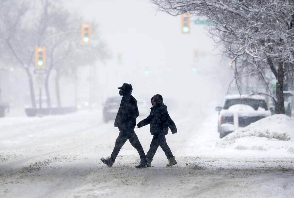
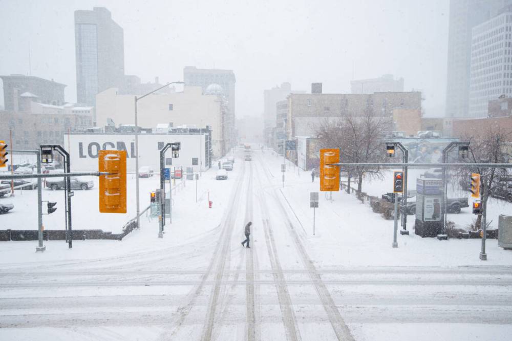
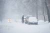
For all intents and purposes, the spring storm that hammered Manitoba is finished, Environment Canada meteorologist Dave Carlson said Friday.
“It’s done,” Carlson said.
All Environment Canada weather alerts for Manitoba have been lifted, and many roadways throughout the province have begun to reopen.
The clouds drifting through Winnipeg skies right now stem from Nova Scotia, Carlson said. Before landing in the prairies, the clouds streamed northwest over two provinces and the Hudson Bay.
Preliminary Environment Canada data from volunteers of the Community Collaborative Rain, Hail and Snow Network (CoCoRaHS) showed snowfall varied significantly throughout southern Manitoba.
Onanole, a town situated to the south of Riding Mountain National Park, garnered the heaviest reported snowfall, with 82 cm.
Jason Potter, the reeve for the municipality of Harrison Park, said snowplow operators were out in full force Friday.
“They’re out there right now doing their best to open up all the roads,” Potter said. “The community is really coming together.”
Potter said he’s shocked by the snowfall. Some residents are reporting three feet to four feet of snow, he said.
“I really feel for all the cattle producers out there,” Potter said. “They’re out there dealing with 10 ft. and 12 ft. snow drifts, and lots of times that’s devastating to the baby cows; they get buried in those snow drifts.”
Winnipeg saw 20 cm to 30 cm of total snow — which placed the total snowfall accumulation on track with the lower end of Environment Canada’s prediction.
Areas to the north and west of Winnipeg encountered significantly heavier snowfall due to a “dry slot” that saw the storm shift beyond the city for a time. Selkirk, located just 40 km from Winnipeg, saw 45 cm of snow. Further north, St. Andrews saw 38 cm.
To the west, Neepawa and Portage la Prairie encountered 20 cm and 19 cm of snow, respectively. To the south, Morden saw 35 cm of snow. And closer to the U.S. border, Killarney was met with a whopping 60 cm of snow.
Areas east of Winnipeg, including Pinawa and The Whiteshell, saw snowfall ranging from 21 cm to 29 cm.
Carlson said the slightly wetter, heavier snow produced by this storm resulted from warmer temperatures in southern Manitoba and the “copious amount of moisture” entering the system from the Gulf of Mexico.
Snowfall in much of southern Manitoba is expected to taper off Friday, Environment Canada reports. However, the long-range forecast predicts more snow may be on the way.
“We’re probably not looking at big snowfalls,” Carlson said.
Environment Canada predicts up to 5 cm of snow will fall in Winnipeg and most of the Red River Valley Sunday afternoon and evening. Tuesday night through Wednesday will see a low-pressure system arrive from North Dakota and Minnesota, this time bringing snow or rain.
“If it’s snow, it shouldn’t be more than 4 cm or 5 cm. And, if it’s rain, it’ll be just some light rain with a few millimeters coming through,” Carlson said.
Next weekend will bring normal to above normal seasonal temperatures. This is when the melt will begin, Carlson said.
The snowstorm that coated Winnipeg in recent days was the city’s biggest April snowstorm since the notorious blizzard of 1997, showed Environment Canada records compiled by retired meteorologist Rob Paola.
Paola is a self-described “weather history buff” who reports on Manitoba’s weather and climate for the Meteorological Service of Canada and the CoCoRaHS. Paola shares his work through the moniker “Rob’s Obs.”
This storm also registered as the fourth biggest April snowstorm in Winnipeg since 1872. The most severe April snowstorm hit Winnipeg from April 4 to 7, 1997. This storm dropped a total of 48 cm of snow on the province’s capital.
Paola noted all of the top five most historic storms to hit Winnipeg occurred outside the traditional winter season of December to February.
This month has, so far, amassed 30.6 cm of snow, making it the snowiest April since 1999, which saw 46 cm of snow.
Winnipeg’s current snowfall season is ranked seventh among the top snowiest seasons since 1872, Paola reported. The snowfall season is measured from October 1 to May 31 each year. As such, Winnipeg still has time to climb the chart.
Related Articles
Explosion of weather lingo is the worst


.jpg?w=100)

Advertisement Advertise With Us
Advertisement Advertise With Us