Open the gates: floodway put into operation in advance of fall storm
Read this article for free:
or
Already have an account? Log in here »
To continue reading, please subscribe:
Monthly Digital Subscription
$1 per week for 24 weeks*
- Enjoy unlimited reading on winnipegfreepress.com
- Read the E-Edition, our digital replica newspaper
- Access News Break, our award-winning app
- Play interactive puzzles
*Billed as $4.00 plus GST every four weeks. After 24 weeks, price increases to the regular rate of $19.95 plus GST every four weeks. Offer available to new and qualified returning subscribers only. Cancel any time.
Monthly Digital Subscription
$4.99/week*
- Enjoy unlimited reading on winnipegfreepress.com
- Read the E-Edition, our digital replica newspaper
- Access News Break, our award-winning app
- Play interactive puzzles
*Billed as $19.95 plus GST every four weeks. Cancel any time.
To continue reading, please subscribe:
Add Free Press access to your Brandon Sun subscription for only an additional
$1 for the first 4 weeks*
*Your next subscription payment will increase by $1.00 and you will be charged $16.99 plus GST for four weeks. After four weeks, your payment will increase to $23.99 plus GST every four weeks.
Read unlimited articles for free today:
or
Already have an account? Log in here »
Hey there, time traveller!
This article was published 09/10/2019 (2375 days ago), so information in it may no longer be current.
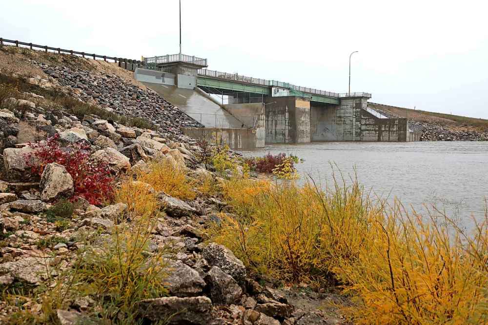
A large, unstable weather system is expected to dump 60 to 100 millimetres of rain on southern Manitoba over the next several days, necessitating the activation of the Red River Floodway in autumn for the first time.
The storm comes as fields throughout the Red River Valley are already soaked due to heavy rains.
As of 4 p.m. Wednesday, the Red River had reached 14.1 feet at James Avenue, the highest fall level recorded since at least 1971, from which time such data is readily available. In November 2010, the Red crested at 13.3 feet James.

The government issued a news release Tuesday evening warning the floodway may be activated Wednesday, after stating earlier the same day its operation was “not expected at this time.” The floodway gates were to be raised at 7 p.m. Wednesday.
Fisaha Unduche, Manitoba’s chief flood forecaster, said the province revised its outlook when it became apparent the weather system would produce mainly rain, rather than snow. Snow would have produced a much slower runoff.
Unduche told reporters Wednesday the floodway is being activated to keep the Red from rising above 14.5 feet at James Avenue.
“Our intent is to limit the high water level within the city so that we can offset the (sewer system) pumping costs and the pumping issues within the city of Winnipeg,” Unduche said.
Much of southern Manitoba received well-above normal precipitation last month, swelling rivers and interrupting harvest operations. Winnipeg received 153 mm of rain in September.
Despite the activation of the floodway, Unduche said he does not anticipate any significant overland flooding from the looming storm. Only low-lying areas are likely to be affected.
Depending on future weather, peak river flows in the city are likely to occur Oct. 17-20.
“The province is working closely with the (rural municipalities) along the Red River from the border to Lake Winnipeg to provide information and assistance as needed,” Unduche said.
Chris Carroll, City of Winnipeg wastewater services manager, said the city has activated a number of flood-pumping stations and deployed temporary pumps to help remove rainwater from sewers. This is being done to minimize basement flooding.

Basement flooding can occur at any time, but the risk increases when river levels rise because the sewer system then relies heavily on pumping stations rather than gravity to deal with runoff.
Prolonged high river levels can be problematic for the city, but Carroll noted there is lots of time for levels to recede before freeze-up.
“It’s more likely than not that this high water will pass before the significant deep freeze comes into place,” he said.
However, the city is “very well-prepared” to deal with whatever happens, he added.
The massive weather system heading toward Manitoba is also expected to dump a significant amount of rain and snow in North Dakota.
The U.S. National Weather Service has issued a flood warning for sections of the Red River around Fargo and from south of Grand Forks to the Manitoba border.
Amanda Lee, a hydrologist with the service’s Grand Forks office, said river crests in fall happen from time to time. High fall river levels have occurred about five times in Fargo since 2006, she said.
“It’s not completely unheard of. It just doesn’t happen every year,” she said.
Unduche said a wet fall does not necessarily mean Manitobans will see widespread flooding next spring.

“Mother Nature could co-operate and we could have a very good spring,” he said.
Low winter precipitation and a gradual snow melt next year could minimize flooding in 2020.
Unduche said the coming storm is expected to affect all of southern Manitoba. Some areas of the Interlake could see as much as 125 mm of rain, he said.
The latest the Red River Floodway was operated in the past was in 2002, when it was activated from early July to early August.
The Assiniboine River walkway has been submerged for some time due to the fall rains. It’s now under close to two metres of water.
larry.kusch@freepress.mb.ca


