

On the map
Affirming people, space and place through visual representation
Advertisement
Read this article for free:
or
Already have an account? Log in here »
To continue reading, please subscribe:
Monthly Digital Subscription
$0 for the first 4 weeks*
- Enjoy unlimited reading on winnipegfreepress.com
- Read the E-Edition, our digital replica newspaper
- Access News Break, our award-winning app
- Play interactive puzzles
*No charge for 4 weeks then price increases to the regular rate of $19.00 plus GST every four weeks. Offer available to new and qualified returning subscribers only. Cancel any time.
Monthly Digital Subscription
$4.75/week*
- Enjoy unlimited reading on winnipegfreepress.com
- Read the E-Edition, our digital replica newspaper
- Access News Break, our award-winning app
- Play interactive puzzles
*Billed as $19 plus GST every four weeks. Cancel any time.
To continue reading, please subscribe:
Add Free Press access to your Brandon Sun subscription for only an additional
$1 for the first 4 weeks*
*Your next subscription payment will increase by $1.00 and you will be charged $16.99 plus GST for four weeks. After four weeks, your payment will increase to $23.99 plus GST every four weeks.
Read unlimited articles for free today:
or
Already have an account? Log in here »
Hey there, time traveller!
This article was published 16/12/2017 (2918 days ago), so information in it may no longer be current.
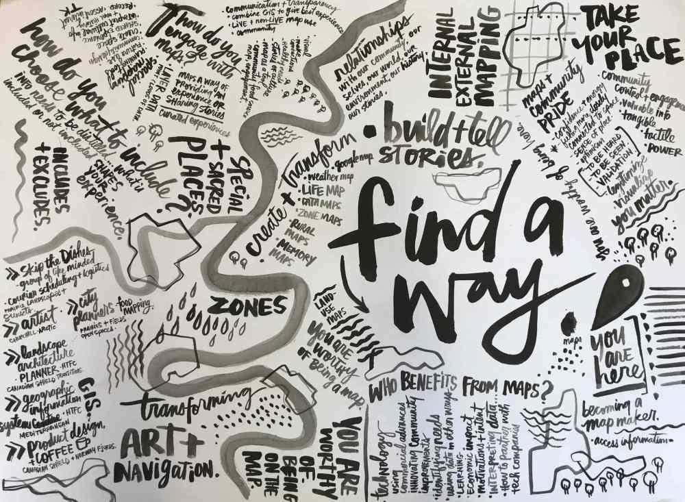
Whether it is a line drawing of coastlines or monochromatic and punchy text visualizing the best places of a neighbourhood, the business of map-making is on-trend. Maps are one of the most powerful communication tools in our society and as we become more visual through social media, the once-ancient technology has evolved to meet a growing demand. The public has become increasingly consumed with the maps of cities, choosing to put them on display in their living rooms or offices, or to offer as gifts for friends and family.
Duets
Everyone designs. From inspired entrepreneurs full to the brim with ideas for our city to the many pop-up shops that have emerged in our downtown. From the local coffee shop on the corner to the delicate, delicious artisan pastries that we can’t help but devour, design is everywhere.
Duets is an exclusive Winnipeg Free Press monthly series that pairs design experts with local champions and innovators to brainstorm new opportunities for civic building.
Duets is written by HTFC Planning & Design’s Jason Syvixay, with imagery and photography provided by Kal Barteski and David Moder Photography.
Want to duet with us? Email HTFC Planning & Design at info@htfc.mb.ca.
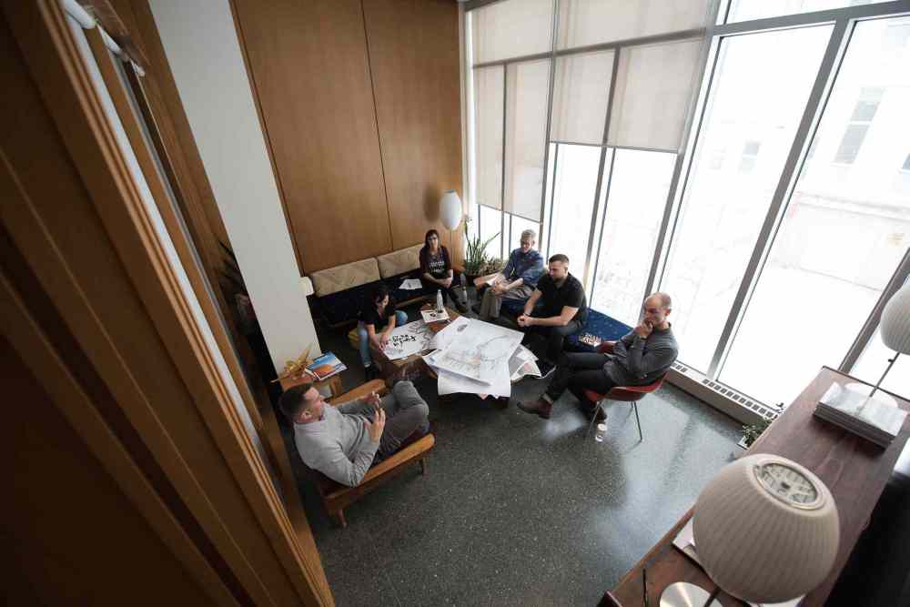
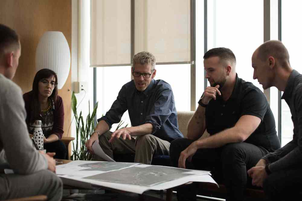
Are these commercial maps educating and informing a person’s understanding of a place — or are they simply decorative? This question about contemporary maps was one of many posed to HTFC Planning & Design’s Tim Hogan and Dustin Brooks, along with Parlour Coffee’s Nils Vik, city planning student Lissie Rappaport, Skip the Dishes logistics expert Rossel Sabourin and artist Kal Barteski.
The group discussed the variety of ways in which people engage in map-making. Maps, as described by HTFC’s Hogan and Brooks, can serve a technical purpose — providing detail about a community’s history, developments and land use. Maps can also be powerful storytellers — communicating a community’s land interests or vision for the future. In this regard, maps are inherently political and can often support or justify decision-making.
Hogan, a principal at HTFC, has been a practising professional planner for almost 20 years. His interest in maps stems from road trips visiting extended family as a child. “We spent long days on the road,” he said. “I was always excited about where we were going. I’d be in the back seat of the car, looking at maps trying to figure out where we were and where we were headed.”
Brooks joined HTFC as a geographic information systems (GIS) lead after many years as a physical geographer. He describes the work of a GIS technician as a 21st-century cartographer — replacing hand-drawn practice with the use of computers to style a wide variety of maps.
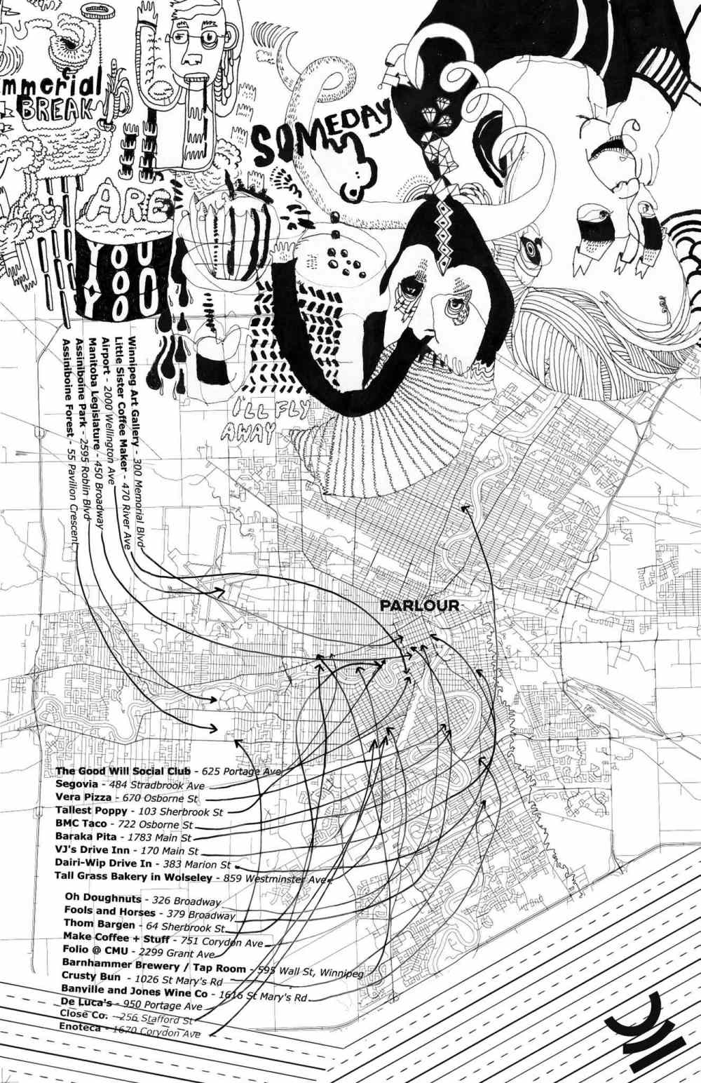
Nils Vik, owner of Parlour Coffee, describes maps as an alternative to a concierge, having developed a map of his own featuring key destinations in the Exchange District. The intent: to serve as a way-finding tool, and a way to instil a sense of community pride and identity.
A graduate of the University of Manitoba’s Faculty of Architecture, Vik was one of the first to pioneer local coffee shops in the city, with Parlour Coffee then Little Sister Coffee Maker, and now Dogwood Coffee.
“My first love was product design and then coffee got out of control over the past six years,” he said. “Now I’m finding myself going back to the design side of things, with work at EQ3 as their director of commercial products and as a sessional instructor at the University of Manitoba’s Faculty of Architecture.”
Growing up in Pinawa, Vik recalls the absence of signage informing travellers about their distance to town, and how that created a notion of insignificance. “We weren’t on the map back then. Now there are signs. We’re worthy of being noted.”
Identifying what can or should not be displayed on a map was discussed at length with the group, using Vik’s map of the Exchange District as an example. His map, which involved the work of Jonathan Dueck, a visual artist and teacher, was loose in its representation. “It was basically our version of being a concierge at the café. People would come in and ask, ‘Where should we go?’ We would grab a piece of paper and make really messy sketches to say, ‘Go here, go there’ and ‘This is where you can grab a coffee, a beer, or buy clothes here.’
“We pooled together ideas from our staff, and made a map — to hand out to local residents and tourists.” But as the group explored, the places that are excluded from a map are as equally important to those that are.
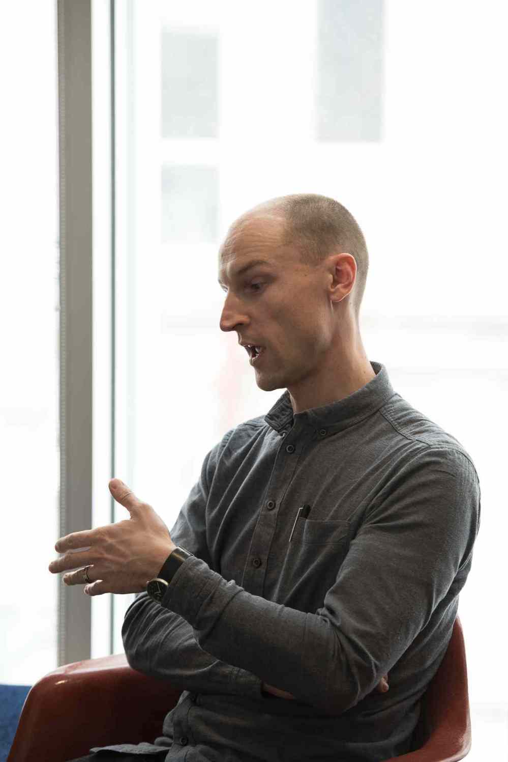
Sabourin, a logistics expert with Skip the Dishes, one of Manitoba’s darling start-up success stories, offered thoughts on how technology companies could participate in city-building efforts.
Sabourin, a native of Letellier, described how maps serve a live and non-live purpose for the company. The digital app features a public map that identifies when food is ordered, picked up, and determines how long it will take until it will reach a customer’s doorstep. “Maps allow us to be transparent and offer the best service possible.”
The non-live side of the map, as Sabourin explained, applies data-rich layers to support decision-making. For example, analytical mapping helps staff determine how far and how long a restaurant will be from potential customers, and offers strategies to address these challenges. “There’s a whole team of people and a bunch of technology behind Skip that makes it all happen,” he said. “We are mapping in many ways, whether it’s visualizing zones, delivery fees, cuisine types, or where to launch.”
Rappaport, a city planning graduate student who has worked in the North End for many years, recently facilitated food mapping through Food Matters Manitoba. The mapping exercise ditched Google Maps and opted, instead, for blank sheets of paper, inviting the community to recollect and narrate their stories in their own unique way.
“We engaged the community about their food stories, food needs and food desires,” she said. In this example, maps were empowering, a tool that encouraged and supported community members to assert their interests and hopes for their communities.
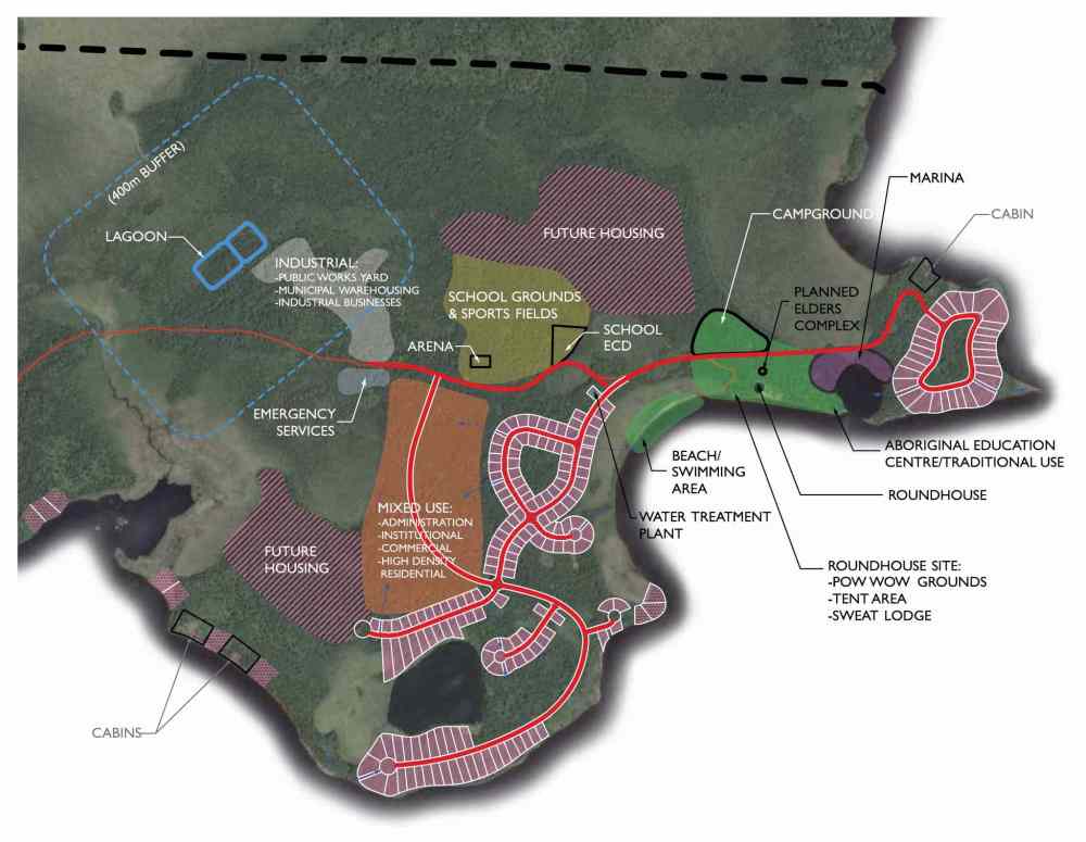
Providing the community with an opportunity to create their own maps was a significant goal of Sea Walls Churchill, an initiative that transformed 18 vacant buildings in Churchill into pieces of artwork. The initiative, curated and produced by Winnipeg artist Barteski, began with a tour with residents through town. The walkabout helped Barteski spatially organize where art should be placed — ensuring artworks were carefully rooted in the local fabric of the community.
Together, they concluded there is more than meets the eye when it comes to maps — that while there are tangible benefits of being marked on the map, the process of empowering people to share their stories and information about the places they live and play, is equally valuable.
How do you engage in map-making in your line of work?
Vik: I had the benefit of growing up in the ’80s before and after the Internet. I remember being in my family’s car, trying to follow a map. I always found maps to be a form of control and empowerment. It was my way of understanding my place in the world in that moment and in that time.
As a user of digital maps and physical maps, I have always been drawn to the benefits and drawbacks of both. In Parlour’s existence, being close to the Fairmont Hotel and in quite a touristy area, the map we created was our way of giving back and providing an experience for those who might be coming to the area for the first time.
Maps can share experiences and potential opportunities.
Brooks: I engage in the very technical side of map-making. I take digital data, and layer data on top of each other. It creates a story. It may help to prove something, like land claims. With GIS, you can take a whole bunch of information, put them into one single file. It’s interesting to see all of the different applications of mapping.
Hogan: In our work, we use mapping and spatial sketches in many different ways and at many different scales. Maps are one of the most important tools we have to gather, analyze and communicate information and ideas.
We’ll use maps as a visioning tool, to build consensus and to show future development. We also use maps as a discussion tool, and as a decision-making tool.
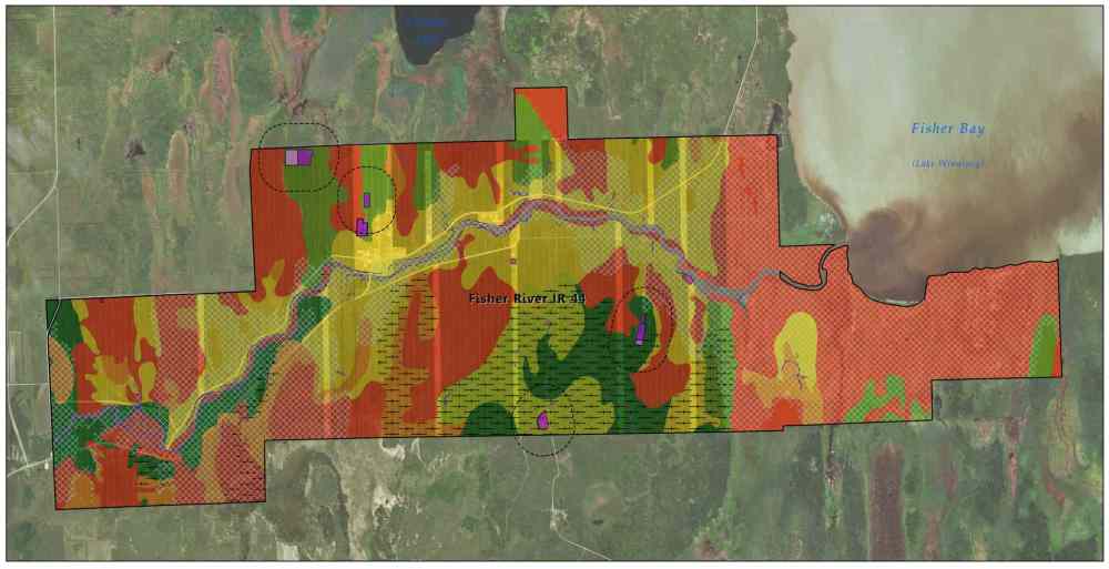
For work such as land or flooding claims, we may use mapping in a really complicated and technical way, to layer a great deal of information and to build modelled histories — like what did the land look like, and what changes have occurred? It’s one of the coolest things — you can’t do that type of work without a map.
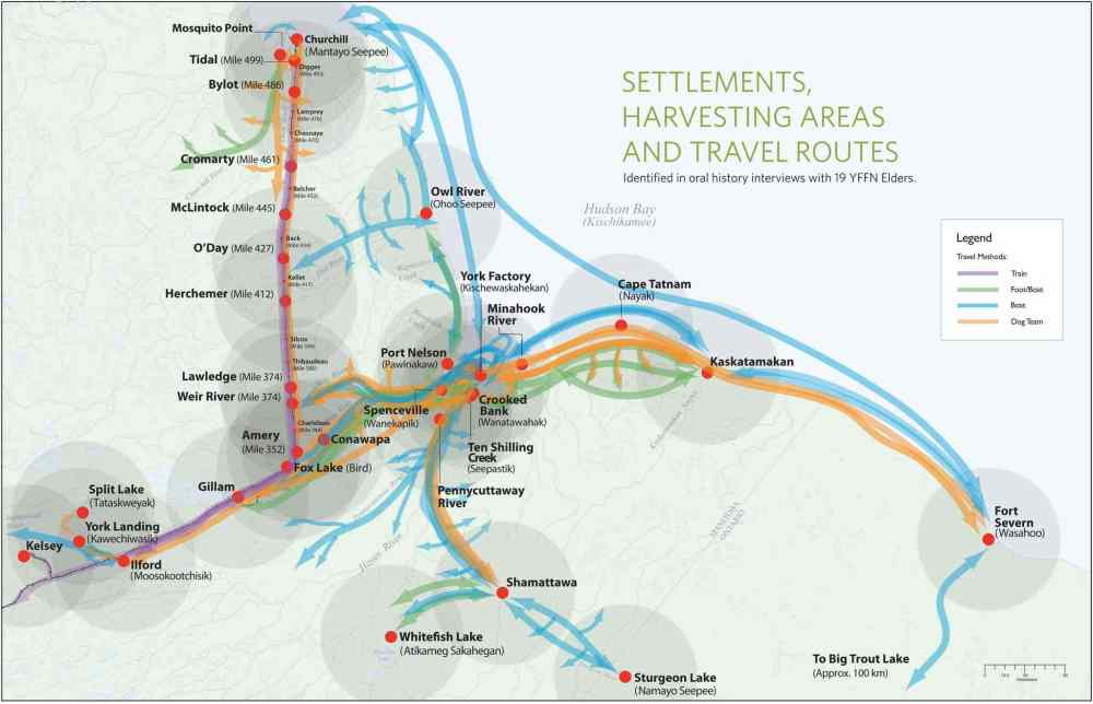
We will also map oral histories, showing the extent of the history and use of land within a community. It changes the way those community members might think about their land, their use of the land over the decades and generations.
Maps can act as a record for historical or current use of traditional knowledge.
Brooks: It’s really interesting to see how traditional knowledge interviews are transcribed then represented on maps. I can see how the visual representation would bring value to communities, as it puts on paper culture and traditions. And a result, the information can later be passed down to different generations.
Rappaport: My first project for Food Matters Manitoba in 2012 was in the North End. The project was meant to engage the community on increasing access to healthy and traditional foods.
We used large blank sheets of paper, markers, stickers and pictures to ask residents where they got their food. We could have easily figured this out on our own, by looking at Google maps. But we wanted to hear from the residents themselves and to determine what was most important to them.
People started to map places like their grandmother’s house, community meal programs or food banks. People started identifying Selkirk Avenue and Main Street as places where people would walk to more regularly to access food. Even if folks were further north in the North End, they would still walk to Selkirk Avenue to get food.
These things we wouldn’t have known or understood without this mapping exercise with residents.
People talked about wanting more traditional foods. In the city, you can’t buy hunted meat — it’s illegal. So we mapped stores that sell meats that are traditionally hunted, but are now farm-raised or other means so people can still access foods in the city that are traditional.
With regards to healthy foods, residents noted that some of the convenience stores were selling fresh fruits and vegetables and healthy snacks. So we were able to design our food programs through this research and also to make connections, and understand what the community wanted.
Sabourin: Mapping is used very extensively at Skip the Dishes. (The service is offered in every Canadian province except Quebec, and in Nebraska, Missouri, Ohio and New York in the United States.)
As a customer, the order tracker is the most visible map. For us, it’s about communication and transparency. You can track your food courier on the way to the restaurant, you can see him or her at the restaurant, and then you can see them driving to your home so you can be ready at the doorstep.
We use GIS maps, for example, when we offer delivery to certain restaurants or determining the delivery fee. We don’t look at the distance, we say, “Is there a toll road that needs to be travelled through?” and “Will that be a fair experience for the courier, or expensive for the customer?” We have to balance those.
We have the live side of mapping and the non-live side of mapping. The non-live side of mapping, for example, through our app, allows customers in neighbourhoods or new cities that want to use the service, to let us know where they are and where they would like to have service. We can map that information and they help us inform our decision-making as a company.
Nils talked about how he engaged an artist to make a map featuring some of the top places to visit in the Exchange District. How do these, and other, types of maps instil a sense of neighbourhood pride?
Brooks: The way I deal with maps is very technical — with datum, projections and co-ordination systems — but when you boil it down to a map like what Nils created or what Kal does in her work, it makes a place so digestible and more usable for the everyday reader.
While it might not show a person that they are 400 metres away from Princess Street, it can build a person’s confidence about taking their visit in their own hands. It makes you confident to use a map. I think that is how it builds community. It makes places familiar.
Hogan: When you’re building a map, and ensuring people are part of building the map, it really creates a sense of pride. There’s an understanding that as community members map out their world, their neighbourhood, or their community, and the development they have experienced — it becomes more and more important, and they become more closely connected to it.
And the more time spent mapping with community members or with community elders, then the closer the connection and the greater that pride. It’s also rewarding to look at community development over time through maps — even small changes — it can generate excitement and optimism about the future.
Vik: It’s almost as if maps legitimize a community or a neighbourhood, that our neighbourhood is worth having a map for, and you can see yourself within that. There’s legitimacy to a printed document that you’re involved in, which is pretty special. We don’t need to legitimize oral culture by putting it on paper, but it means a lot to the people who are telling the stories, because it’s now written, it’s now visualized.
I see that even with pointing out destinations in travel maps or tourist guides — it signifies that it’s worth going there. It’s nice to have a map made of where you are.
Rappaport: Yeah, I think it’s about becoming the map-maker, whether you’re a community member, a business or employee. Historically, maps have been created by the government or larger institutions, where you don’t get that hidden knowledge or community knowledge — so you don’t see yourself represented in that map.
So being able to physically put your spot on there, and say this is my grandma’s house or my house, it’s a legitimate place to be recognized — you become the map-maker. Maybe it’s changing with crowdsourcing of data — and you can put things on Google maps now. But, it’s about becoming a map-maker, you’re in control of what you want represented.
I’m sure the Parlour map shows very different things than the city’s tourism map, because it comes from the local people, and those who live and work there.
Brooks: Maps tell a story — what you choose to display on there is going to tell a different story for different people.
Barteski: Community maps give you an opportunity to say, “Our community is great. We have this school, and this shop, and they’re great because we say they are.”
I just painted a series of mini murals in my back lane. It wasn’t a project that I set out to do. Neighbours asked me to paint their garages after they saw mine painted. But people started to come, and then we got questions, “What is this place?” So we created a location Facebook and suddenly it became a “thing” and people were sending us congratulations.
It was weird. We created a place. We changed the map. It was interesting to see how people were getting to the place, even though the back alley has always been there.

I like how maps can tell a story; how you can legitimize history, you can foresee the future, you can steer things based on maps. I think it’s really neat that there’s this combination of technical, systems-based maps like what Skip the Dishes uses, but also the tactile community-based mapping exercises — I think that’s really cool.
Rappaport: I think those two things are getting closer now. I’m sure Skip the Dishes has changed the visualization of how the streets and cars look like — based on community preferences.
Just recently, Sidewalk Labs, a company of Google, won a bid to design one of Toronto’s waterfronts, Quayside. Quayside will make use of Sidewalk’s analytical data compiled through its apps and other companies, to consider and dream urban form changes. Can you imagine Skip the Dishes working with city planners and designers in the future — by using some of the data you collect from your digital maps?
Sabourin: We’re a pretty passionate team about innovating. We’re always on the lookout for breakthroughs both within Skip the Dishes and the greater community. What we’re seeing more of is municipalities and cities and neighbourhoods reaching out to us and saying, “We’re planning on this development. We notice that we’re not in the delivery area. What does it take to get that service?”
As we become more engrained in communities, I think there will be very cool and interesting ways in which we can engage with city planners.
Vik: I’m mildly concerned about a company like Sidewalk Labs developing and designing public space. What are their motivations and intentions? Data is great but what we do with it is another thing. Is the intent of the tech-giant to build a public space that brings free joy to everyone? Or is it a means to gather more data to generate more cash?
I’m generally skeptical of those types of tech companies. And I don’t know how much I want them dictating our urban fabric. However, they have a whole host of information that can be used for building excellent public spaces.
Do I trust them to be the ones to execute that? I don’t know. Maybe. But I would rather that be a partnership with some other organization.
Syvixay: The reason I ask the question is that city builders are faced with the dilemma of not having enough data. How do we get that information? How can we partner with the innovative companies that are either knowingly or unknowingly collecting useful civic data?
How are places chosen to be featured on a map?
Vik: Yeah, it’s almost as if what you leave out is just as important as what you do include. It can be a contentious thing. What Parlour made was rather insignificant, in many ways, we just told people where to grab a drink or buy food in the Exchange District.
But when you would flip the map, we did point out some other places in Winnipeg to visit — so I’m sure I’ve hurt some feelings because of that and that certainly wasn’t our intention. But for a map to be relevant, information needs to be distilled. The way we navigate a city for the first time — what is included and not included — shapes our experiences and what we know. It’s quite political in a way.
As a kid growing up in Pinawa, there were always hopes to increase traffic and tourism, and I would always think, “How come Pinawa isn’t on the highway road signs?” and “There should be signs telling people how far they were from Pinawa.” It was this feeling like, “Well, where’s Pinawa?”
But back then, it was kind of embarrassing. We weren’t on the map. Now there are signs. We’re on the map. We’re worthy of being noted.
Hogan: Some of the most fulfilling mapping I’ve done is working with youth. And I love what Lissie did with starting with a blank canvas with people — to get them sharing their thoughts about their places.
When people put their ideas onto a map, it can’t be taken away. It’s empowering and it’s important.
In terms of what’s not on the map: sometimes we’ll want to identify sensitive places so they can be protected through zoning or management designations. Community members want to identify these sensitive areas, whether it’s a sacred space or an area where traditional medicines are grown, but protecting them may mean they cannot be shown to others. Often these maps are internal, held close by the community and never shared outside.
Barteski: It’s sort of like our experience in Churchill — some places weren’t part of our mural map, whether it was because they didn’t want to talk about it, they didn’t want to acknowledge that it even happened, or they wanted to forget because it was a traumatic experience.
Rappaport: We weren’t producing maps to be used for navigating the neighbourhood. We were using them to purely tell stories.
Sabourin: We typically think of maps as navigation — you have legends, distance, and titles. But at Skip the Dishes, we use weather maps, for example, to track weather systems, as weather moves across Canada. We use it to estimate order volume. These maps help us with capacity switching and demand forecasting within a city.
Dustin, you mentioned how that there is a restaurant outside of your delivery area — that’s done based on data and decisions to ensure that the food quality from that restaurant is high enough.
Using maps and understanding your distance and the average time it takes for a courier to drive, the food quality wouldn’t be up to standards.
Brooks: Everyone always ask what I do for my job. I always have to boil my answer down to, “Yeah, I make maps.” Most people understand the classic sense of a map as navigation.
From the conversation today, we start to realize that there is so much than just getting from Point A to Point B — that maps serve a multiplicity of purposes.
History
Updated on Sunday, December 17, 2017 6:24 PM CST: corrects typo