Water rising, clock ticking for homeowners City issues dike-building orders as number of properties at risk grows; more southern Manitoba communities under states of emergency
Read this article for free:
or
Already have an account? Log in here »
To continue reading, please subscribe:
Digital Subscription
One year of digital access for only $75*
- Enjoy unlimited reading on winnipegfreepress.com
- Read the E-Edition, our digital replica newspaper
- Access News Break, our award-winning app
- Play interactive puzzles
*Billed as $5.77 plus GST every four weeks. After 52 weeks, price increases to the regular rate of $19.95 plus GST every four weeks. Offer available to new and qualified returning subscribers only. Cancel any time.
Monthly Digital Subscription
$4.99/week*
- Enjoy unlimited reading on winnipegfreepress.com
- Read the E-Edition, our digital replica newspaper
- Access News Break, our award-winning app
- Play interactive puzzles
*Billed as $19.95 plus GST every four weeks. Cancel any time.
To continue reading, please subscribe:
Add Free Press access to your Brandon Sun subscription for only an additional
$1 for the first 4 weeks*
- Enjoy unlimited reading on winnipegfreepress.com
- Read the E-Edition, our digital replica newspaper
- Access News Break, our award-winning app
- Play interactive puzzles
*Your next Brandon Sun subscription payment will increase by $1.00 and you will be charged $17.95 plus GST for four weeks. After four weeks, your payment will increase to $24.95 plus GST every four weeks.
Read unlimited articles for free today:
or
Already have an account? Log in here »
Hey there, time traveller!
This article was published 03/05/2022 (1551 days ago), so information in it may no longer be current.
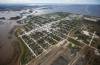
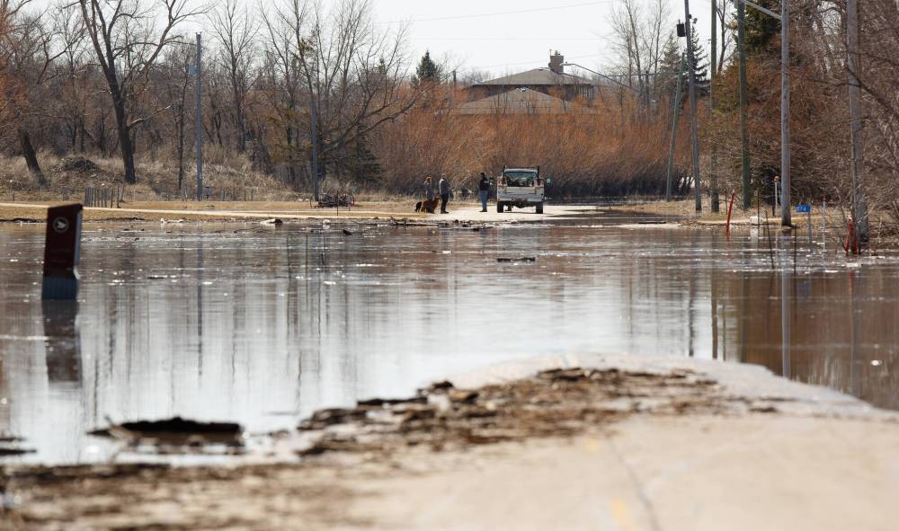
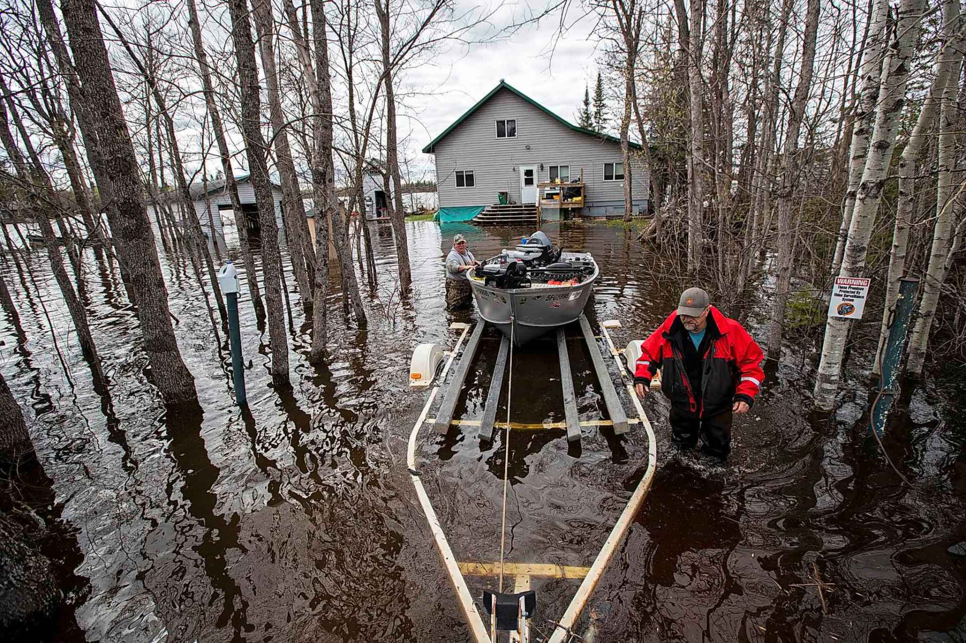
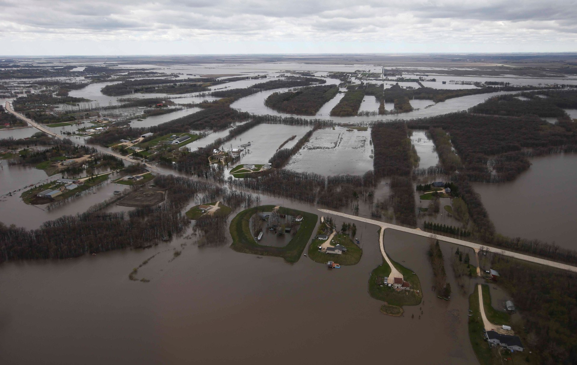
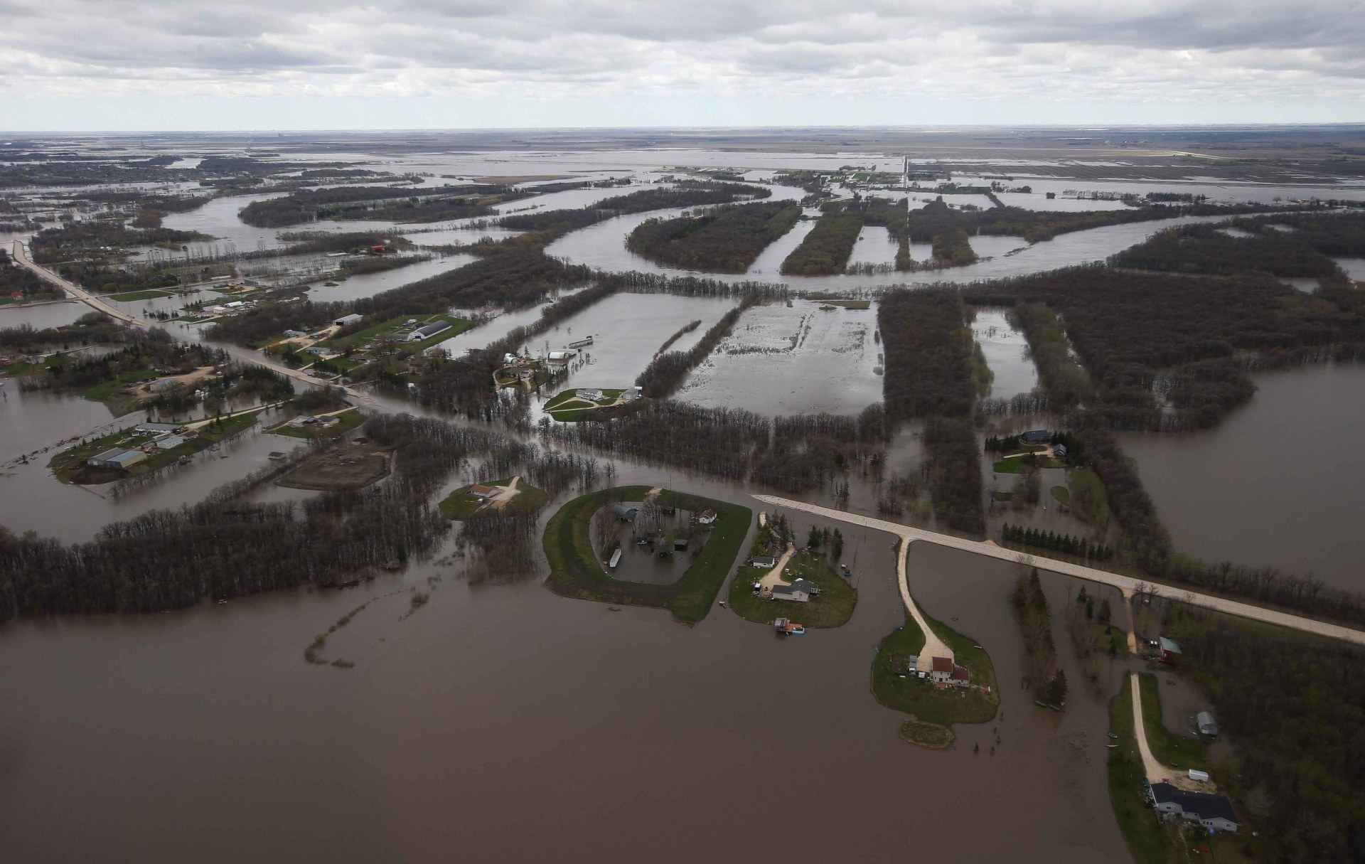
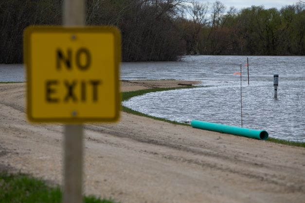
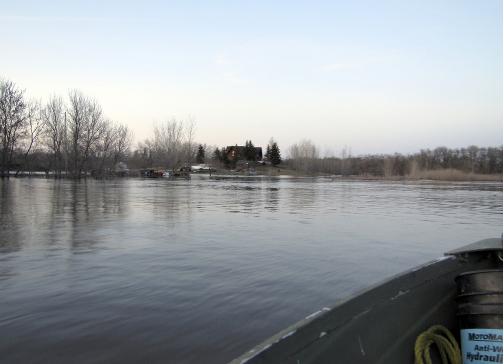
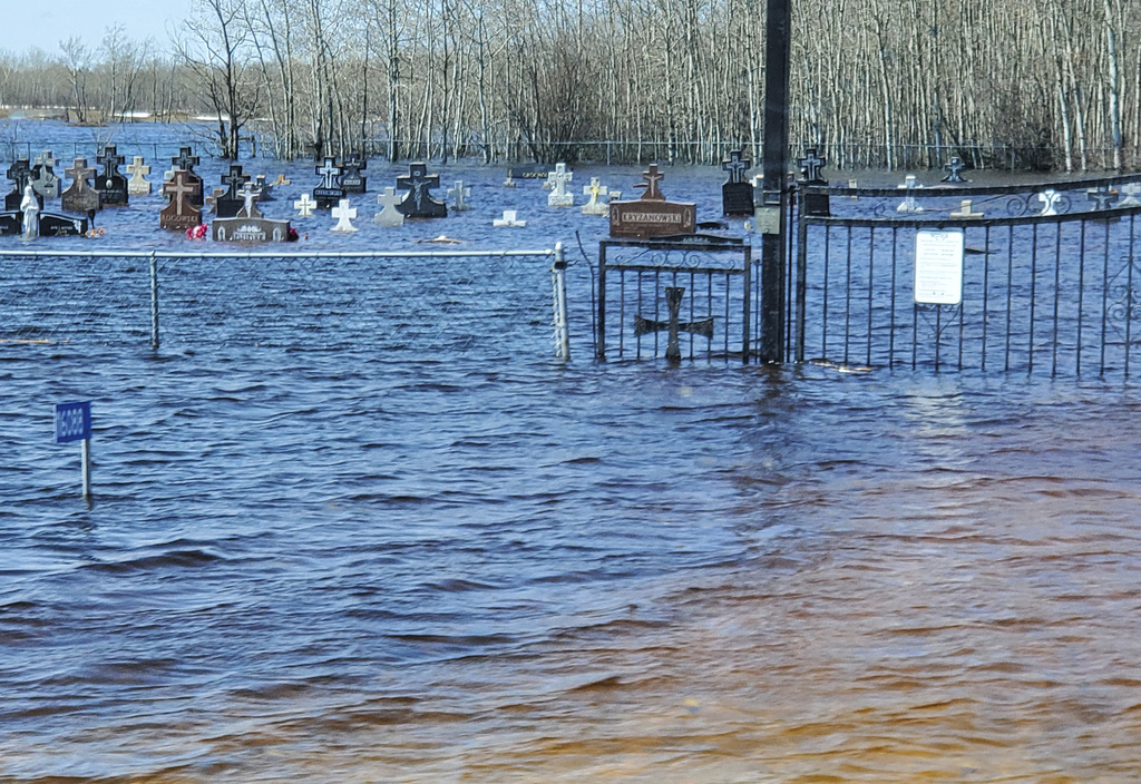
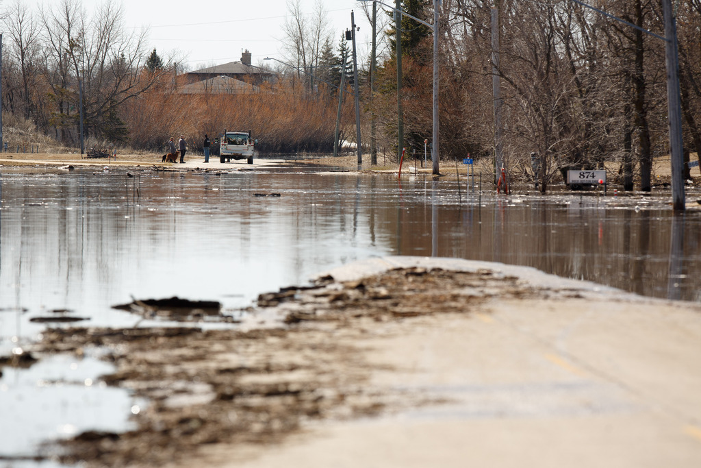
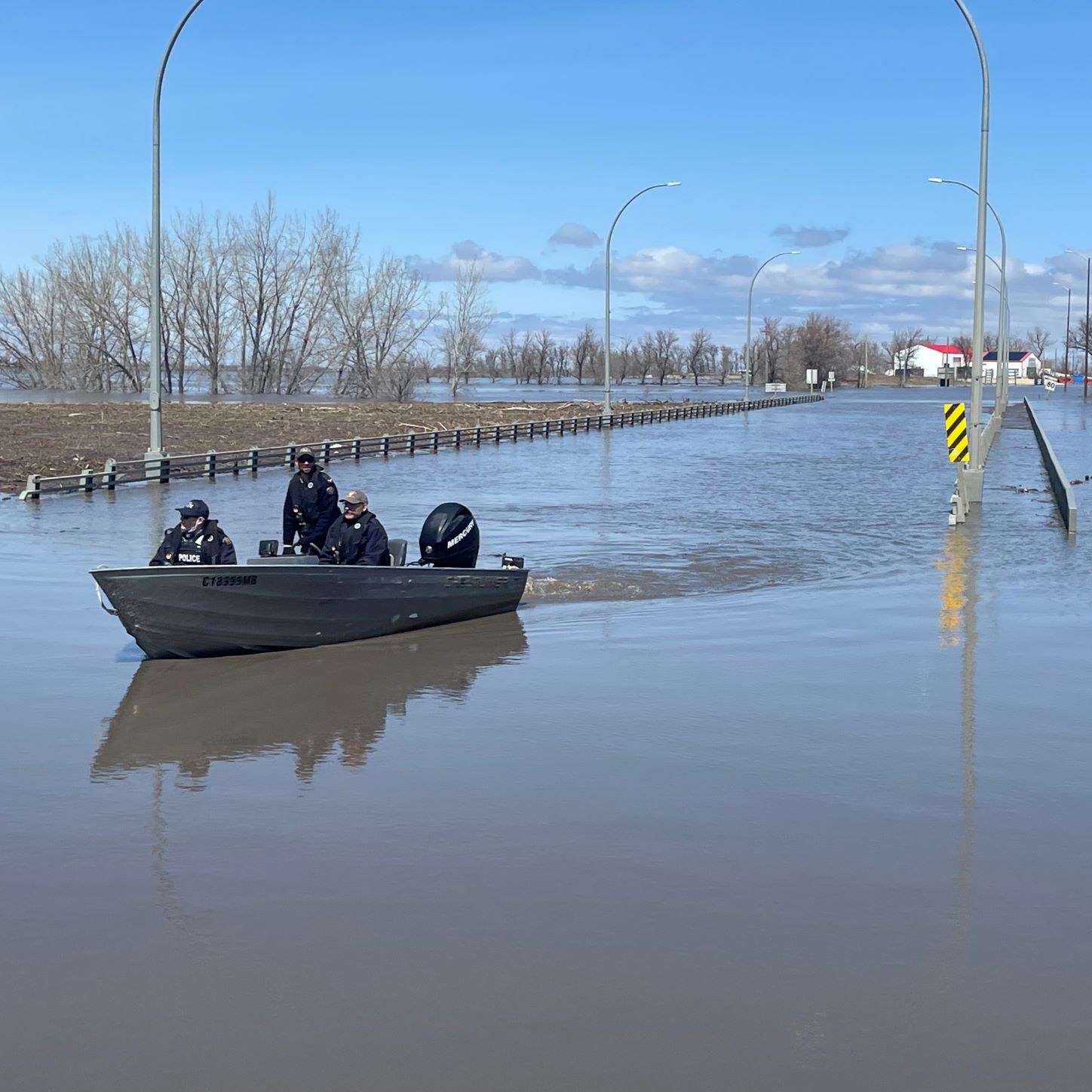
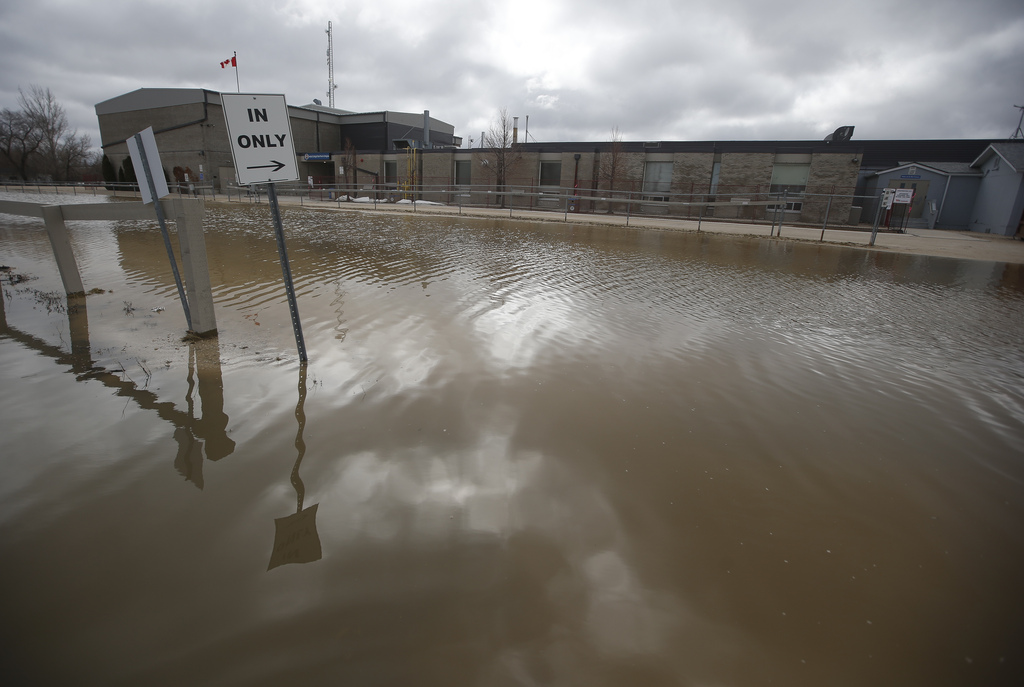
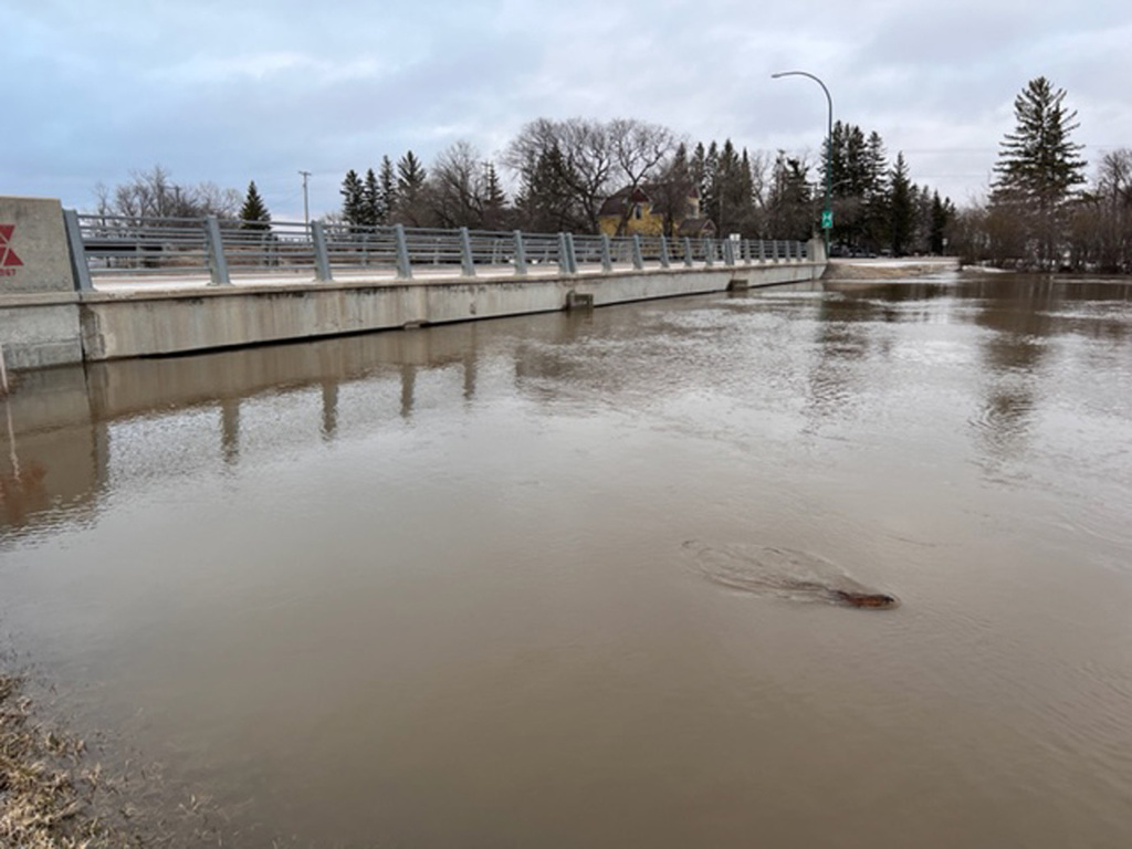
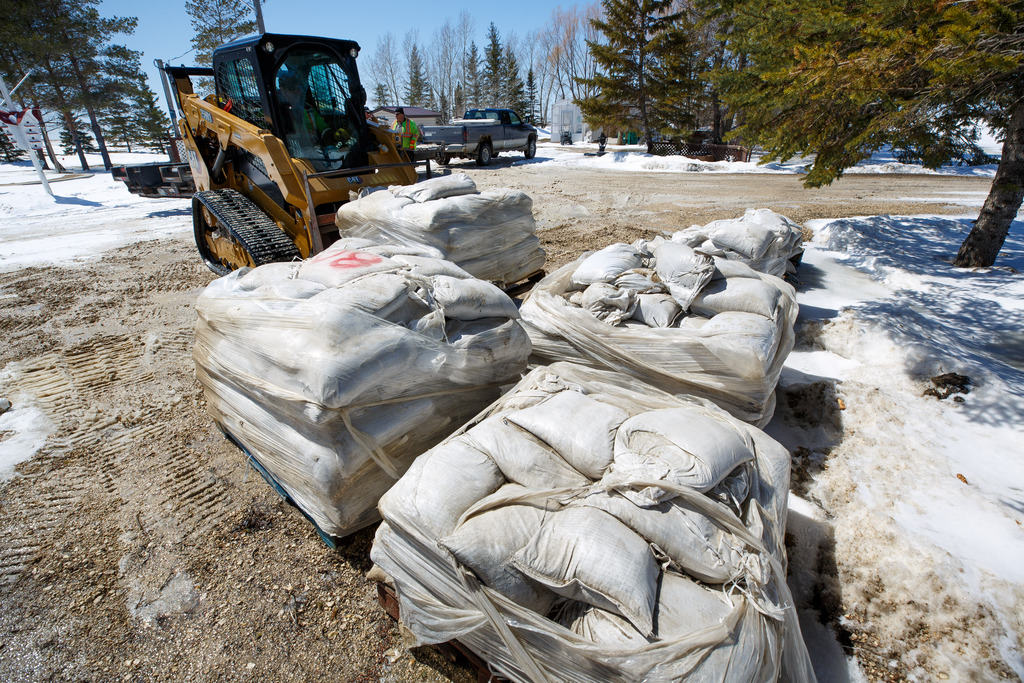
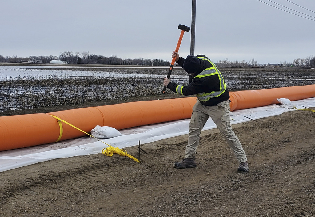
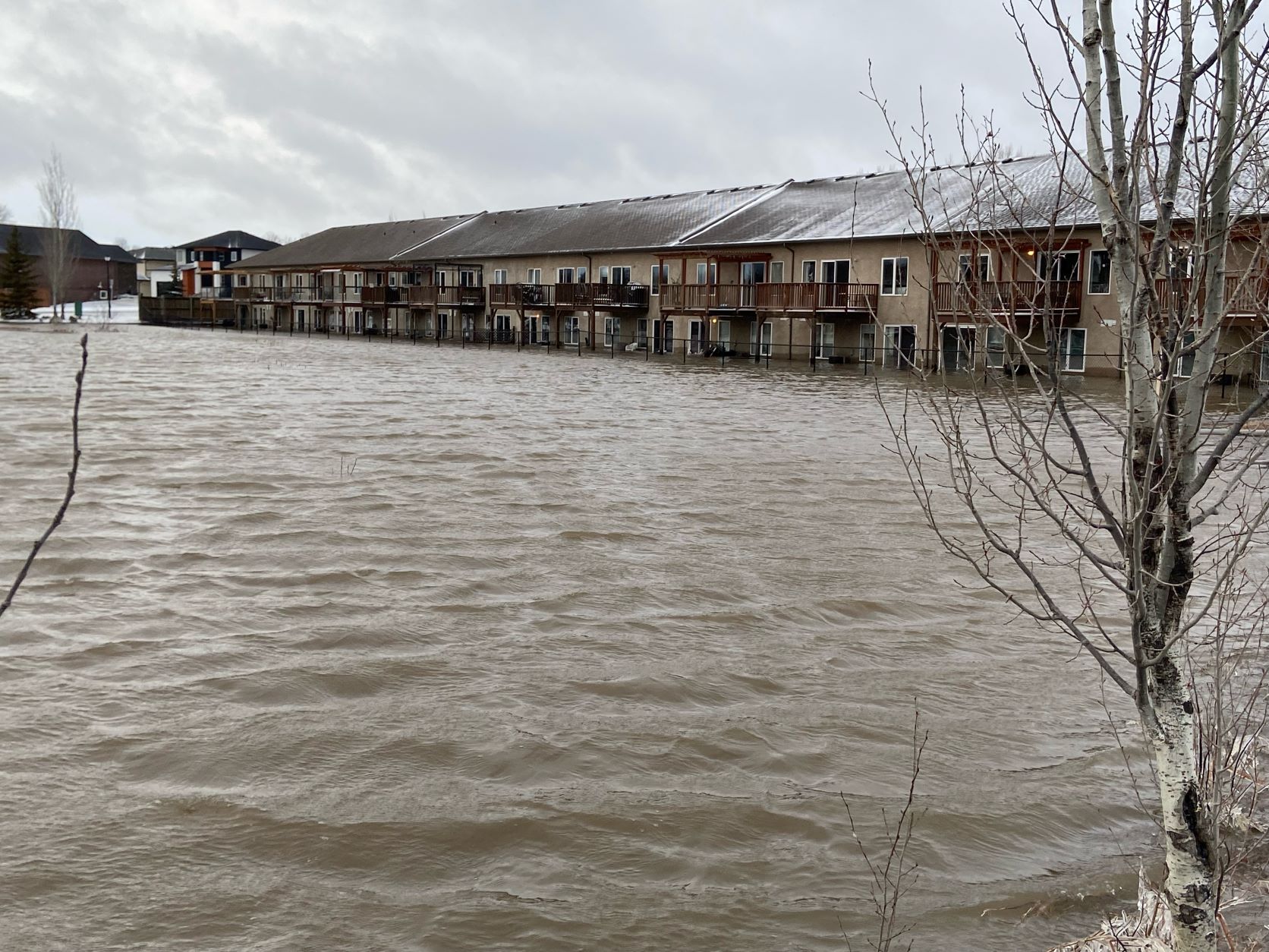
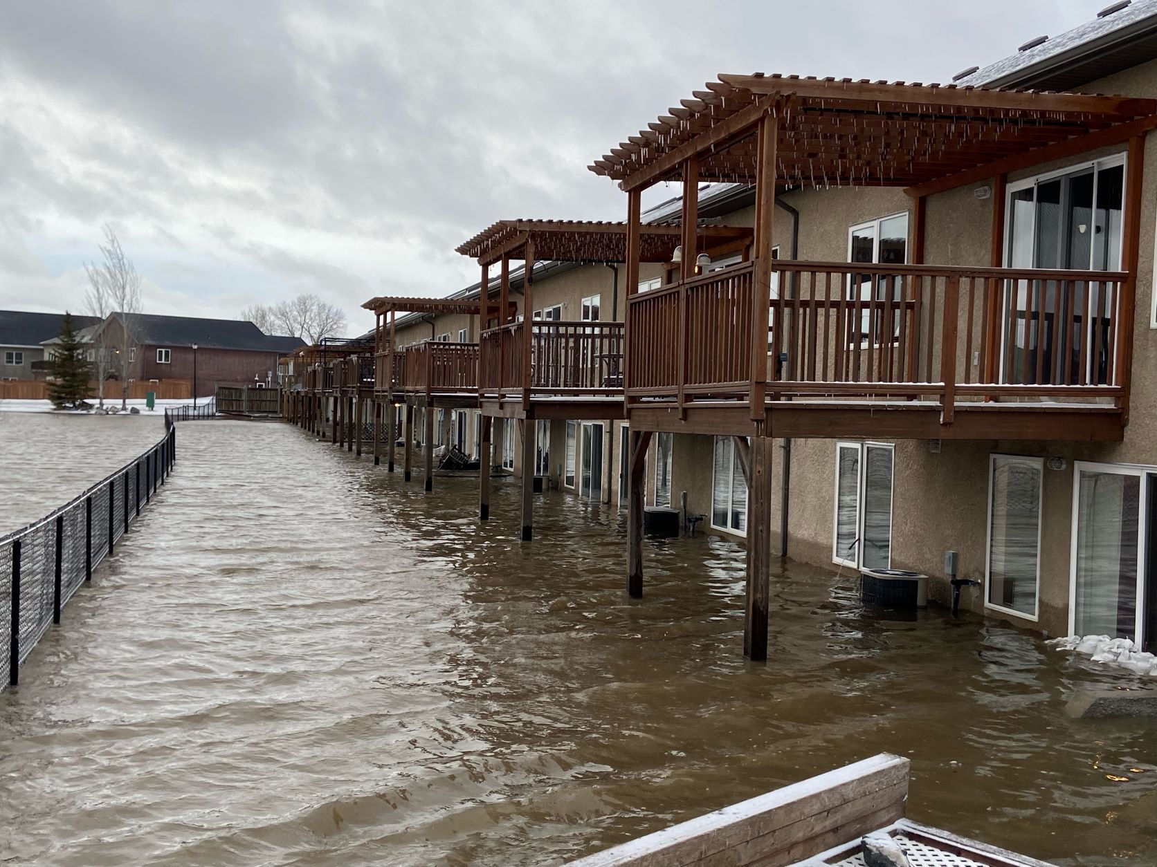
Red River Valley residents whose homes are at risk of flooding are being urged to build or close dikes before it’s too late, as final preparations for next week’s peak begin.
In Winnipeg, the number of properties at risk of river flooding has climbed to 27. The city has told the occupants of 17 of them to have a dike in place by Friday.
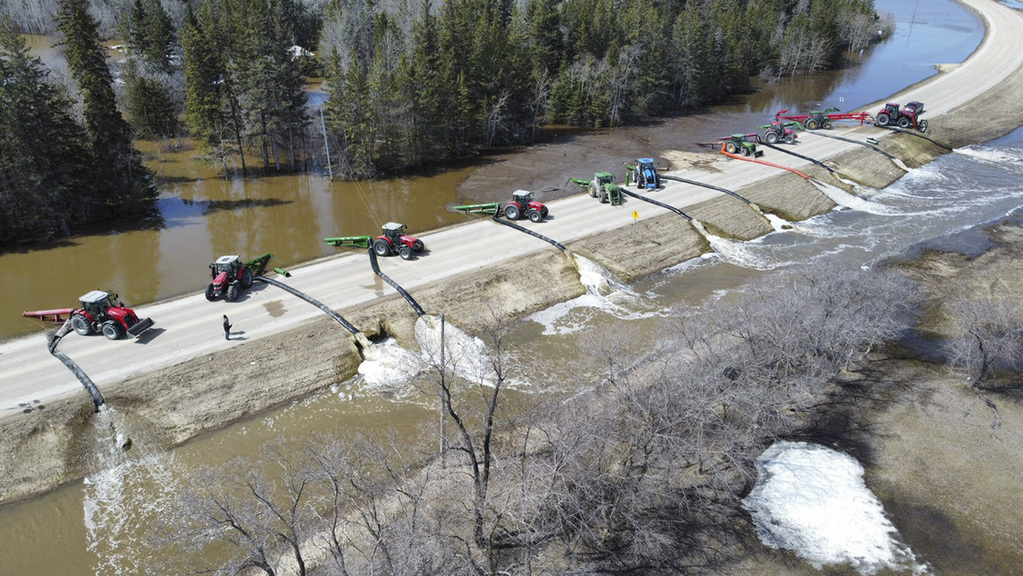
A clay dike at Turnbull Drive in the St. Norbert area is being raised to protect homes from the rising Red, but residents didn’t appear to be alarmed as work continued Tuesday.
“We go through this at least every 10 years, it seems,” said Earl Stafford, who’s been watching trucks deliver clay for several days. “I don’t think we’re that worried. It just depends on how high (the river) is going to go.”
Peter Narth said the existing dike was raised for the Flood of the Century in 1997, when residents were forced to leave their homes for about a month.
“We’ve been through ’97, ’09 and ’11,” said Narth. “The worst was in ’97. That was pretty much touch and go. The dike held in the other floods.”
Municipalities on guard
As of Tuesday afternoon, 24 municipalities had declared states of local emergency.
As of Tuesday afternoon, 24 municipalities had declared states of local emergency.
• Town of Arborg
• RM of Armstrong
• RM of Bifrost-Riverton
• RM of Cartier
• RM of Coldwell
• RM of Dufferin
• RM of Emerson-Franklin
• RM of Fisher
• RM of Grahamdale
• RM of Grey
• RM of Headingley
• RM of MacDonald
• RM of Montcalm
• City of Morden
• RM of Morris
• RM of Norfolk Treherne
• RM of Pembina
• RM of Ritchot
• RM of St. Laurent
• RM of Thompson
• RM of West Interlake
• RM of Whitemouth
• Town of Winnipeg Beach
• RM of Woodlands
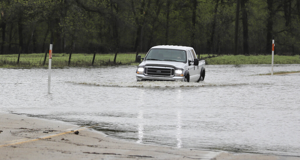
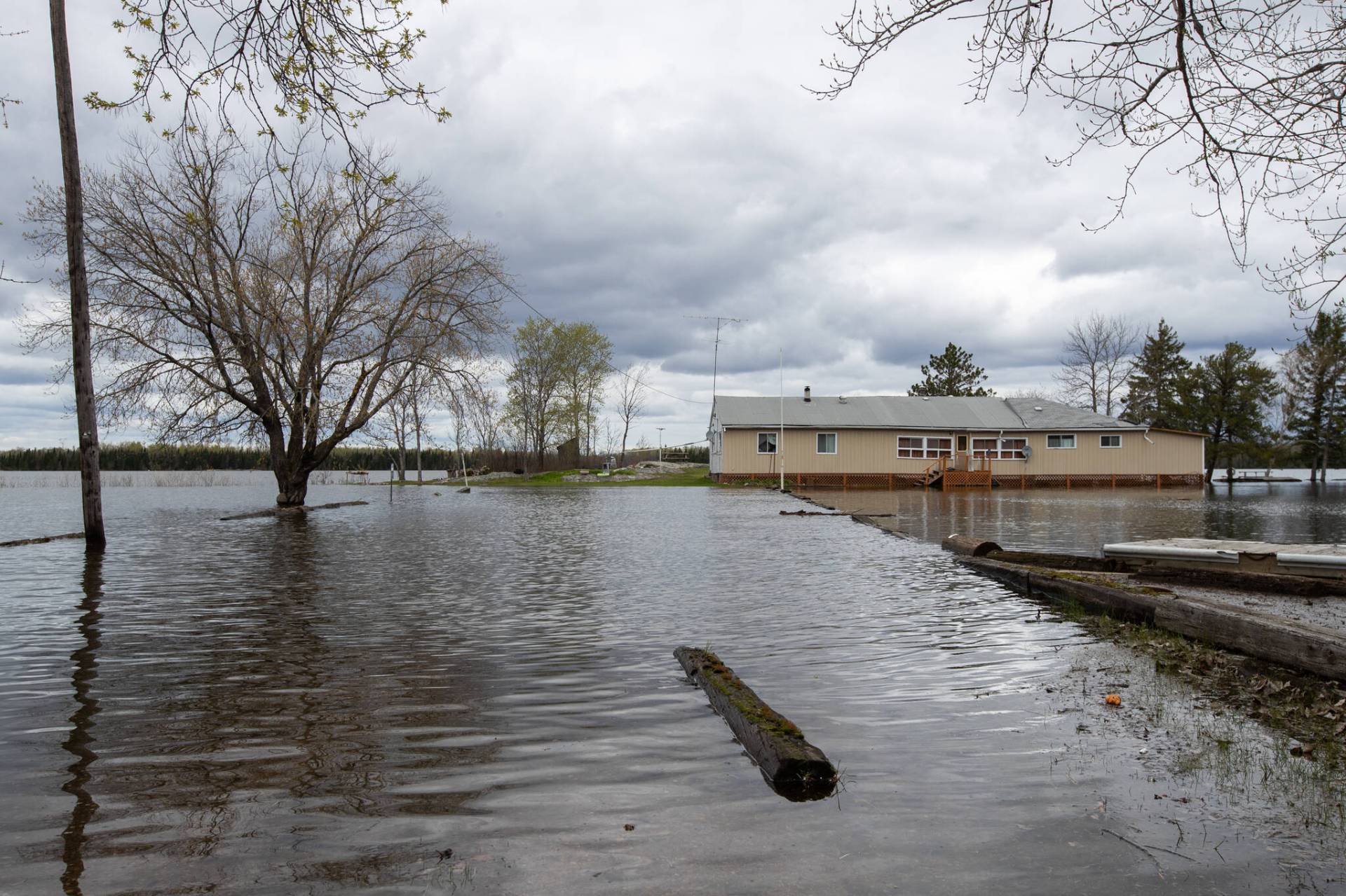
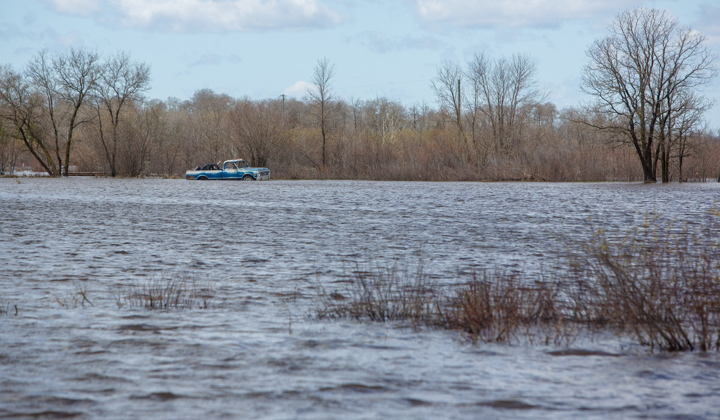
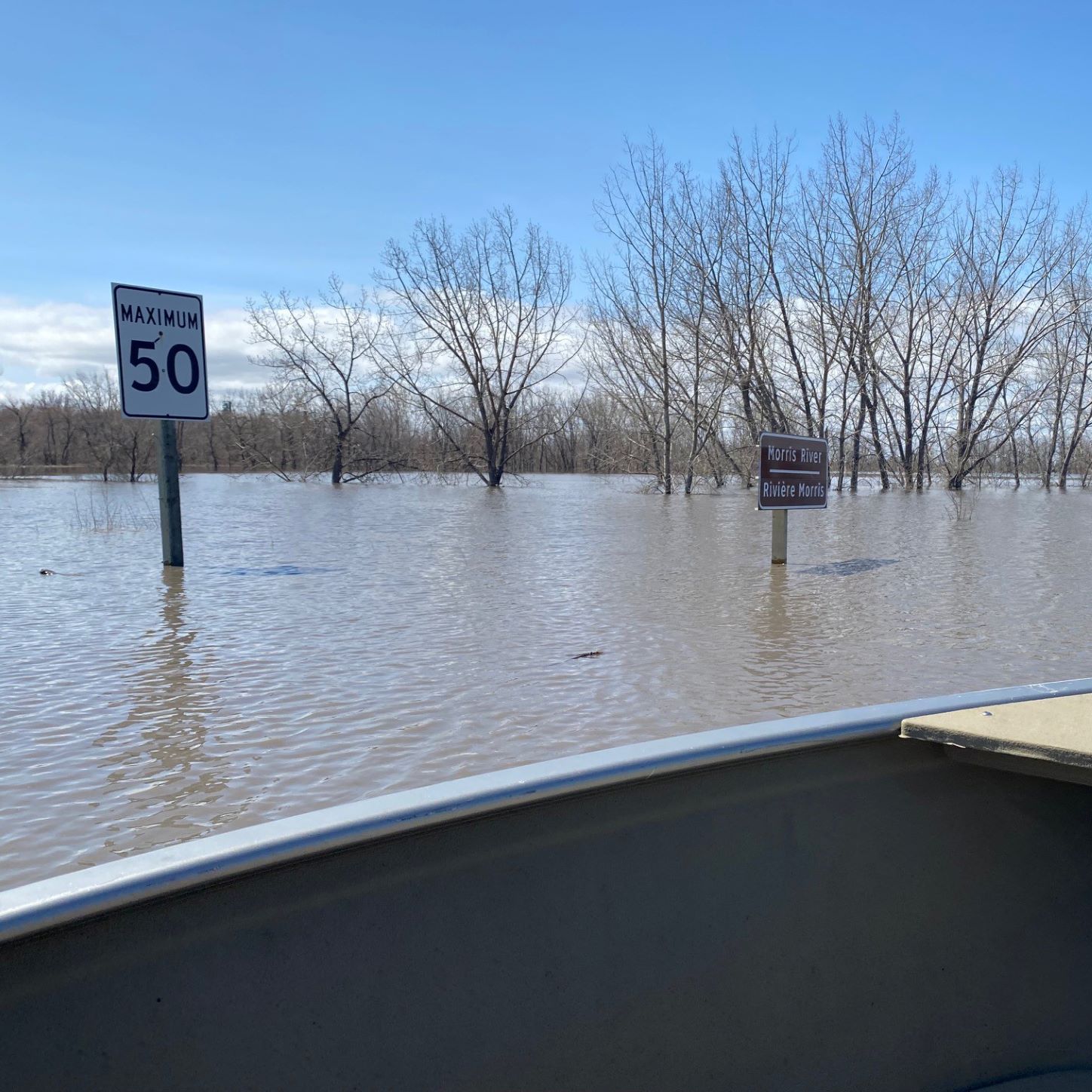
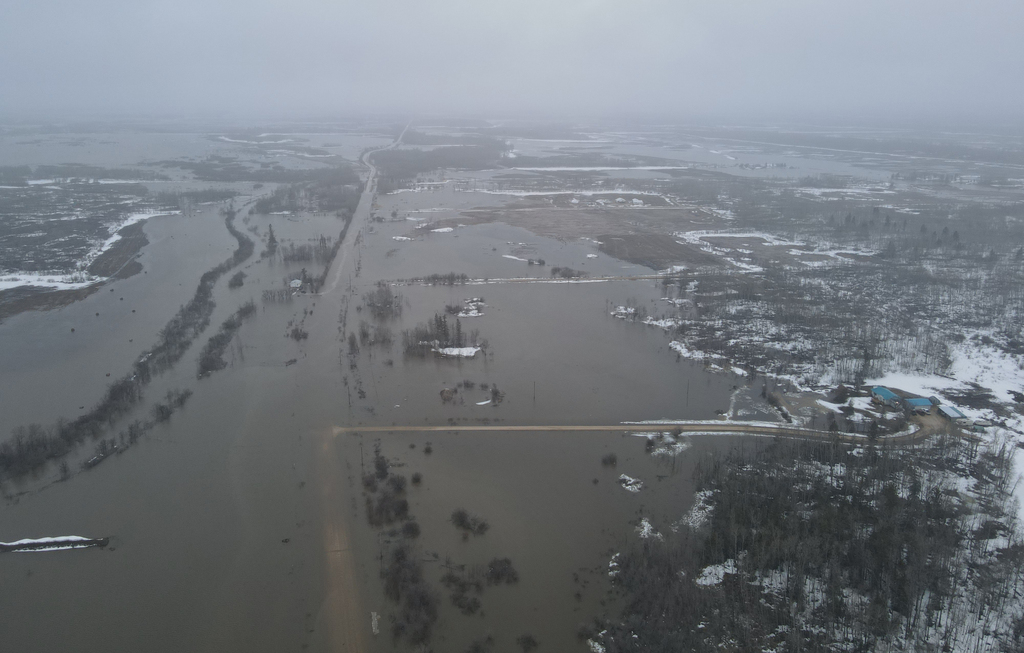
This spring, the province is expecting peak flows similar to or exceeding those of 2009, which were the highest since 1997.
Water levels in Winnipeg are expected to range between 19 and 20.4 feet at James Avenue from May 5 to May 14, the city said in a news release.
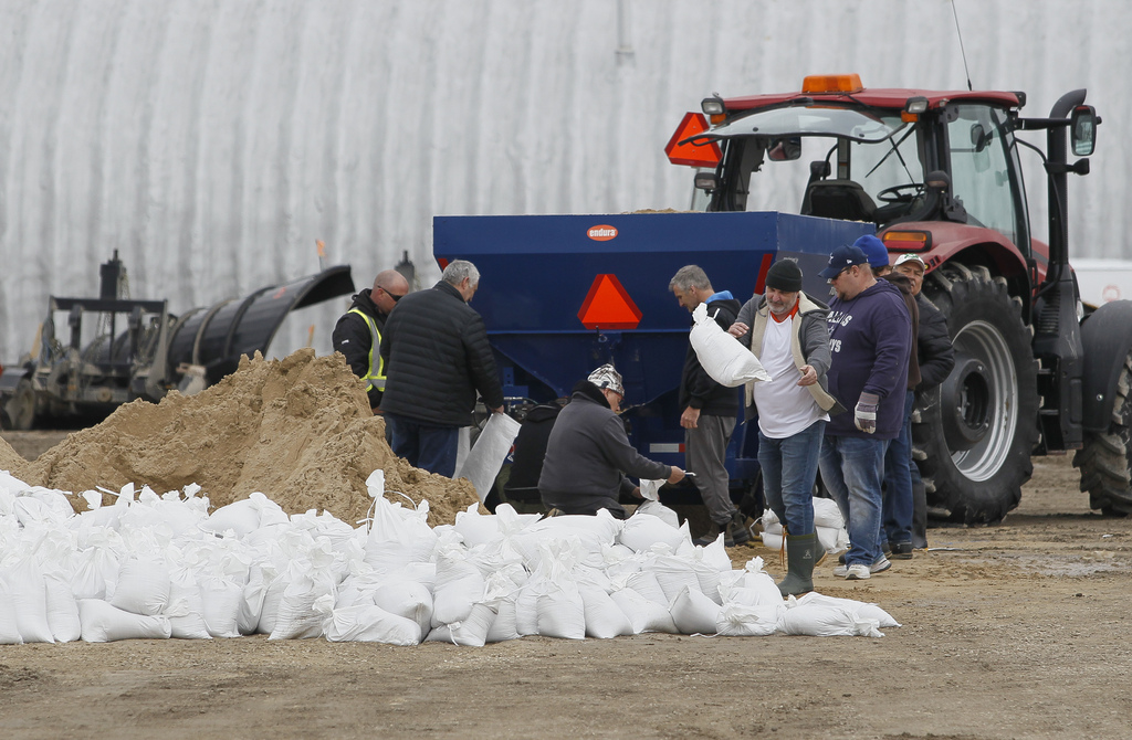
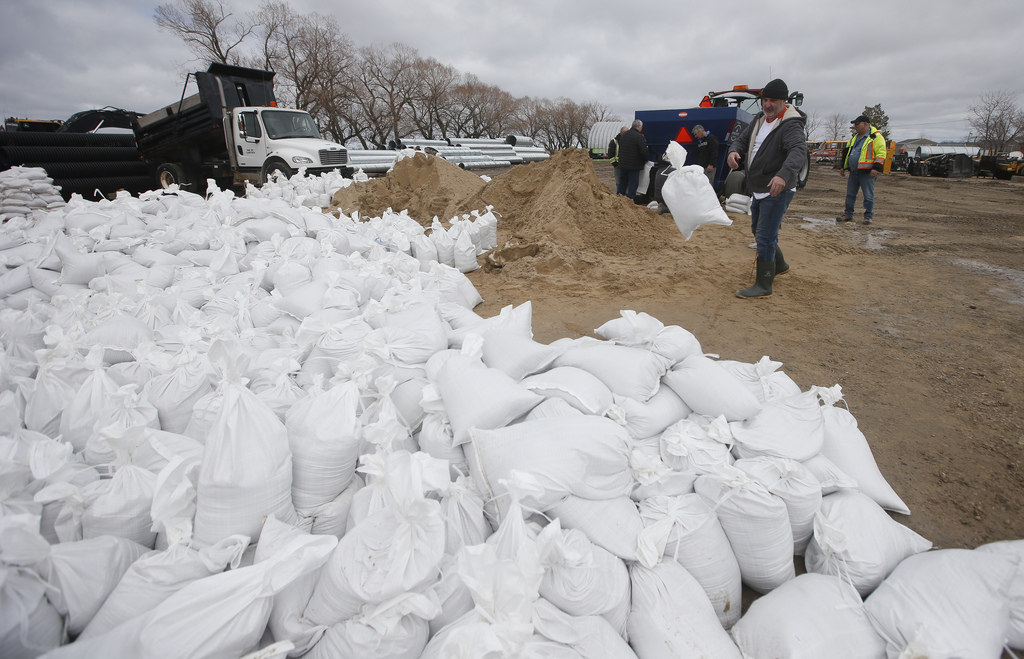
It is estimated the capital will need about 29,000 sandbags to protect at-risk properties. The Red River Floodway and Portage Diversion are being used to reduce water levels in Winnipeg.
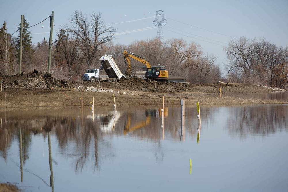
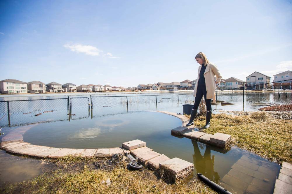
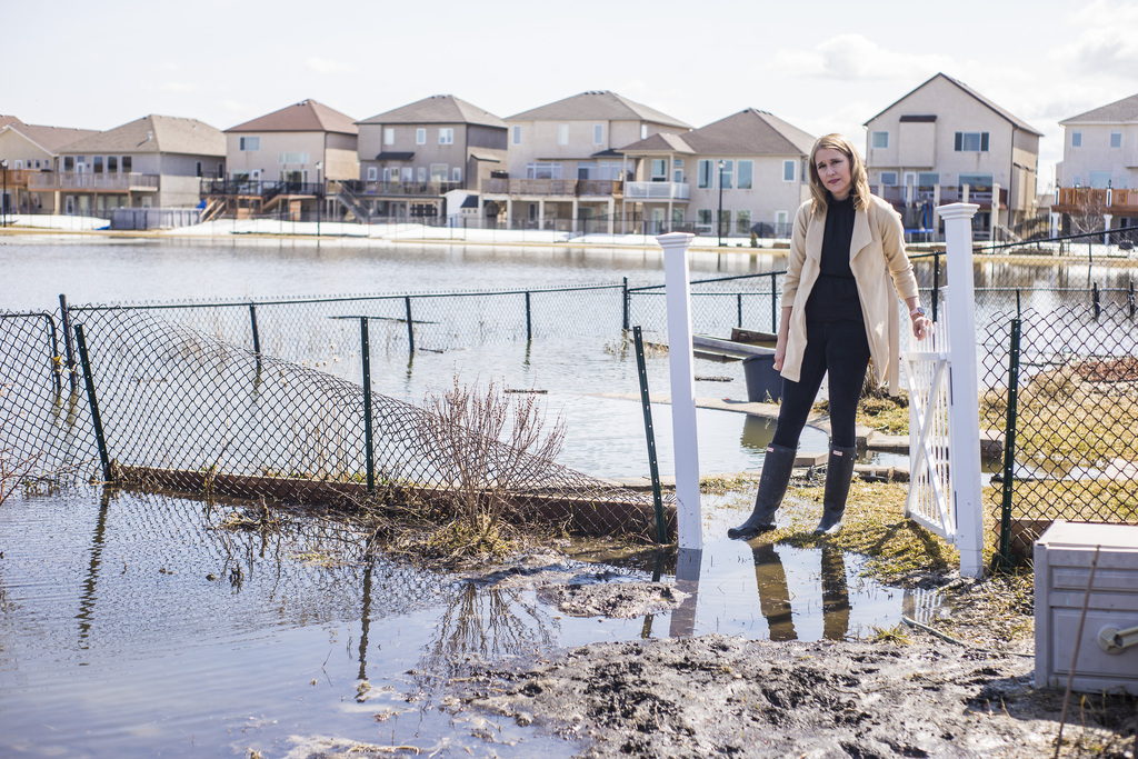
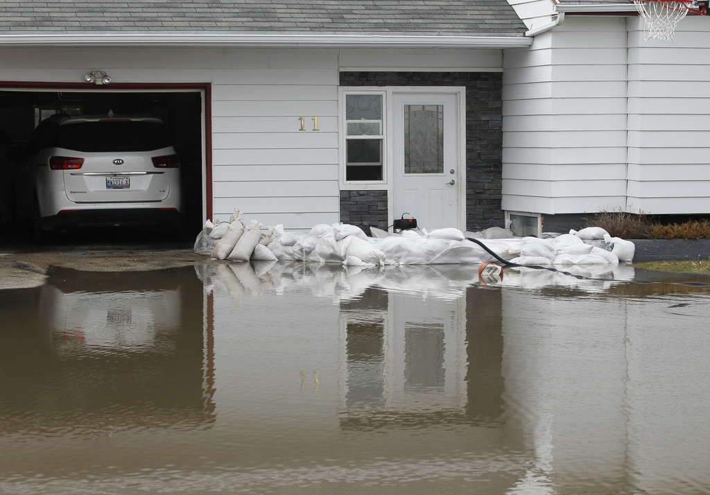
It’s not just rivers that are causing concern. Residents such as Jennifer Lim are worried about high levels on retention ponds in the city.

Lim, and her Amber Trails neighbours have considered sandbagging their homes after a pond spilled into their backyards.
“The water has receded by about (15 cm) from where it was Saturday,” said Lim. “We were really nervous. I didn’t sleep at all this past weekend.”
The city’s 311 service has received 64 calls about high water in retention ponds since April 23, said spokesman David Driedger.
Meanwhile, the number of flood-hit municipalities to declare states of local emergency has increased by six, to 24. The latest are the RMs of Coldwell, Emerson-Franklin, MacDonald, Norfolk Treherne, Whitemouth and Woodlands.
Local emergencies have also been declared by some First Nations communities, including Fisher River and Peguis, where more than 1,000 people have been forced to evacuate to Winnipeg, Selkirk and Gimli.
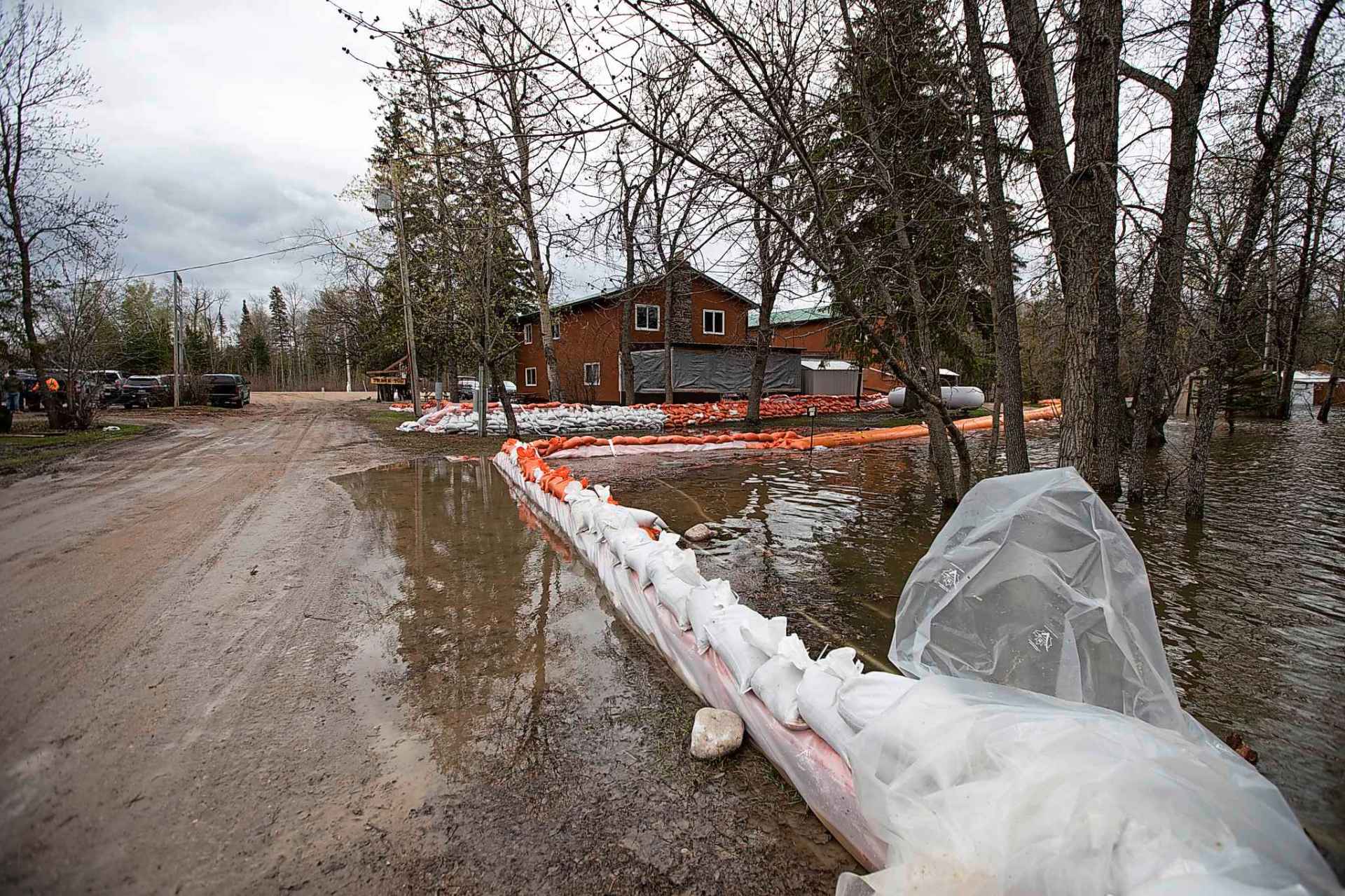
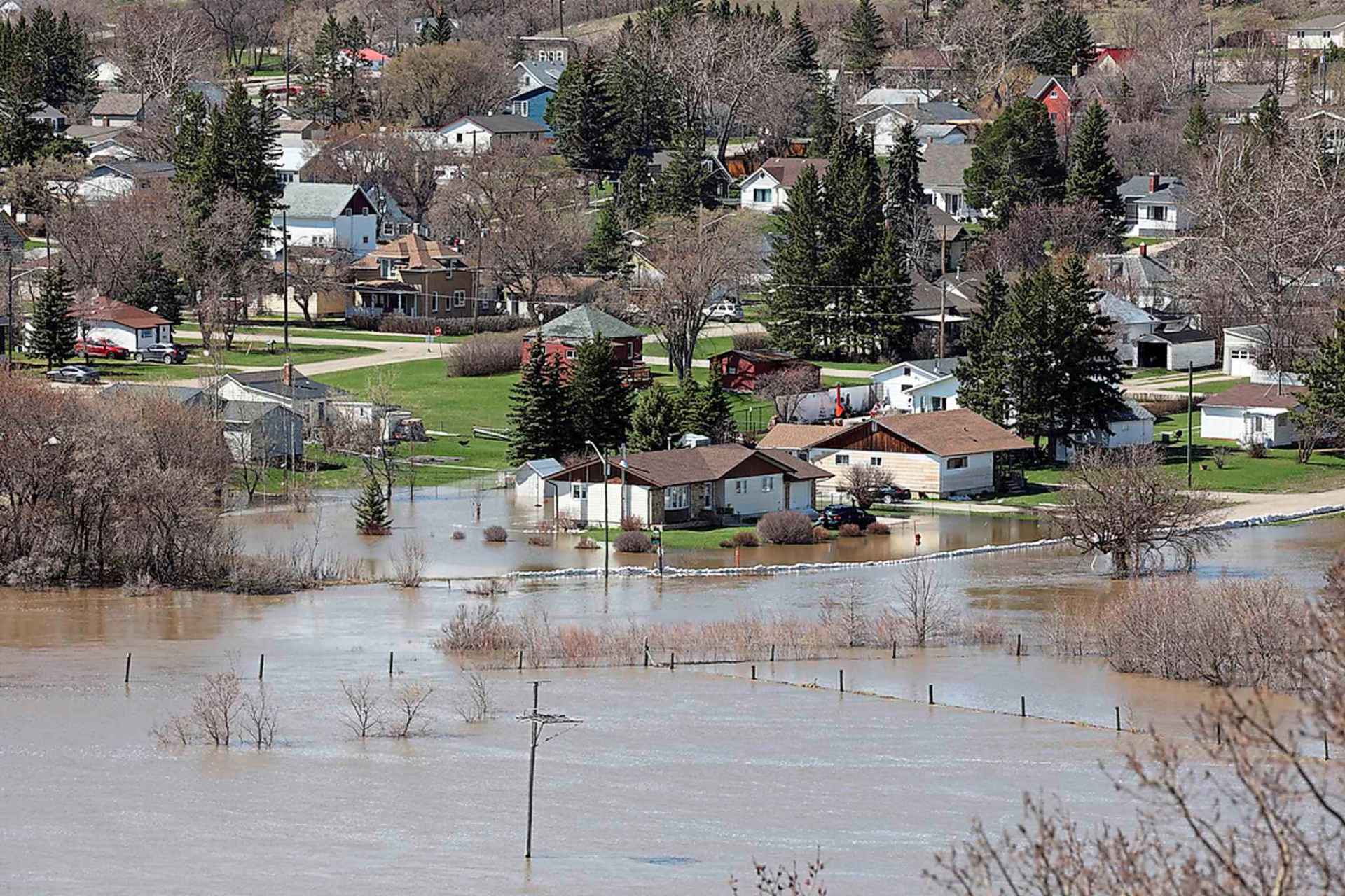
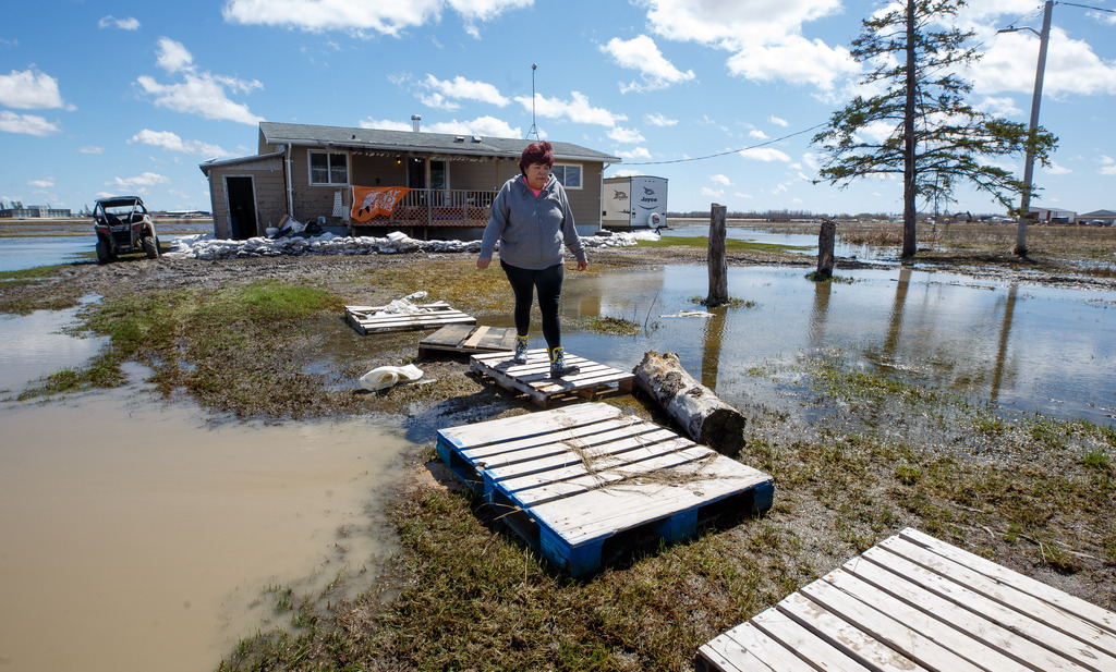
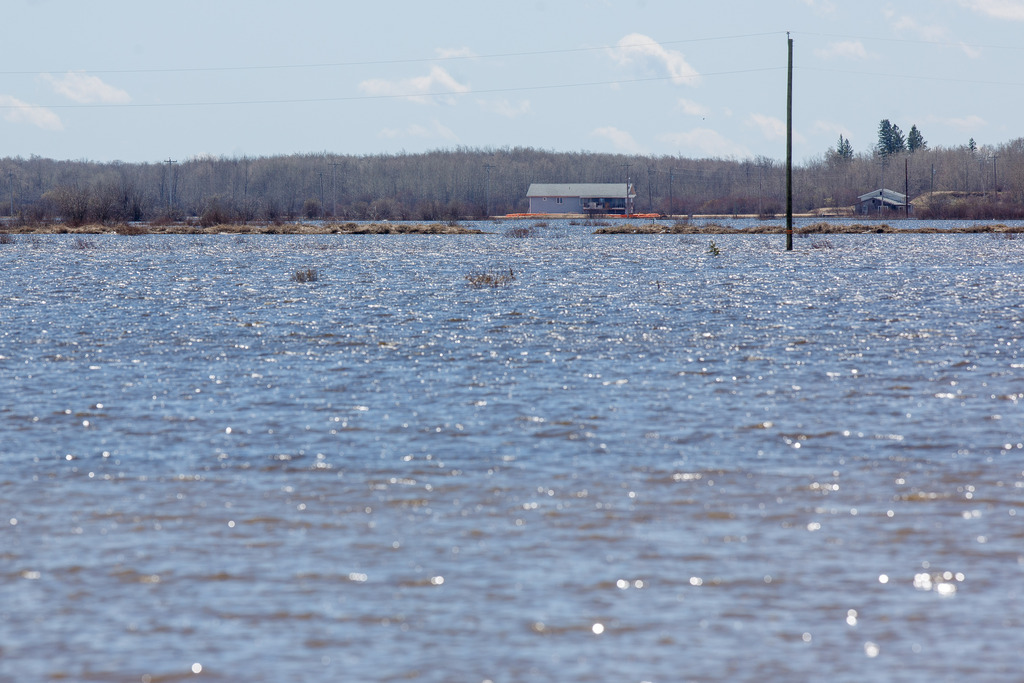
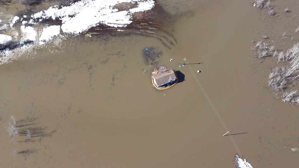
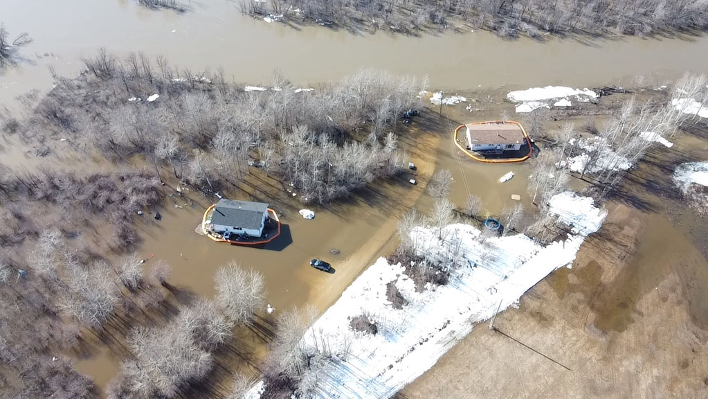
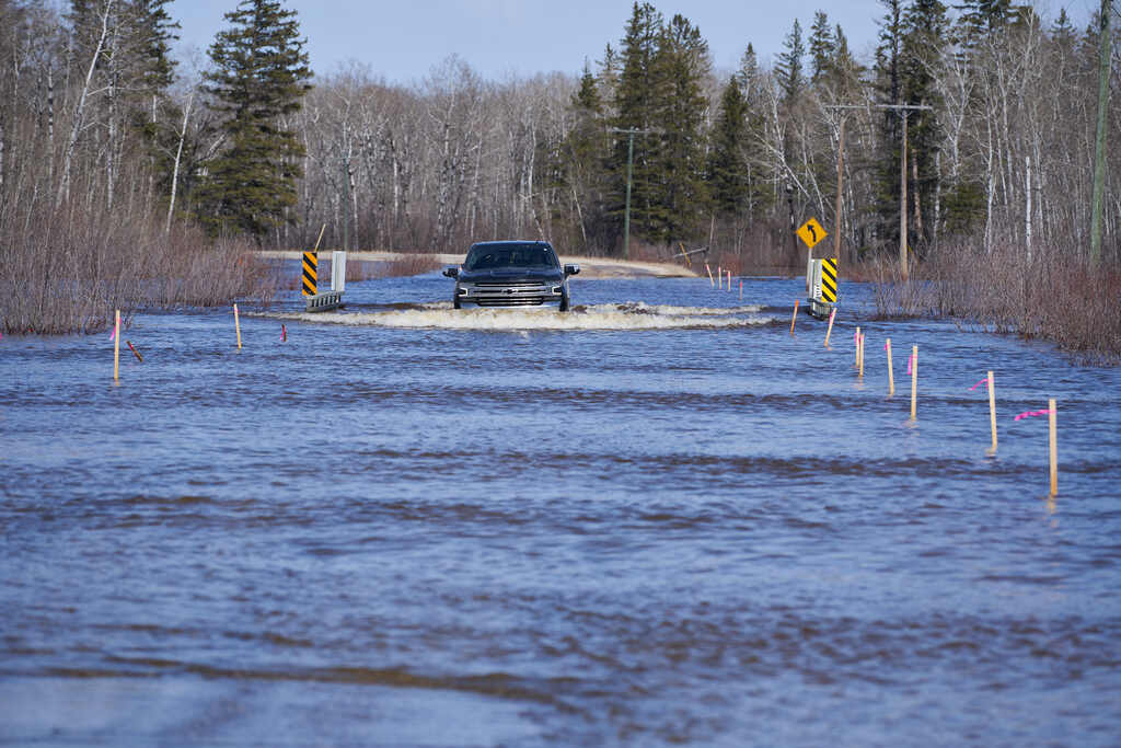
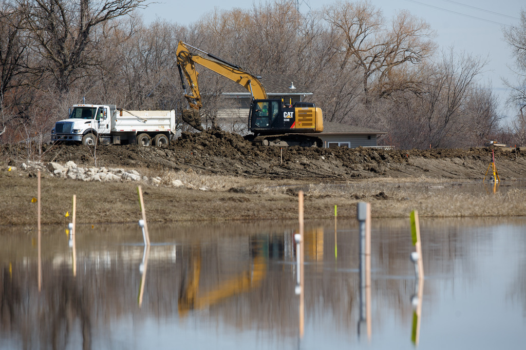
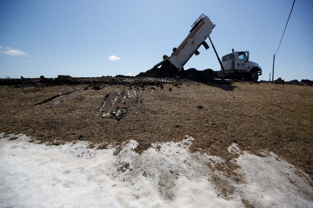
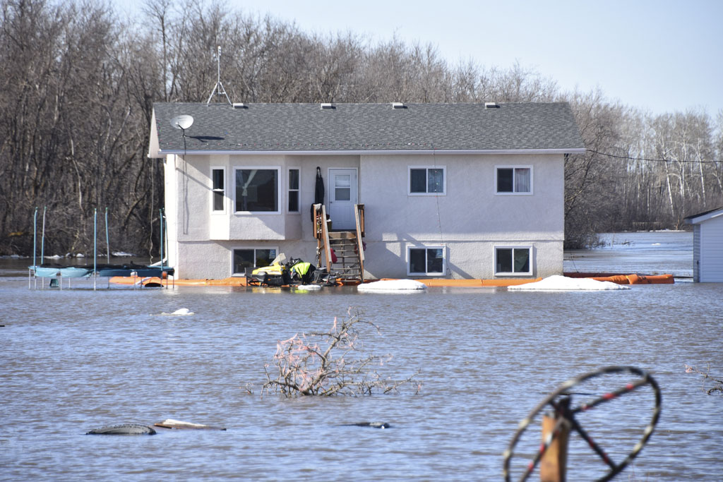
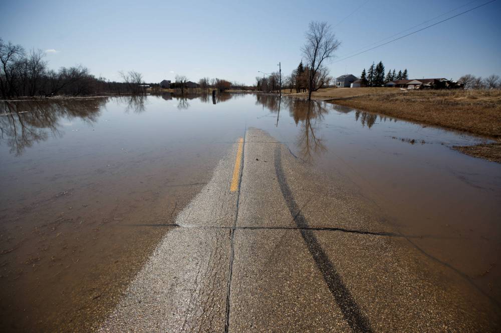
Communities south of Winnipeg continue to issue evacuation notices and work on closing ring dikes as the water rises.
The RM of Ritchot, already in a state of emergency, has given notices to more than 110 homes, with almost half of those households evacuating, thus far.
“We are seeing more evacuations happening,” said Mayor Chris Ewen. “The water is rising quite quickly.”
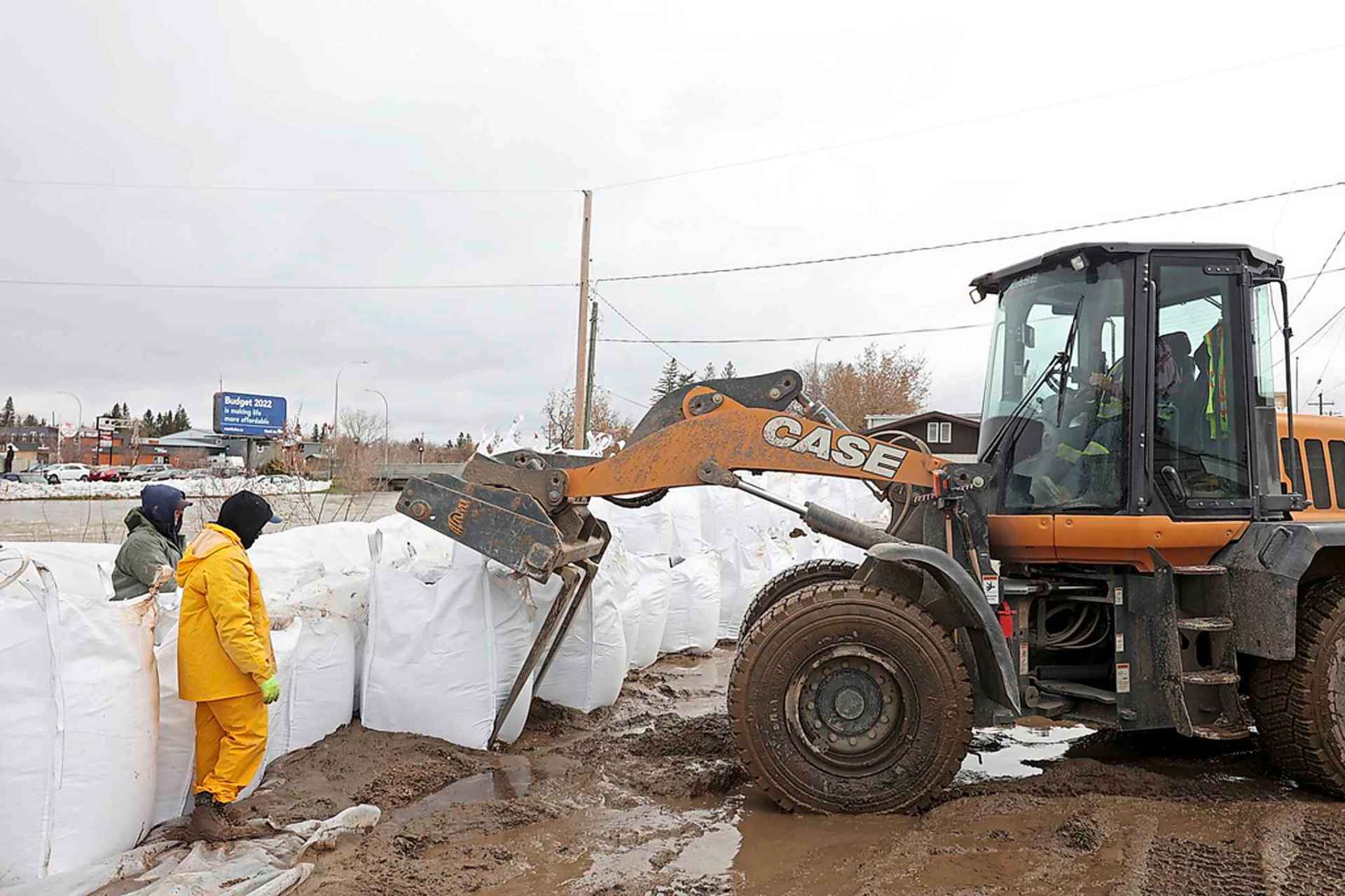
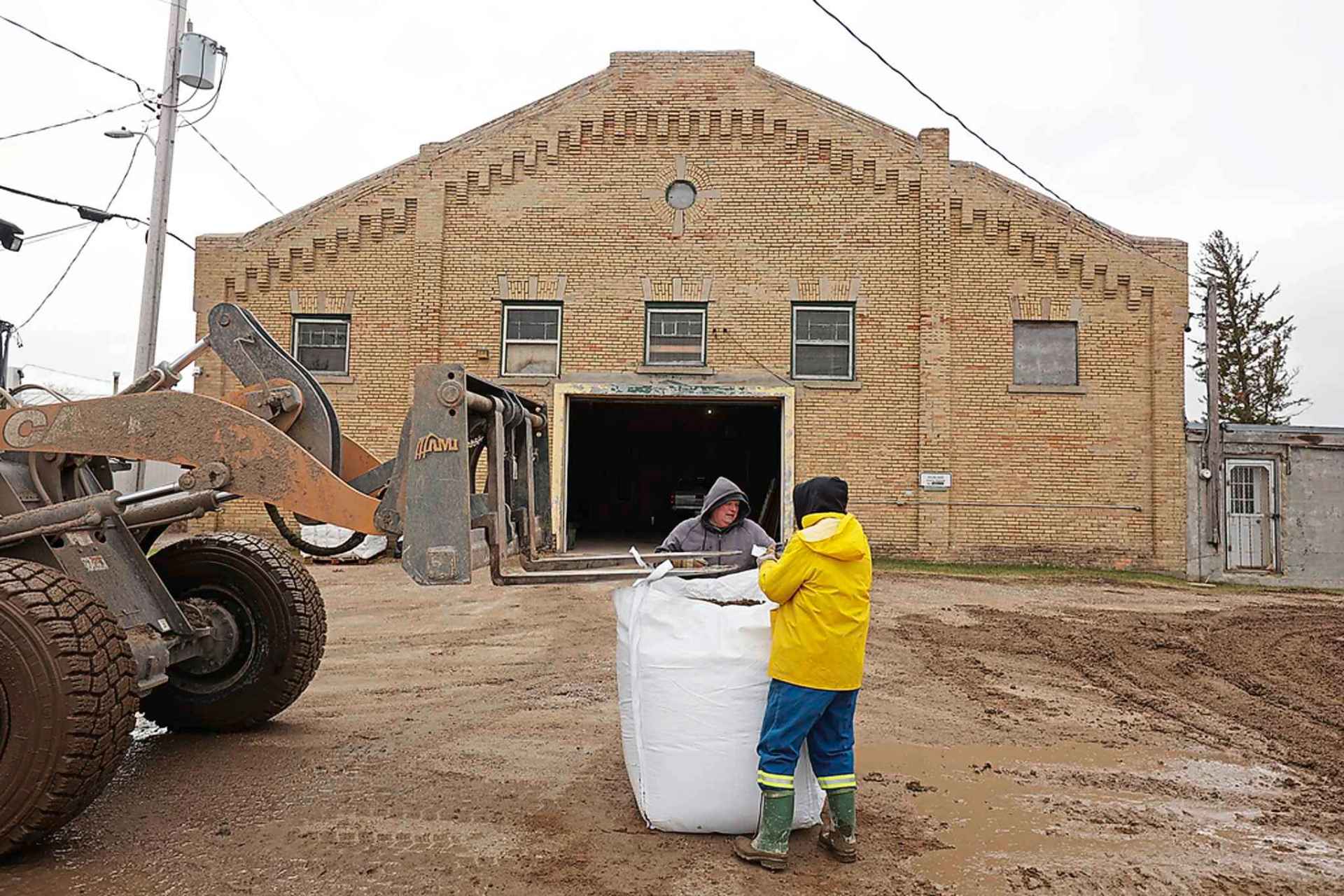
The municipality has put out a call for volunteers to help with sandbagging.
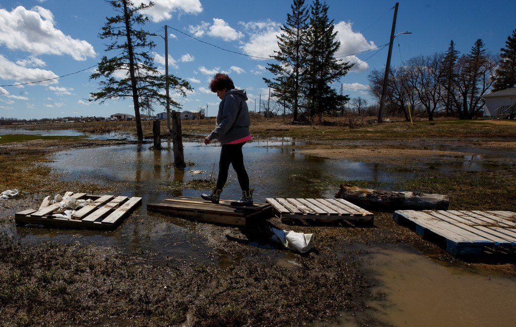
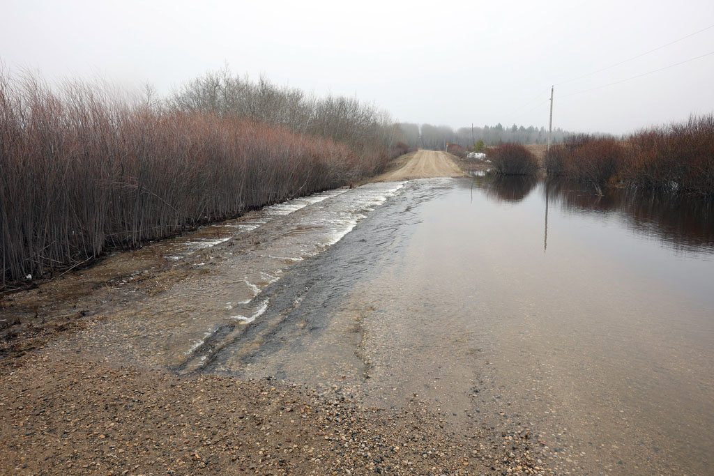
Residents should make sure their dikes are ready or they have all the material they need before their road is washed out, he said.
People who are planning to stay put in properties that will become surrounded by floodwater should stock up on (drinking) water, food and other essentials.
“It will get to the point where you (need) a boat or you choose not to leave your home for a certain number of days,” said Ewen. “People should consider if staying home is the right thing to do.”
Emerson-Franklin has given evacuation notices to 17 households at risk of becoming cut off, said Reeve Dave Carlson.
Some properties will likely have to close their ring dikes as the water rises, he said.
The municipality declared a local emergency following a meeting Monday.
“Just because we’re looking at 2009 levels and we’re losing road access to some of our residents, we felt that was the right move to make,” said Carlson. “We’re hoping the weather stays dry and warm. That should take the frost out of the ground and, hopefully, allow some moisture to soak into the soil.”
.jpg?w=1920)


.jpg?w=1920)
.jpg?w=1920)
.jpg?w=1920)


.jpg?w=1920)

Environment Canada is predicting sunny skies and daytime highs of about 20 C from Thursday to Saturday, but more rain is possible Saturday night.
Forecasters are keeping an eye on a Colorado low that could dump large amounts of rain in southern Manitoba early next week.
The U.S. National Weather Service is expecting the Red to crest in Pembina, N.D., just across the border from Emerson, at 53 feet Sunday. The peak will be slightly above 2009 and 1.9 feet below 1997.
The Red is expected to crest at the floodway inlet between May 11 and 14.
“It will get to the point where you (need) a boat or you choose not to leave your home for a certain number of days.”– Chris Ewen, RM of Ritchot Mayor
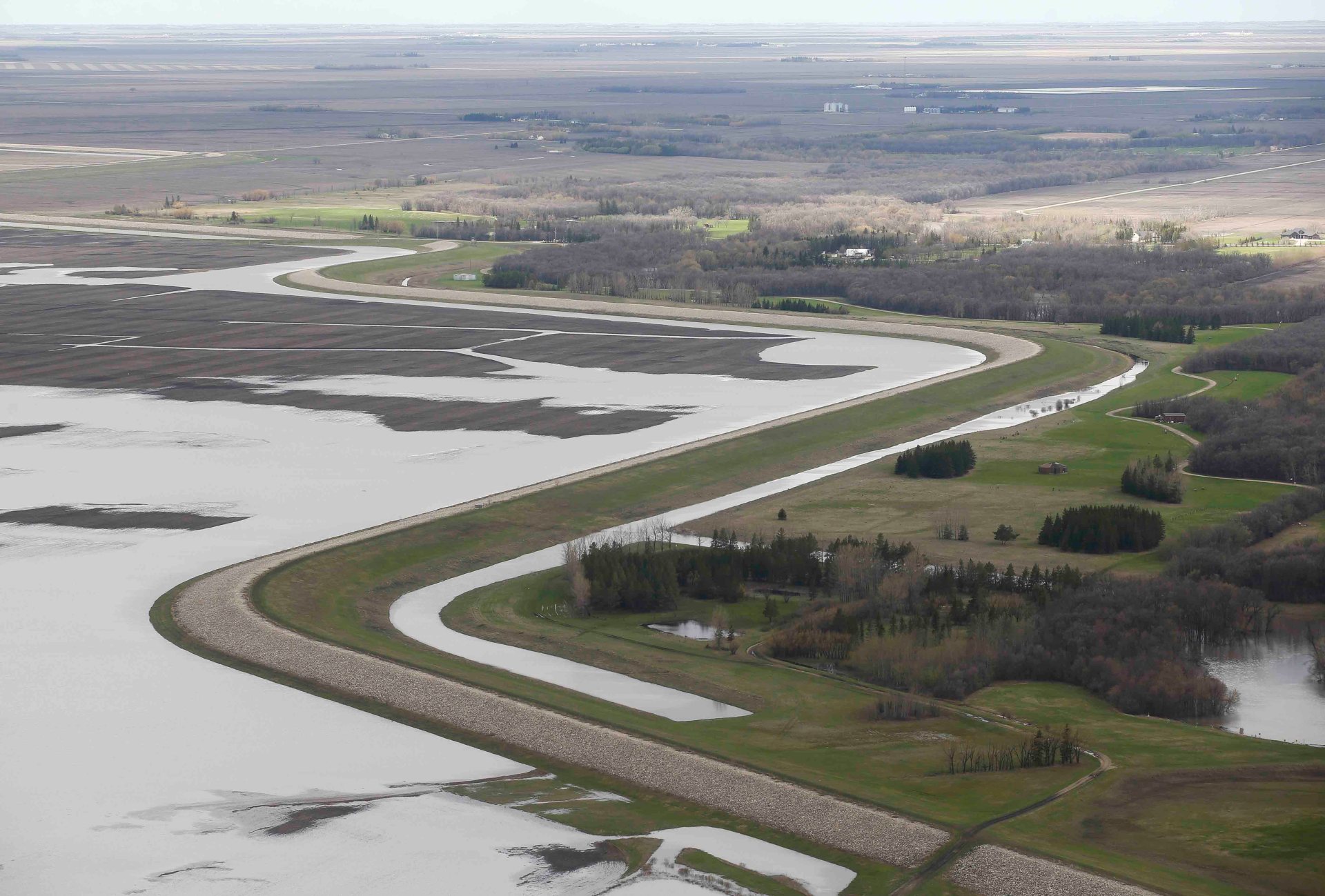
Community ring dikes and most rural properties are protected against 1997 flood levels plus two feet.
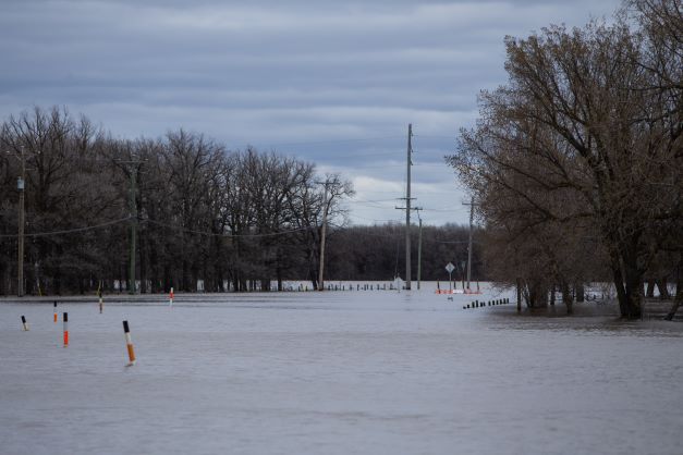
To protect Morris, the province closed Highway 75 on the south side of town Monday night. The north side was closed Friday.
Motorists now face a detour of about 165 kilometres via Carman and Winkler, said Aaron Dolyniuk, executive director of the Manitoba Trucking Association.
For truckers, the detour will add up to $250 to $300 per trip, and the cost is typically passed on to consumers, said Dolyniuk.
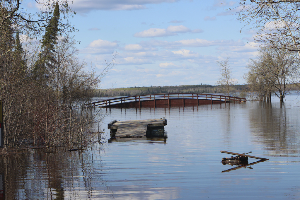
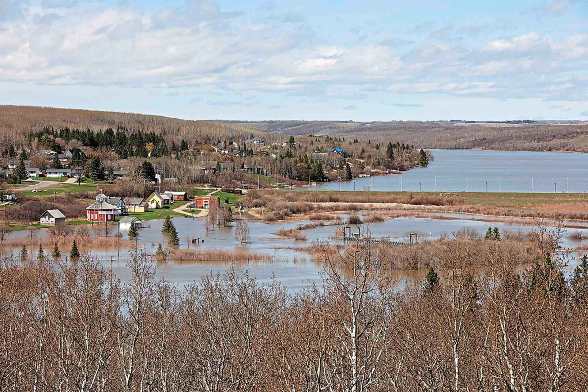
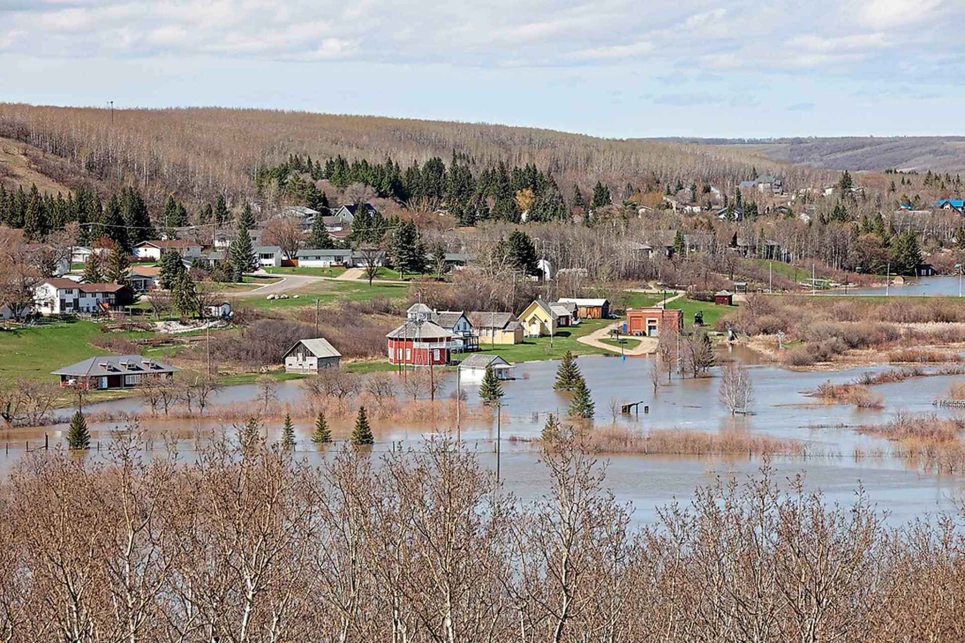
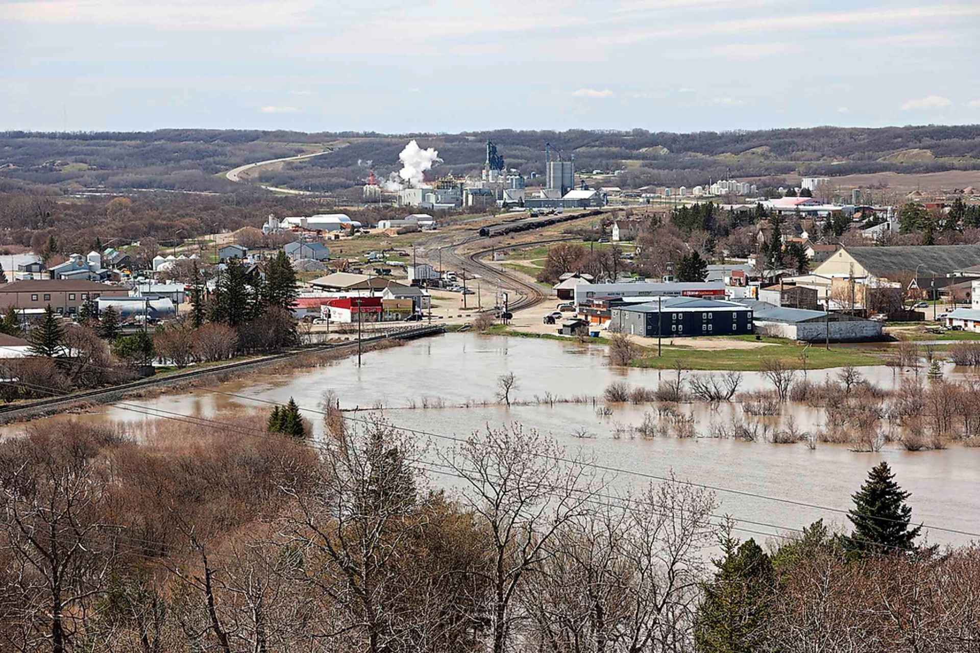
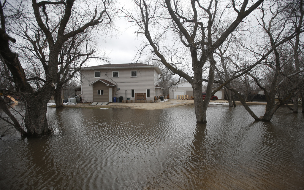
In the Interlake, several communities continue to deal with flooding.
Arborg Mayor Peter Dueck said the Icelandic River had receded by up to 15 cm in the 24 hours before Tuesday morning.
“We haven’t lost any homes,” he said. “We’re keeping our fingers crossed we have averted the biggest problem.”
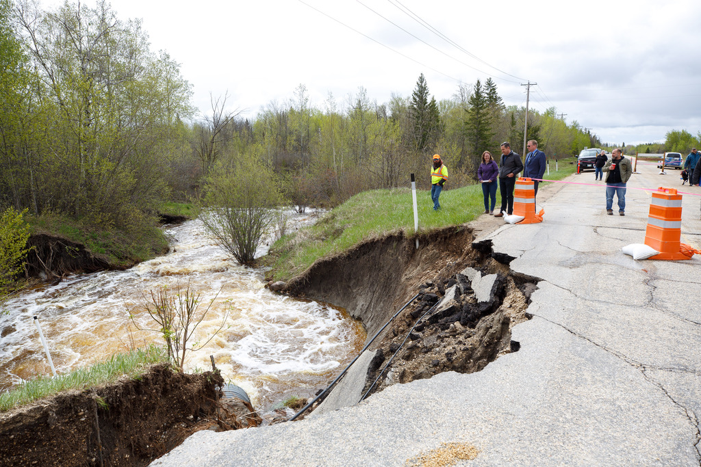
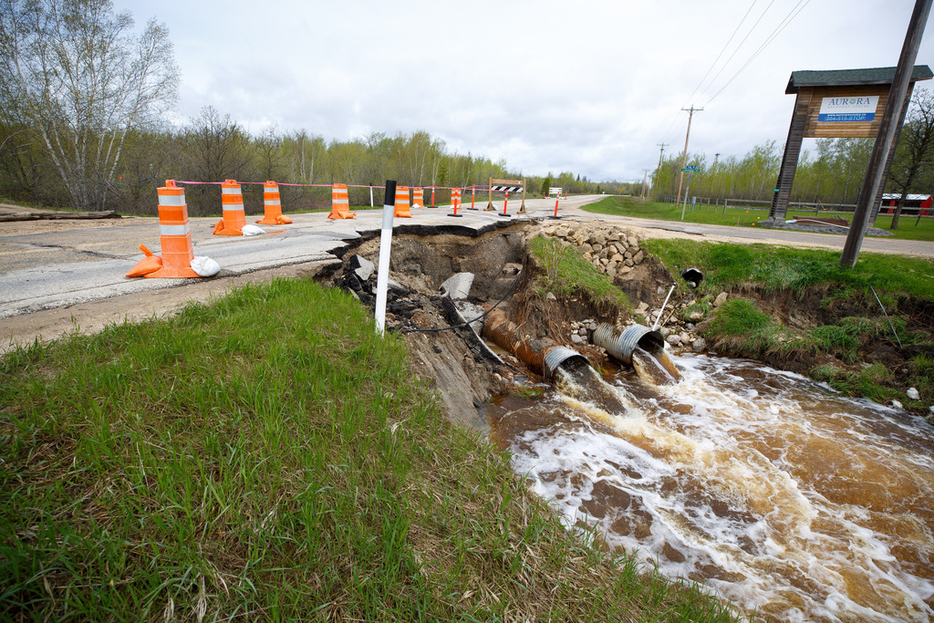
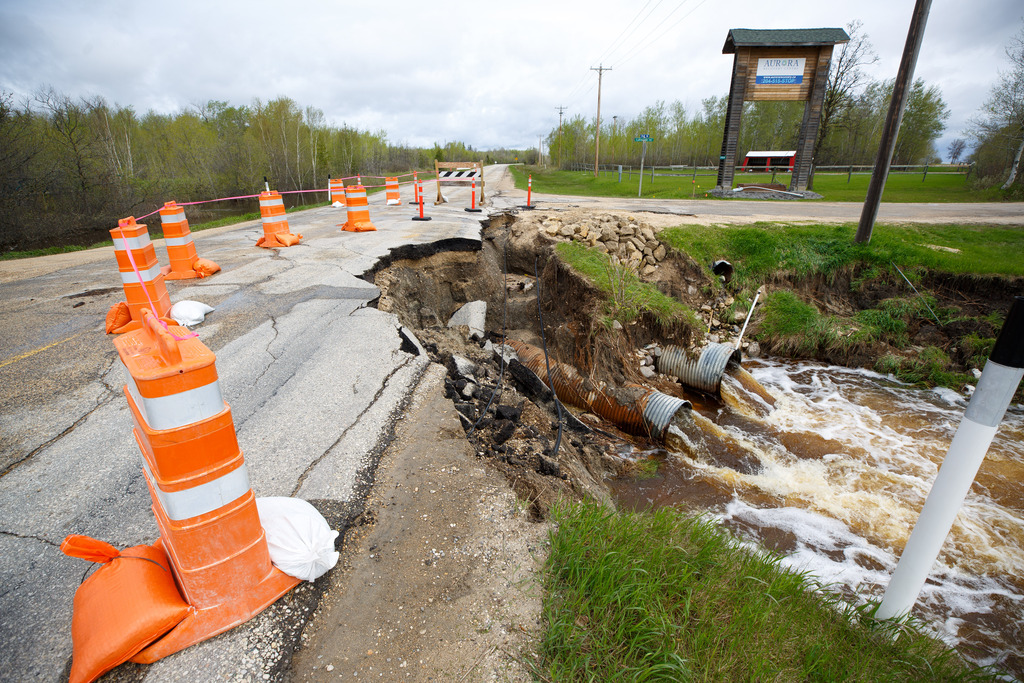
The junction of highways 7 and 68 was closed due to a washout.
Dueck hailed town staff and volunteers, saying about 300 people were involved in the effort to protect up to 20 properties in the town, about 100 kilometres north of Winnipeg.
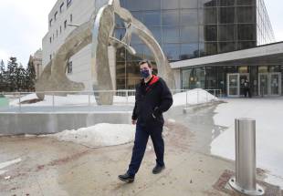
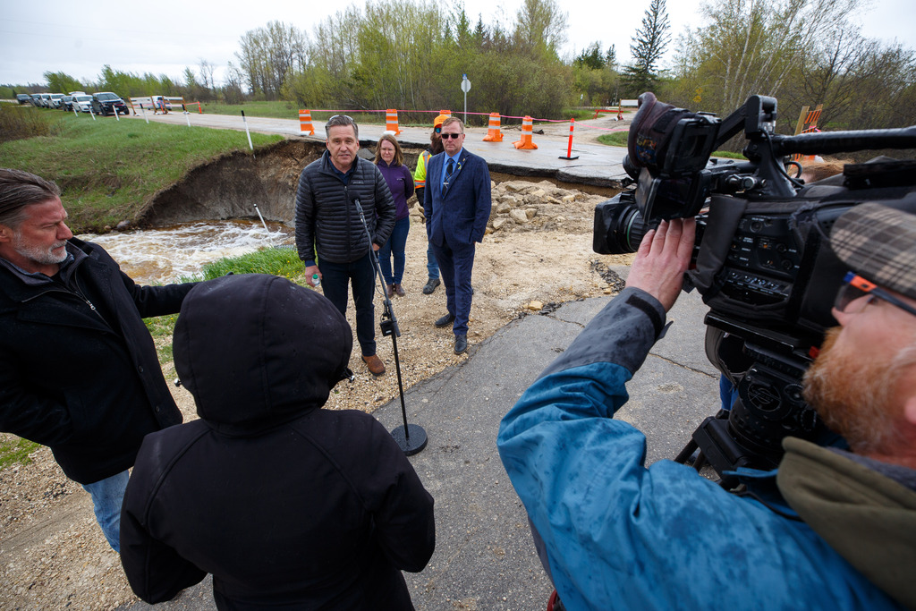
He spoke with Premier Heather Stefanson and Transportation and Infrastructure Minister Doyle Piwniuk, as they visited flood-hit areas of the Interlake.
Stefanson and Piwniuk were unable to visit Peguis due to poor road conditions, a spokeswoman for the premier said.
Doug Anderson, a spokesman for North East Interlake Emergency Measures, said there are so many road closures in the Municipality of Bifrost-Riverton that it has run out of barricades.
A home for people living with disabilities was evacuated after water crossed an access road. A garden centre flooded, said Anderson.
In Fisher Branch, crews are pumping water to protect homes and businesses, he said.
chris.kitching@freepress.mb.ca
Twitter: @chriskitching

Chris Kitching is a general assignment reporter at the Free Press. He began his newspaper career in 2001, with stops in Winnipeg, Toronto and London, England, along the way. After returning to Winnipeg, he joined the Free Press in 2021, and now covers a little bit of everything for the newspaper. Read more about Chris.
Every piece of reporting Chris produces is reviewed by an editing team before it is posted online or published in print — part of the Free Press‘s tradition, since 1872, of producing reliable independent journalism. Read more about Free Press’s history and mandate, and learn how our newsroom operates.
Our newsroom depends on a growing audience of readers to power our journalism. If you are not a paid reader, please consider becoming a subscriber.
Our newsroom depends on its audience of readers to power our journalism. Thank you for your support.