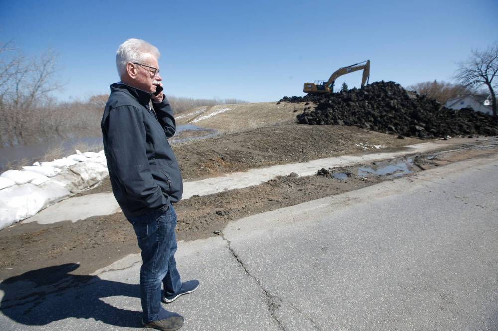
Morris prepares to close Highway 75 as rivers rise
Advertisement
Read this article for free:
or
Already have an account? Log in here »
To continue reading, please subscribe:
Monthly Digital Subscription
$0 for the first 4 weeks*
- Enjoy unlimited reading on winnipegfreepress.com
- Read the E-Edition, our digital replica newspaper
- Access News Break, our award-winning app
- Play interactive puzzles
*No charge for 4 weeks then price increases to the regular rate of $19.00 plus GST every four weeks. Offer available to new and qualified returning subscribers only. Cancel any time.
Monthly Digital Subscription
$4.75/week*
- Enjoy unlimited reading on winnipegfreepress.com
- Read the E-Edition, our digital replica newspaper
- Access News Break, our award-winning app
- Play interactive puzzles
*Billed as $19 plus GST every four weeks. Cancel any time.
To continue reading, please subscribe:
Add Free Press access to your Brandon Sun subscription for only an additional
$1 for the first 4 weeks*
*Your next subscription payment will increase by $1.00 and you will be charged $16.99 plus GST for four weeks. After four weeks, your payment will increase to $23.99 plus GST every four weeks.
Read unlimited articles for free today:
or
Already have an account? Log in here »
Hey there, time traveller!
This article was published 26/04/2022 (1325 days ago), so information in it may no longer be current.
MORRIS — Officials prepared for the potential call to close Highway 75, the main link to the U.S. border, at the northern end of town, where an excavator smoothed out massive mounds of black soil on the ring dike next to the Morris River.
Workers trucked in loads of earth to build up the banks near the swollen river, a tributary of the Red River.
If it gets too high, Manitoba Infrastructure will make the call to extend the dike across the highway.

“As of right now, we’re already seeing water levels back up at the peak of what we had earlier in the spring, with potentially more to come,” Morris Mayor Scott Crick said Tuesday, in reference to a Colorado low that may land in southern Manitoba this weekend.
The Red River at the eastern edge of the town had dropped considerably before the weekend rain, Crick said. At this time, the town’s flood outlook was average.
They Morris River has risen to the bottom of the Highway 75 bridge, but floodwater is well below the limits of the dike.
“We are fully protected,” Crick said.
Crick said the province will keep this route open for as long as possible, though it’s likely to be closed as of Friday.
“Hope for the best and prepare for the worst — that’s certainly what we do,” Crick said.
Provincial crews will continue to monitor water levels. A flood warning remains in effect for the Red River from Emerson to the Red River Floodway Inlet south of Winnipeg and the La Salle River at Sanford.
The north section of the Morris ring dike was sealed for four weeks in 2011 — the last time there was a closure. In 2020 and 2021, the province built a ramp on the Highway 75 bridge to allow traffic to pass through.

Crick expects the upcoming closure of Highway 75 will cause inconvenience people who commute in and out of the town.
However, the province’s recent upgrades to Provincial Road 246 east of the Red River will give drivers a reliable detour, Crick said.
Morris is touched with signs of flood-readiness. Some are physical, like the clumps of mud along the town’s main drag lost on the way to the dike, or the Manitoba government workers who waded into ditches south of town Tuesday to take GPS readings that inform when, and to what extent, the ring dike will close.
Other signs are subtle, like conversations at coffee shops and gas stations about the rising rivers and soggy back roads.
“After the big event in 1997, we took action and prepared for events like this,” said Ralph Groening, reeve of the rural municipality of Morris. “Am I concerned? Yes, because it (the flood) is going to isolate some homes.”
The RM’s emergency services organization is working with one family who may choose to relocate until floodwater no longer threatens their road access, which Groening says is crucial to keeping residents safe.
“We will allow people to remain even if they lose road access. Most of our people have boats… But young children shouldn’t be in that kind of vulnerable position,” Groening said. “There’s a culture of meeting the challenge of high water.”
If the floodwater continues to rise, the next step is for the province to close the western opening of the ring dike, and, if the situation worsens, the southern entrance. Morris is equipped to withstand the flood, and most, if not all, residents outside the community hadraised their homes following the flood of 1997, Groening said.

RM crews continue to clear snow and ice from nearby channels, culverts and ditches so water can flow freely.
Groening said he isn’t aware of any property damage, though there has been substantial overland flooding.
“There are fields that essentially look like lakes,” Groening said.
An overland flood warning remains for southern Manitoba from the Saskatchewan border to Highway 12 and from the U.S. border to the Trans-Canada Highway. The warning includes areas north of the Trans-Canada Highway between Highway 5 and Highway 16, and north of the Trans-Canada Highway between Portage la Prairie and Winnipeg.
fpcity@freepress.mb.ca


