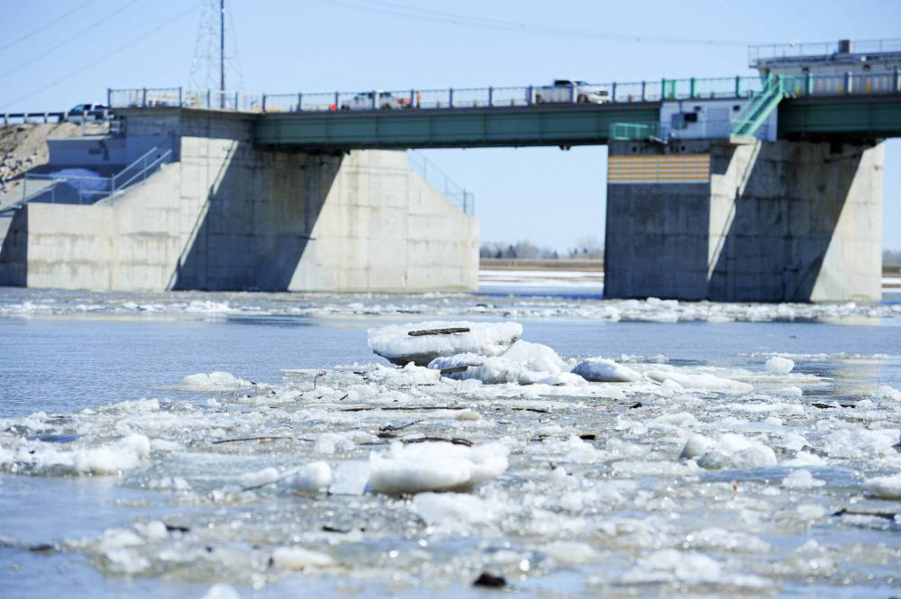
Red River Floodway springs into action
Advertisement
Read this article for free:
or
Already have an account? Log in here »
To continue reading, please subscribe:
Monthly Digital Subscription
$1 per week for 24 weeks*
- Enjoy unlimited reading on winnipegfreepress.com
- Read the E-Edition, our digital replica newspaper
- Access News Break, our award-winning app
- Play interactive puzzles
*Billed as $4 plus GST every four weeks. Offer only available to new and qualified returning subscribers. Cancel any time.
Read unlimited articles for free today:
or
Already have an account? Log in here »
Hey there, time traveller!
This article was published 08/04/2022 (1029 days ago), so information in it may no longer be current.
The Manitoba government has activated the Red River Floodway to protect low-lying riverside properties in Winnipeg from flooding.
Infrastructure Minister Doyle Piwniuk announced the measure in a video on Twitter Friday. The clip shows Piwniuk triggering the opening of the gates, with the turn of a dial, at the control station south of Winnipeg.
The province opened the Red River Floodway at 9:45 a.m. Friday in response to recent precipitation throughout the Red River basin. When the opening began, the Red River’s upstream water level was 229.63 m and the gate elevation was 224.67 m. The gate was raised by 9.05 ft.

The Red River has peaked at Emerson, St. Jean Baptiste and Letellier. At Morris, the Red River is near its peak.
Due to ice jamming, a Red River flood warning remains in effect for St. Jean Baptiste to Morris, at St. Adolphe, and the Selkirk region. The flood watch continues for the Red River from Emerson to the floodway inlet.
Paul Sabourin, a councillor for the RM of Montcalm, said a “flood of inconvenience” is happening in his community. Apart from a few road closures and damage to ditches, the RM has avoided significant issues.
“It’s a sort of a typical flood situation that we encounter often,” Sabourin said.
The Roseau River and Red River are of equal concern to the RM, but both watersheds are behaving better than expected, Sabourin said. He credits this to droughts last summer and fall.
Selkirk Mayor Larry Johannson said the gradual spring melt combined with Amphibex ice-breaking work on the Red River has kept the water flowing through the area.
The only exception was brief ice damming near the Selkirk Bridge a couple of nights ago,” he added.
“Thankfully, it broke loose,” Johannson said. “The water went down two feet almost immediately, but with the water coming from the south, it went back up two feet.”
With the Selkirk area free from ice, Johannson’s attention turns to residents who live north along Highway 320 towards Netley Marsh.
“The ice has to get out to the marsh area. Once it gets out to the marsh area, they can send all the water they want from the south,” Johannson said.
He hopes water from the floodway activation will push the ice along. Right now, the ice is plugged up by Sugar Island, just north of the city.
“It should be called jammed-up island,” Johannson joked.
North of Selkirk, Highway 320 is closed 4.2 km north of Highway 4 onward due to uneven surfaces and water on the road. Only local traffic is allowed to pass through.
The City of Selkirk has taken the added precaution of closing the dike at the boat launch and Selkirk Park. City workers have also removed some decorative lighting. Residents are urged to keep away from the water.
In its most recent flood bulletin Friday afternoon, Manitoba Infrastructure announced the Portage Diversion had also been activated. The move will allow a small amount of water to flush ice from the channel. The division’s regular spring operation is expected to begin this weekend.
Completed in 1970, the Portage Diversion is a 29-km channel that diverts water from the Assiniboine River into Lake Manitoba.
As of Friday afternoon, the Red River near the James Avenue pumping station in Winnipeg’s Exchange District sat at 16.59 ft. The Red River is expected to crest at about 18 ft. at the James Avenue station between April 10 to 16.
The City of Winnipeg confirmed Friday that the number of homes at risk of being affected by spring flooding remains at 16.
The floodway has been in operation for 34 of the 51 years since it was built, Manitoba Infrastructure reports.
fpcity@freepress.mb.ca


