

Blowing snow, plunging temperatures in store across southern Manitoba

Advertisement
Read this article for free:
or
Already have an account? Log in here »
To continue reading, please subscribe:
Digital Subscription
One year of digital access for only $75*
- Enjoy unlimited reading on winnipegfreepress.com
- Read the E-Edition, our digital replica newspaper
- Access News Break, our award-winning app
- Play interactive puzzles
*Billed as $5.77 plus GST every four weeks. After 52 weeks, price increases to the regular rate of $19.95 plus GST every four weeks. Offer available to new and qualified returning subscribers only. Cancel any time.
Monthly Digital Subscription
$4.99/week*
- Enjoy unlimited reading on winnipegfreepress.com
- Read the E-Edition, our digital replica newspaper
- Access News Break, our award-winning app
- Play interactive puzzles
*Billed as $19.95 plus GST every four weeks. Cancel any time.
To continue reading, please subscribe:
Add Free Press access to your Brandon Sun subscription for only an additional
$1 for the first 4 weeks*
- Enjoy unlimited reading on winnipegfreepress.com
- Read the E-Edition, our digital replica newspaper
- Access News Break, our award-winning app
- Play interactive puzzles
*Your next Brandon Sun subscription payment will increase by $1.00 and you will be charged $17.95 plus GST for four weeks. After four weeks, your payment will increase to $24.95 plus GST every four weeks.
Read unlimited articles for free today:
or
Already have an account? Log in here »
Hey there, time traveller!
This article was published 18/01/2022 (1645 days ago), so information in it may no longer be current.
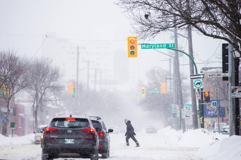
Expect hazardous winter conditions throughout the day as high winds whip up the snow that blanketed southern Manitoba overnight and continues to fall.
A winter storm warning is in effect in Winnipeg and other areas in southern Manitoba.
Gusty northerly winds and freshly fallen snow will reduce visibility in the Red River Valley this afternoon and evening, Environment Canada said in an alert.
The low-pressure system responsible for the snow will also produce significant winds in the afternoon.
The combination of 10 to 15 cm of fresh snow overnight along with winds gusting up to 80 km/h at times will produce blowing snow that will severely hamper visibility on highways, the weather agency said.
Even within Winnipeg, visibility will likely be reduced by blowing snow, especially downwind of open areas, the alert stated.
Gusts will begin to slow late this evening, leading to improved visibility by Wednesday morning. Forecasters don’t currently expect blizzard conditions, but that could change by later this afternoon.
Environment Canada expects temperatures to drop following the storm system.
An arctic ridge of high pressure will clear skies and drop temperatures into the -20s starting this evening. Wind chill values will approach the -40 C mark once again before temperatures moderate somewhat near the end of the week, the weather agency said.
Meantime, numerous southern Manitoba school divisions outside of the city either cancelled classes or buses. Some daycares and preschools outside of the city closed, as well.
The City of Winnipeg’s street maintenance manager, Michael Cantor, said city plows began clearing priority regional streets, sidewalks and active transport paths at 7 a.m.
“With the drifting snow, with the winds (tonight), we are probably going to clear them again, and maybe again,” he said just before noon.
“We’re concentrating… on our priority ones, (so) emergency vehicles, public transit can drive those streets.”
That means major routes, such as Pembina Highway, Lagimodiere Boulevard, Bishop Grandin Boulevard and Portage Avenue, for example.

Second-priority streets will see plows later this afternoon, Cantor said.
The city will monitor the accumulation of snow and make further snow-clearing operational decisions as the weather system passes through Winnipeg, a city spokeswoman said in an email.
On Monday, senior climatologist with Environment Canada David Phillips said a so-called “Prairie clipper” was expected to roll through the the province, with the hardest hit area in the Parklands, through the Red River Valley and Winnipeg, and all the way to Lake of the Woods in Ontario.
“Unlike most clippers, this one is packing a little bit more moisture than most,” Phillips said.
Continued heavy snowfall is good news for southern Manitoba farmers who’ve faced parched fields amid drought conditions in recent years.
So far this year, Winnipeg has had 78.6 centimetres of snow dumped on it, compared to 55.2 cm at this time last year and 101.1 cm up until this time during the winter of 2019-20, Phillips said.
The average snowfall at this point is 59.9 cm.
erik.pindera@freepress.mb.ca
Erik Pindera is a reporter for the Free Press, mostly focusing on crime and justice. The born-and-bred Winnipegger attended Red River College Polytechnic, wrote for the community newspaper in Kenora, Ont. and reported on television and radio in Winnipeg before joining the Free Press in 2020. Read more about Erik.
Every piece of reporting Erik produces is reviewed by an editing team before it is posted online or published in print — part of the Free Press‘s tradition, since 1872, of producing reliable independent journalism. Read more about Free Press’s history and mandate, and learn how our newsroom operates.
Our newsroom depends on a growing audience of readers to power our journalism. If you are not a paid reader, please consider becoming a subscriber.
Our newsroom depends on its audience of readers to power our journalism. Thank you for your support.
Related Articles
City snow, snow clearing complaints pile up
Advertisement Advertise With Us
Advertisement Advertise With Us